Srednji Vrh - Maloško poldne / Mallestiger Mittagskogel
Starting point: Srednji Vrh (960 m)
| Lat/Lon: | 46,4894°N 13,8371°E |
| |
Time of walking: 2 h 55 min
Difficulty: easy unmarked way
Altitude difference: 863 m
Altitude difference po putu: 900 m
Map: Kranjska Gora 1:30.000
Recommended equipment (summer):
Recommended equipment (winter): ice axe, crampons
Views: 10.269
 | 1 person likes this post |
Access to the starting point:
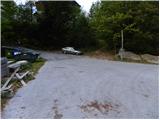
From the motorway Ljubljana - Jesenice, take the exit Jesenice - west (Hrušica) and continue in the direction of Kranjska Gora. When you reach Gozd-Martuljek, turn right in the direction of Srednji Vrho and follow the narrow and steep road to the above-mentioned place. When the road levels out a bit, you will come to a crossroads of several roads and a turning point. Park here in a suitable space at the junction.
Path description:
From the turning point at Srednji Vrh, continue north, where you will immediately reach a small crossroads. From the junction, continue along the lower right-hand road, which is closed to public traffic by a traffic sign. The road first gently descends and then begins to climb gently past a few houses, after which the asphalt ends. At two successive small crossroads just above the village, bear left and continue for some time along a gently ascending road which crosses a number of torrents, ravines and streams. In the lower part of the path, we get some more views of the Martuljkovo group of mountains, and then the road turns into a forest. For the first hour of the walk, the road climbs gently to moderately, then flattens out and even descends slightly a few times. In the last part of the ascent along the road, the forest thins out and the path leads to the Hladnik hunting lodge, which is situated in the middle of a large meadow.
After the hunting lodge, continue to the left, and the path immediately leads to an unmarked crossroads. Here, continue right into the forest and continue climbing up the relatively steep cart track. At a slightly higher altitude, you reach the next fork in the track, where you continue along the right-hand track, which continues to climb cross-country to the right. The above-mentioned cart track soon becomes completely flat and leads to a small valley where the Hladnik stream is crossed. Immediately after the stream, turn left and climb moderately along it for a while, then the path passes into a dense forest where it starts to climb steeply. After 15 minutes of steep ascent, the path leads us out of the forest, which then lays down and slowly begins to disappear on the grassy slopes of Grajšca. In a few places, the less visible path, which runs along the valley, leads us higher up past the animal watering point, and the valley splits into two parts just above the watering point.
Continue along the left-hand side of the much longer and steeper valley, which slowly turns more and more to the left. Here, if we are quiet enough and lucky enough, we may spot a marmot. In the middle of the upper part of Grajšca, a passage to the right branches off towards the boundary ridge, and we continue straight ahead and begin to climb through a sparse larch forest in an increasingly narrow valley. Higher up, the valley narrows into a torrential gully, which leads to a small pass north-west of Murnovec. Leave the path leading to Techantinger Mittagskogel and continue sharp right on a ridge with a view and dwarf pines. The ridge trail first descends slightly and then begins to climb steeply, initially on a rather crumbly slope. After just 10 m the path returns to the ridge, where it gradually flattens out and leads to the headland of Maloški połudnevo. A very short descent follows, and then the path climbs gently to Maloško poldne, the top of which opens up a beautiful view of Lake Baška.

Pictures:
 1
1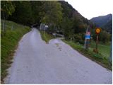 2
2 3
3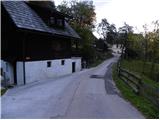 4
4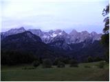 5
5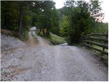 6
6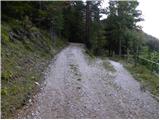 7
7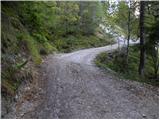 8
8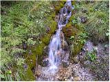 9
9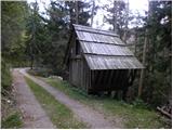 10
10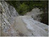 11
11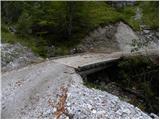 12
12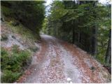 13
13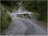 14
14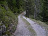 15
15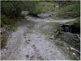 16
16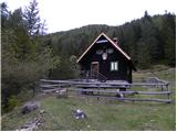 17
17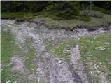 18
18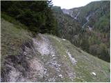 19
19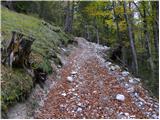 20
20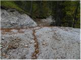 21
21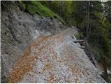 22
22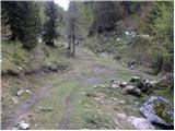 23
23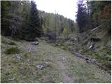 24
24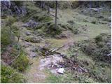 25
25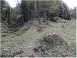 26
26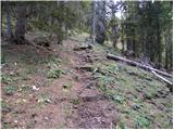 27
27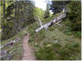 28
28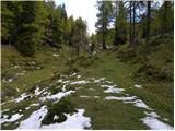 29
29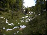 30
30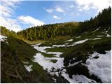 31
31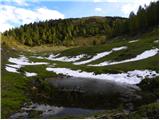 32
32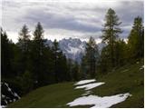 33
33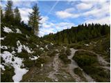 34
34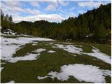 35
35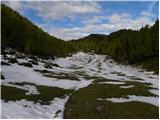 36
36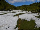 37
37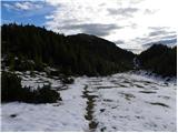 38
38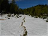 39
39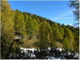 40
40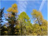 41
41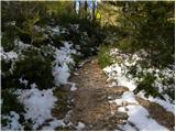 42
42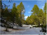 43
43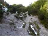 44
44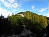 45
45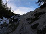 46
46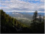 47
47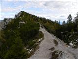 48
48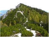 49
49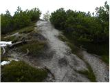 50
50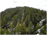 51
51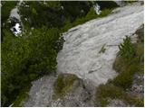 52
52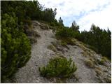 53
53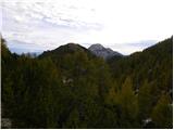 54
54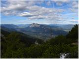 55
55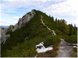 56
56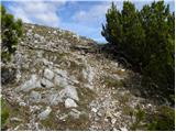 57
57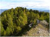 58
58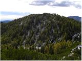 59
59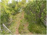 60
60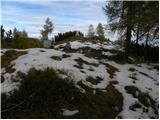 61
61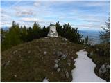 62
62 63
63
Discussion about the trail Srednji Vrh - Maloško poldne / Mallestiger Mittagskogel
|
| Flora124. 10. 2010 |
Včeraj opravili pot vas Srednji vrh, lovska koča, Kresišče, po grebenu na Maloško poldne, do Trupejevega poldna in dol ob potoku do lovske koče in do vasi Srednji vrh. Mrzlo, a ne tako kot prejšnji teden, veter. Pot je na grebenu na mestih zasnežena, potrebna previdnost, drugače krasen ambient z rumenimi macesni in snegom. Lovci so spet nekaj streljali. Na Kresišču sva še srečali ljudi, naprej po grebenu in do lovske koče nikogar.
|
|
|
|
| Flora124. 10. 2010 |
vas Srednji Vrh 
|
|
|
|
| tango24. 02. 2021 |
Danes sva z ženo izkoristila krasen dan in skočila na Maloško poldne. Ne čisto tako kot je v zgornjem opisu, saj sva šla po Grajšči čisto do sedla, potem pa levo po grebenu do cilja. Razmere solidne, mogoče bi nama za nazaj koristile krplje, katere sva sicer pustila v avtu. Je pa bila vidljivost zaradi obilice puščavskega peska taka, kot da bi gledal skozi oranžno meglen filter, sploh je bilo to očitno pri pogledih proti Špikovi skupini, Jalvocu, manj na sever proti Dobraču. Kresišče presmučano v nulo!
|
|
|
|
| Fulcrum10. 10. 2021 19:04:38 |
Od mesta kjer prečimo potok (slika 25) do prihoda na Grajšco (slika 29) je pot po novem speljana po kolovozu. Pot skozi gozd, ki je opisana zgoraj je neprehodna, saj je na njej veliko podrtega drevja.
|
|
|