Srednji Vrh - Techantinger Mittagskogel (Trupejevo poldne) (via valley of stream Žlebnica)
Starting point: Srednji Vrh (960 m)
| Lat/Lon: | 46,4894°N 13,8371°E |
| |
Name of path: via valley of stream Žlebnica
Time of walking: 2 h 45 min
Difficulty: easy unmarked way
Altitude difference: 971 m
Altitude difference po putu: 991 m
Map: Kranjska Gora 1:30.000
Recommended equipment (summer):
Recommended equipment (winter): ice axe, crampons
Views: 14.860
 | 1 person likes this post |
Access to the starting point:
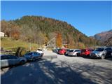
a) From the motorway Ljubljana - Jesenice, take the exit Jesenice - West (Hrušica) and continue in the direction of Kranjska Gora. When you reach Gozd-Martuljek, turn right in the direction of Srednji Vrho and follow the narrow and steep road to the above-mentioned place. When the road levels out a bit, you will come to a crossroads of several roads and a turning point. Park in the marked parking lot next to the turning point.
b) Take the Kranjska Gora, then continue driving in the direction of Jesenice. When you arrive in Gozd - Martuljek, first cross the Sava Dolinka river over the bridge, then pay attention to the left forks, as the road to Srednje Vrho soon turns off to the left. Continue along the road, which leads us past a few more houses, and then begins to climb steeply along a relatively narrow road, which leads us past the waterfalls of the Jerman stream. When the road is higher, we arrive at Srednji Vrho, where we park in a marked parking area at the turning point.
Path description:
From the starting point, continue along the left-hand road, which immediately forks, and we take the lower right-hand road, which is closed to public traffic by a road sign. The road first leads us past a few houses and then the asphalt ends. A little further on, we see a notice that we are entering a bear area, and we continue our journey along a dirt road that climbs up the slopes above the right bank of the Hladnik stream, which we can hear from time to time, and we also cross several of its relatively picturesque right tributaries. As we climb, we occasionally get a fine view of Julian Alps, and then, after a good hour's walk, we reach Lovska koča za Lepim vrhom, where there is a crossroads of several paths.
After the hut, follow the leftmost cart track, which continues slightly above the stream Žlebnica. Continue through the forest, going straight ahead at the first crossroads. After the crossroads, cart track ends, and the ascent continues along the right side of a pleasant babbling brook. Higher up, the steady stream ends and you continue along the stream, passing briefly on the left. When the torrent turns left from the valley we are walking through into the hillside, we continue straight ahead, continuing along the valley, where we continue to follow a well-traced path. Higher up, the path rises above the valley and then leads to a larger clearing where the path loses its way a little. On the other side of the larger clearing, where the path returns to the larch forest, the path again becomes more distinct, but slowly begins to turn more to the left, where it gradually passes to the eastern slopes. A few minutes climb up an undistinguished valley, then over a grassy slope to a better-beaten path leading through the mountain pasture of Grajšec.
When you reach this path, follow it to the left and we quickly reach the saddle between Bele peči on the left and Techantinger Mittagskogel on the right.
At this saddle, continue right and in less than 10 minutes, via lane of dwarf pines, climb up to the main ridge, where the trail lays down and turns left. Less than 5 minutes of walking later, the scenic route, which offers a beautiful view towards Julian Alps and Austria, quickly leads to the summit, where a cross and a wishing bell stand. Description and figures refer to the situation in 2015 (November).

Pictures:
 1
1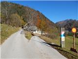 2
2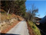 3
3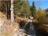 4
4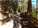 5
5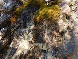 6
6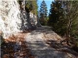 7
7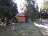 8
8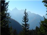 9
9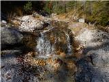 10
10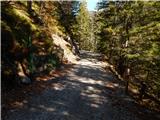 11
11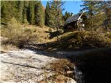 12
12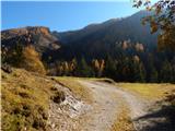 13
13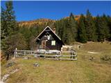 14
14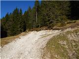 15
15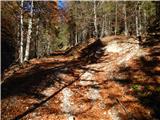 16
16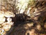 17
17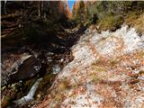 18
18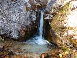 19
19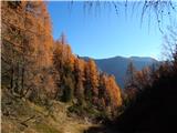 20
20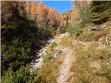 21
21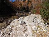 22
22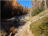 23
23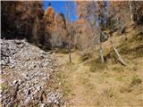 24
24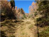 25
25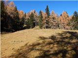 26
26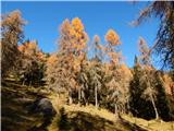 27
27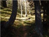 28
28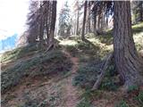 29
29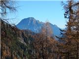 30
30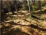 31
31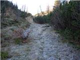 32
32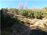 33
33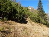 34
34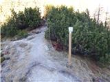 35
35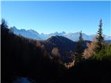 36
36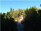 37
37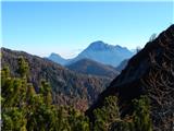 38
38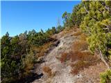 39
39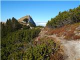 40
40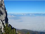 41
41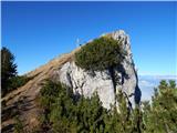 42
42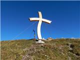 43
43 44
44
Discussion about the trail Srednji Vrh - Techantinger Mittagskogel (Trupejevo poldne) (via valley of stream Žlebnica)
|
| tango1. 11. 2022 17:04:13 |
Za naju z ženo nov pristop na Trupejevo poldne. In vse je bilo fino tja nekje do slike25.Tam se nama je steza izgubila, malo sva krožila, a potem sva jo mahnila kar po ozki grapi (dokaj strma), mimo razsutega napajališča za živino in prišla na pot z Grajšče kakšnih 600 m bolj vzhodno kot je v opisu. Nadaljevanje bp, sva pa podalšala še na Blekovo planino, Zajčnik in Vošco. Nazaj čez Jureževo planino in tako se nama je nabrala spodobnih 18,3 km. Verjeli ali ne, teloh že cveti in to ne samo posamezni. Pa še-lovska koča za Lepim vrhom ima novo mizo in klop in ta taki, da bi ju moral zapisati z veliko začetnico. Super dan in odlična tura.
|
|
|