Stara Baška - Obzova (via Lipica)
Starting point: Stara Baška (45 m)
| Lat/Lon: | 44,9614°N 14,6847°E |
| |
Name of path: via Lipica
Time of walking: 2 h 30 min
Difficulty: easy marked way
Altitude difference: 523 m
Altitude difference po putu: 620 m
Map:
Recommended equipment (summer):
Recommended equipment (winter):
Views: 7.277
 | 1 person likes this post |
Access to the starting point:
From the motorway Rupa - Rijeka / Rijeka or Zagreb - Rijeka / Rijeka, drive towards Rijeka, and from there follow the signs to Krk Island. When the motorway or expressway in the last part ends, we descend to the Krk Bridge (toll 35 kuna - March 2014) and then continue driving to Omisalj, Njivice, Malinska, Krk, Punat and Baška. At Punat, leave the road leading to Baška and turn right at the roundabout towards the Punat and Stara Baška exit. Continue through Punat, and after Punat the road first climbs and then begins to descend towards the Škrila bivouac. From the bivouac, the road first climbs to a bus turnaround and then to Stara Baška. At the beginning of Stara Baška, just behind the Stanka guesthouse, you can see the mountain direction signs for Obzova and Veli vrh. This is also the official start of the trail, but as there are no parking places for hikers in the vicinity, you should park earlier, preferably near the Škrila camp or drive further from Stara Baška and then park in the large parking lot. If you park at the Šrkila bivouac, it will take you about 10 minutes longer, and if you park at the parking lot at the end of Stara Baška, it will take you about 20 minutes longer.
Path description:
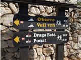
From Stara Baška, where you can see the signs for Obzova, the trail first crosses above the beginning of the settlement and then leads under a nearby power line. With fine views of Škrila beach, Stara Baška, Galun and Cres island, we climb a step higher, where the trail first turns slightly right and then transversely flattens out. It then crosses a valley, where the path turns left and then climbs steeply, partly on rough and partly on overgrown scree, reminiscent of the highlands of the Slovenian mountains. When the crossing ends, the path gradually flattens out into a more plateau-like world, where it also gradually moves away from the sea. There is an easy climb on rather rocky terrain, and we follow the relatively well-marked path to the Kanjine crossroads, which is located by a small stone enclosure.
From the crossroads, continue right towards the Veli Hlam peak and the Spuhotina crossroads (left Obzova via the Mala Brestovica crossroads) along a relatively gentle path that continues to climb through the plateau-like terrain. Follow the well-marked trail to the Spuhotina crossroads, where continue left on a barely visible and poorly marked trail, which bypasses Veli Hlam on the left and leads directly to the Lipica crossroads, where it rejoins the better-trodden and well-marked trail via a narrow passage in a stone enclosure.
From the Lipica crossroads, continue left (Veli Hlam on the right) and first descend along the stone fence. After a few minutes, the descent ends and you reach a plateau, over which you climb steeply, taking in the beautiful views. A little further on, you cross another small pasture fence, and then the trail takes a rather illogical right turn downhill, onto steeper slopes. Cross the valley below, then start climbing over the rocky world. The path quickly flattens out and returns to the edge of the plateau, where a wooden cross can be seen on the right-hand side, slightly off the path. The path ahead takes us past an animal watering station and then across the interesting world of the island of Krk to a scenic peak.
From Zminja we first descend a little, then continue along the marked path, which climbs gently towards Obzova. Obzova, the highest point of the island of Krk, is reached after about 15 minutes' walk from Zminja. In the fog, orientation is very difficult for most of the route.

Pictures:
 1
1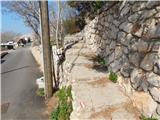 2
2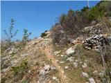 3
3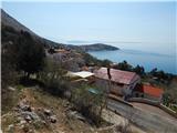 4
4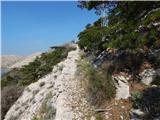 5
5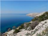 6
6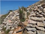 7
7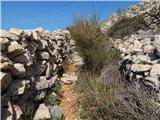 8
8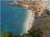 9
9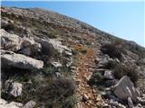 10
10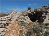 11
11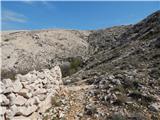 12
12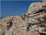 13
13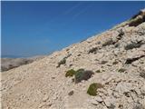 14
14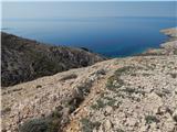 15
15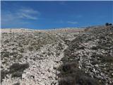 16
16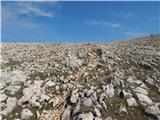 17
17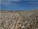 18
18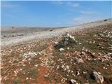 19
19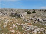 20
20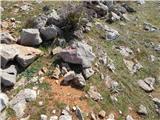 21
21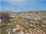 22
22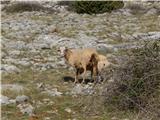 23
23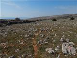 24
24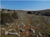 25
25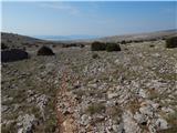 26
26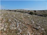 27
27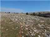 28
28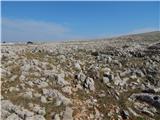 29
29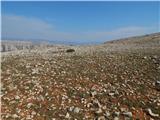 30
30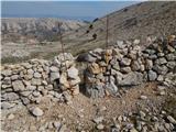 31
31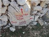 32
32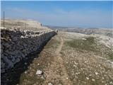 33
33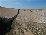 34
34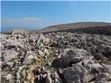 35
35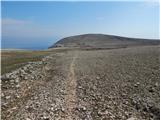 36
36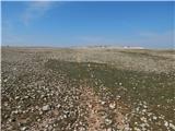 37
37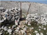 38
38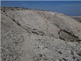 39
39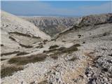 40
40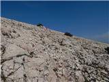 41
41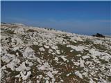 42
42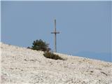 43
43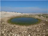 44
44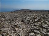 45
45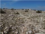 46
46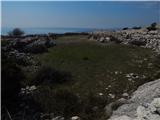 47
47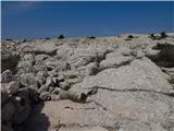 48
48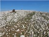 49
49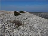 50
50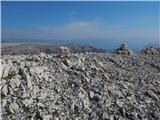 51
51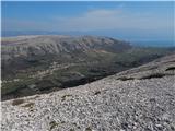 52
52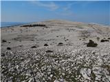 53
53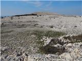 54
54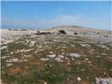 55
55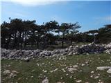 56
56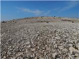 57
57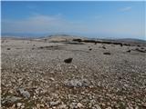 58
58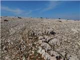 59
59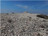 60
60 61
61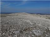 62
62
Discussion about the trail Stara Baška - Obzova (via Lipica)
|
| Laščan12. 03. 2016 |
Administrator Tadej!
Pri opisu poti je enako besedilo kot pri opisu dostopa do izhodišča, razen opisa nadaljevanja od Zminje naprej! Lp
|
|
|
|
| Tadej12. 03. 2016 |
Hvala za opozorilo, sem popravil. Lp, Tadej
|
|
|