Štenge - Visoki vrh (via Vretov vrh)
Starting point: Štenge (850 m)
| Lat/Lon: | 46,4806°N 13,9105°E |
| |
Name of path: via Vretov vrh
Time of walking: 3 h
Difficulty: difficult pathless terrain
Altitude difference: 978 m
Altitude difference po putu: 1000 m
Map: Kranjska Gora 1:30.000
Recommended equipment (summer):
Recommended equipment (winter): ice axe, crampons
Views: 8.172
 | 1 person likes this post |
Access to the starting point:
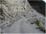
From the Ljubljana - Jesenice motorway, take the Jesenice - West exit and then continue along the regional road towards Kranjska Gora. Follow the road to Belca and continue for a few 100 m, then you will see the beginning of a forest road on your right, leading into the Belka valley. Take the road and follow it to a steep rocky part. Park a few 10 m earlier in a suitable place along the road.
Path description:
Just before the road crosses the steep slope, you will see a small cairn on the left and next to it the start of the path that climbs over the Štenge. The path immediately climbs steeply and is soon joined on the left by a path from a slightly lower starting point. The path then turns right and climbs steeply for some time. Higher up, you will come to a wide track, where you will reach an unmarked crossroads. Continue on the left path (right Visoki vrh through the Za Vršič valley), which becomes technically difficult. The traverse ascends over sometimes quite steep and slip-prone slopes, and then reaches a ridge where the less visible path becomes more difficult to follow. Continue along the ridge, which is sometimes partially overlooked, on a path that sometimes becomes completely lost. Continue in the same direction for some time, then reach a small watering place for game.
From here, continue slightly to the left, where you can still occasionally follow the remains of the track. Higher up, the path leads to a steep wooded slope, over which we climb slightly to the left to a nearby ridge, partly covered with dwarf pines. A barely visible path climbs very steeply ahead, then loses its way and turns to the right, crossing steep slopes at the foot of small cliffs. There is a short climb to the right to reach the Barakarjeva špica ridge. Walk along and along the ridge for some time, and then before reaching the summit of Vretov Peak, the path turns right and crosses the slopes towards the saddle between the aforementioned peak and Visoki vrh. When you reach the saddle, you join a much more beaten track, and we follow it in a cross-climb to the right to the Vršič lookout (which is located slightly to the right of the track).
At the saddle, a few metres below Vršič, continue left (the straight path leads to the road Belca - Sedlič, possibility of descent) and continue along the well-traced path, which begins to climb through the lane of dwarf pines. The path then climbs gently for some time along the edge of steep slopes, before reaching the summit slope of Visoki vrh, where it gradually becomes steeper and steeper. A few more minutes of walking and the increasingly scenic path quickly leads to the summit.

Pictures:
 1
1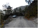 2
2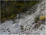 3
3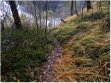 4
4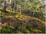 5
5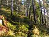 6
6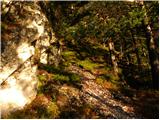 7
7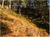 8
8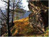 9
9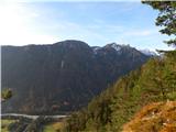 10
10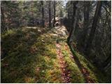 11
11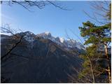 12
12 13
13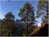 14
14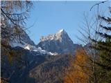 15
15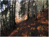 16
16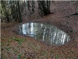 17
17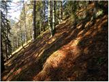 18
18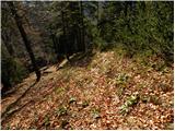 19
19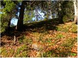 20
20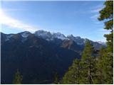 21
21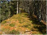 22
22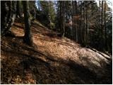 23
23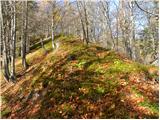 24
24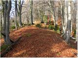 25
25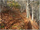 26
26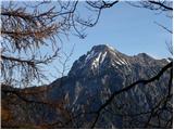 27
27 28
28 29
29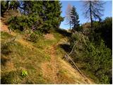 30
30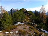 31
31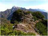 32
32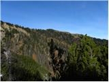 33
33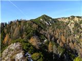 34
34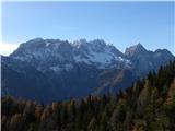 35
35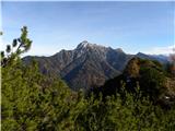 36
36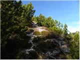 37
37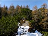 38
38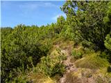 39
39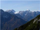 40
40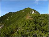 41
41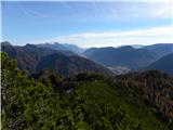 42
42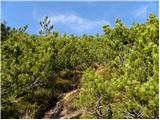 43
43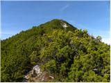 44
44 45
45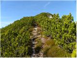 46
46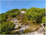 47
47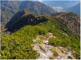 48
48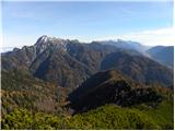 49
49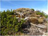 50
50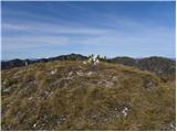 51
51 52
52
Discussion about the trail Štenge - Visoki vrh (via Vretov vrh)
|
| RadoPres11. 05. 2014 |
Skupinica smo se včeraj namenili osvojiti Visoki Kurji vrh.Držali smo se levega grebena s čudovitimi razgledi na zg.savsko dolino,ki me je spominjala na dolino Soče, in prekrasno martuljško skupino, na drugi strani pa Kepa.Kot opisano, z zemljevidi, opisom, slikami in gps-om, smo uspeli priti le na Vretov vrh.Naprej pa neprehodno-nizki borovci.Desna, spodnja pot mimo Vretovega vrha, pa zelo nevarna-oska,zaraščena,polna malega suhega listja in še pod ostrim naklonom.. Lepo a zahtevno. Drugič,verjetno po drugi poti, pa na vrh 
|
|
|
|
| ljubitelj gora30. 05. 2014 |
RadoPres se spomnem Vretovega vrh je poraščen z borovci, pot je nižje na severni strani, kot si ugotovil, je ozka in strma, toda le malo naprej postane lažja. Vrh vas bo počakal.
|
|
|
|
| metod2. 06. 2014 |
Sva šla danes s hčerko. Do napajališča (manjša kal z lesenim koritom) je šlo po opisu, naprej nekaj časa bolj po intuiciji. Bistven je umik mimo Vretovega vrha na SV stran, da se izogneš ruševju. Na tem delu pridejo do izraza dobri čevlji. Nazaj sva šla čez Mojstrovico in v dolino Belce. Dober opis in fina tura. Razgledi tudi krasni. Do napajališča uro in pol in še uro do vrha.
|
|
|
|
| andi229. 06. 2014 |
Danes prehodil, čudovita pot, sestopil čez Bašinov breg, 4 ure popolnega brezpotja, zelo dober opis obeh poti. Parkiral sem nižje ob leseni utici,lažje obrnit. Orientacija je ključna nad napajališčem, kjer sem poiskal v levo razgleden strm greben z ruševjem in potko na njem. Kasneje sem prečil proti Barakarjevi špici pod prvo malo večjo skalo na grebenu v desno (lepo viden odcep). Tako sem prišel na greben špice dovolj visoko, da sem po njegovi levi strani praktično v 5 minutah prišel do slike 26 (mini sedelce,zelo dober posnetek) kjer se prečka pod Vretovim vrhom v desno prične. Potka se ves čas v obrisih navzgor lepo sledi,je pa zoprn vzpon po ruševju do vrha, kjer se plaziš skozi goščavo, kot v tunelu s klopi na vejah . Verjetno bi za nazaj bila dobra pot čez dolino Za Vršičem, ki pa je nisem preveril.
|
|
|
|
| Edina8. 07. 2014 |
Končno sem to potko prehodila tudi jaz. Zgrešila sem napajališče, kljub temu prišla na greben Vretovega vrha in po opisu nadaljevala proti vrhu. Čudovita tura. Tudi vračala sem se po njej, da se bolje vsede, ker jo bom zagotovo komu šla pokazat. Navdušujoče. Več http://stezeinsledi.blogspot.com/2014/07/visoki-kurji-vrh.html
|
|
|