Stubenbergsee - Kulm (via Kulmkögerl)
Starting point: Stubenbergsee (387 m)
| Lat/Lon: | 47,23594°N 15,79699°E |
| |
Name of path: via Kulmkögerl
Time of walking: 2 h
Difficulty: easy marked way
Altitude difference: 588 m
Altitude difference po putu: 615 m
Map:
Recommended equipment (summer):
Recommended equipment (winter): ice axe, crampons
Views: 129
 | 1 person likes this post |
Access to the starting point:
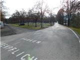
a) Leave the A2 motorway Graz / Graz - Vienna / Vienna at the exit for Gleisdorf, then follow the signs for Hartberg and Weiz, and later only Hartberg and Ilztal. From the roundabout in Ilztal, take the road towards Hartberg and Pischelsdorf. Leave the road to Hartberg at Kaibing, turn left towards Fürstenfeld and St. Johan b. h. , and at the next junction turn left towards St. Johan b. h. From Sankt Johann bei Herberstein, drive to the nearby lake Stubenbergsee, turn left at the end of which and park in the large pay parking area, where parking is permitted from 6am to 8pm. The price for parking until 20:00 is €3 (November 2022).
b) From Prekmurje, take the first exit to Border crossing Kuzma, then drive towards Jennersdorf, and before that take the expressway towards Vrbne / Feldbach. We soon leave the expressway as the signs for the motorway and the village of Riegersburg. Follow the main road to Hatzendorf, where you turn left, and when you reach Riegersburg, turn right. Then drive to Ilz, where you turn right and then immediately left towards Lake Stubenbergsee. From the roundabout on the outskirts of Großhartmannsdorf, take the exit towards Großsteinbach, and then follow the main road all the way to Lake Stubenbergsee, at the end of which turn left and park in the large pay-and-display parking lot, where parking is permitted from 6am to 8pm. The price for parking until 20:00 is €3 (November 2022).
Path description:
From the parking lot, walk to the bridge over the river Bistritz / Feistritz, and after the bridge you will reach a small crossroads. Continue straight on to footpath Kulmweg 31 and then turn left and walk parallel to the nearby road. After a few minutes crossing a strip of scrub, the path then turns right and climbs steeply. At a higher level, you reach an asphalt road and follow it to the right for a few 10 paces, then go behind a fence to the left and continue the ascent along a narrow path that leads between the two fences. After the fence, enter the woods and climb steeply for a few minutes, and when you leave the woods, with a nice view of Lake Stubenbergsee, walk to the second asphalt road, which you follow to the left. The road ahead leads past the Gasthaus Windhaber, then take a sharp right at a small crossroads. Follow the asphalt road to the next hamlet, where you leave the road and continue along the fence of a nearby property. When you get back on the road, go left, and a little further on, turn right onto a grassy path that climbs up a scenic slope to a nearby bench. At the bench, the path curves slightly to the right and then ascends to the next hamlet, where you pass a chapel. Continue following the few signs, and at a small crossroads, follow the road slightly to the left, which turns slightly further to the left. Signs for Kulm point us slightly to the right on a path by a fence, and above the fence we reach a road which we follow to the left. This road does not stay long either, as the signs lead us right into the woods, through which we climb moderately. Cross two meadows higher up, and when you return to the forest, continue slightly to the left from the crossroads. There is some more ascent, and when you reach an indistinct ridge, go right towards the Kulmgipfel (Kulm on the left). After a minute's walk, you reach the summit with the cross.
From the top, return a few 10 steps to the last crossroads, then continue along the marked path, which continues along an undistinguished ridge. There are stations of the cross along the way, and within a few minutes we reach the saddle linking the two peaks.
At the saddle, we also get on the road, and we pass a tourist building to reach a crossroads, where we continue on the upper right road. A little further on, turn slightly right from the asphalt road onto the initially paved path, which after a few steps turns into a grassy cart track. Cart track quickly leads us to a log cabin, after which we return to the tarmac road, which leads us past a paragliding airstrip. The road then turns into a forest, and we follow it at a moderate incline to its end at the Mariabrunn church.
After the church and in front of a private house, go left and the waymarked path splits into two parts. To reach the top of Kulm, you can either follow the north path on the left or the south path on the right. Both paths lead us to the top of Kulma in just over 5 minutes of further walking, from which a beautiful view opens up.
Starting point - Kulmkögerl 1:20, Kulmkögerl - Mariabrunn 0:33, Mariabrunn - Kulm 0:07.
Description and pictures refer to November 2022.

Pictures:
 1
1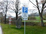 2
2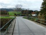 3
3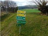 4
4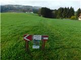 5
5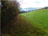 6
6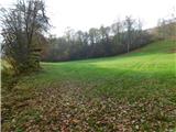 7
7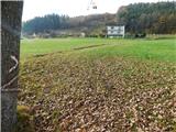 8
8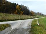 9
9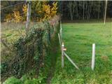 10
10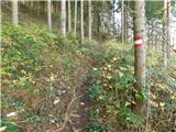 11
11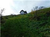 12
12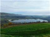 13
13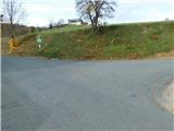 14
14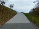 15
15 16
16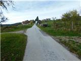 17
17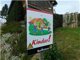 18
18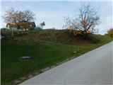 19
19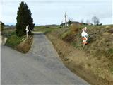 20
20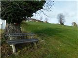 21
21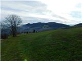 22
22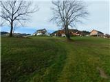 23
23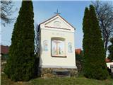 24
24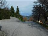 25
25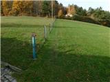 26
26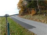 27
27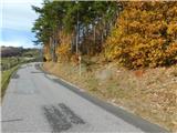 28
28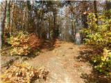 29
29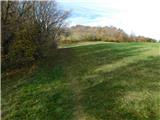 30
30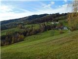 31
31 32
32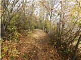 33
33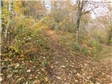 34
34 35
35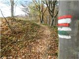 36
36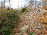 37
37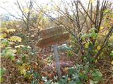 38
38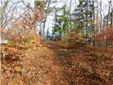 39
39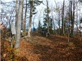 40
40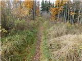 41
41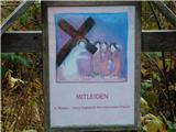 42
42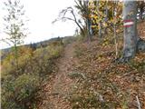 43
43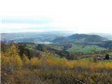 44
44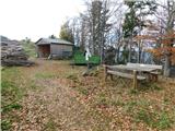 45
45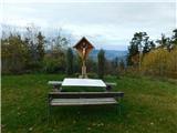 46
46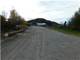 47
47 48
48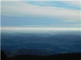 49
49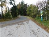 50
50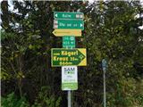 51
51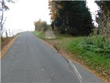 52
52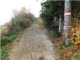 53
53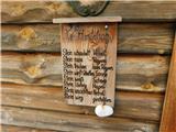 54
54 55
55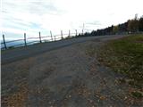 56
56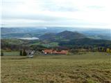 57
57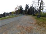 58
58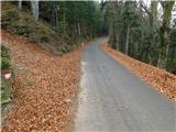 59
59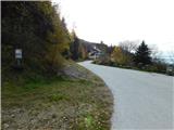 60
60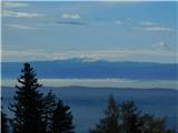 61
61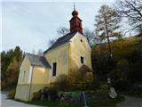 62
62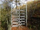 63
63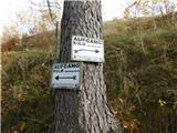 64
64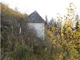 65
65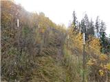 66
66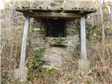 67
67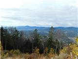 68
68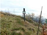 69
69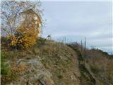 70
70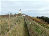 71
71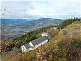 72
72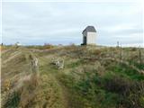 73
73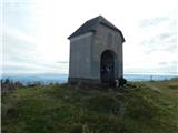 74
74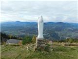 75
75
Discussion about the trail Stubenbergsee - Kulm (via Kulmkögerl)