Studenice - Formila na Boču (on road and mountain path from Makole)
Starting point: Studenice (260 m)
| Lat/Lon: | 46,2999°N 15,6138°E |
| |
Name of path: on road and mountain path from Makole
Time of walking: 1 h 10 min
Difficulty: easy marked way
Altitude difference: 364 m
Altitude difference po putu: 460 m
Map: Posavsko hribovje Boč - Bohor 1:50.000
Recommended equipment (summer):
Recommended equipment (winter):
Views: 2.118
 | 2 people like this post |
Access to the starting point:
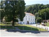
a) From Maribor, leave the motorway at Slovenska Bistrica, where signs direct you to Poljčane. In the centre, turn left in the route Studenice and after about three kilometres reach Studenicee, where you continue to the right over the bridge over the Dravinja River into the central part of the settlement. Park safely in front of the monastery complex.
b) From the route of Ljubljana, leave the motorway at Slovenske Konjice and drive through Žič, Loč and Zbelovo to the centre of Poljčany. In the centre, turn right towards Studenice and after about three kilometres reach Studenice, where you continue right over the bridge over the Dravinja River into the central part of the settlement. Park safely in front of the monastery complex.
c) From the route of Ptuj, Kidričevo via Ptujska gora, Majšperk and Makole, arrive at Studenice, where you continue left over the bridge over the Dravinja river into the central part of the settlement. Park safely in front of the monastery complex.
Path description:
After a short tour of the central part of Studenice, we continue to the left of the monastery complex by the parish. In the passageway/underpass between the parish and the St Martin Studenice Vineyarders' Association, continue up the cart track along the stone walls and the Nun's Cemetery. Soon reach the spring(s) of the Warm Studeniškės Stream on the left of the path and cross the stream on a narrow footbridge. Continue uphill, now on the old Roman road, which has retained its original form over the centuries as a basic route higher up to Boč. At the exit to the forest road turn left, the road to the right leads to the settlement Podboč or Zgornje Poljčane.
Follow the forest road and on the left side of the path there is a turnoff for the hunting lodge LD Poljčane, and we continue straight ahead. At the first major crossroads/fork, continue straight ahead or left, to the right is the road to Formilo, the tower at Boč. . . At the crossroads on the right is a landmark, a small abandoned concrete forestry warehouse. Continue along the road, to the left of the path is a small partly abandoned wooden building under the road and a little further on the left is a lookout point to the lower area and towards Pohorje. . .
Further on, we soon reach a crossroads and the mountain trail from Makol. It is not marked with direction signs and we continue sharp right upwards, now on the forest mountain path, which is well marked with markings. An iron hunting crossing will soon be on the right side of the trail, and the trail will continue on a slightly shelving ridge below Kisovec. To the right of the path is another wooden hunting crossing, this time wooden, and soon you will be heading downhill through a part of the forest that was felled a few years ago. Further on, right onto a wider forest road and also practically descending to Formilo.
Formila is reached and there is a short extension to the crossroads, left for the partisan hospital, Gavez, Gril's chapel, Plešivec. . . and right for the mountain lodge on Boč. The crossroads is also the contact with the Styrian - Zagorje or ,,B,, - Brother trail.
The trail is about 5700 metres long, 460 vertical metres and 50 negative vertical metres.

Pictures:
 1
1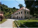 2
2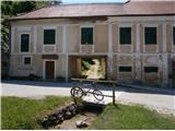 3
3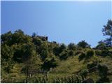 4
4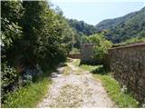 5
5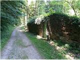 6
6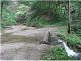 7
7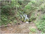 8
8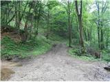 9
9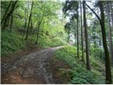 10
10 11
11 12
12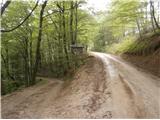 13
13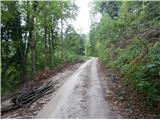 14
14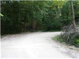 15
15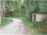 16
16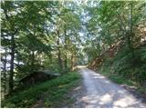 17
17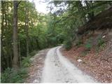 18
18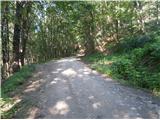 19
19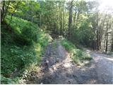 20
20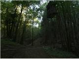 21
21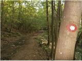 22
22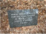 23
23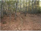 24
24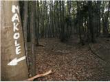 25
25 26
26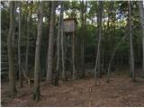 27
27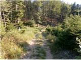 28
28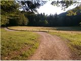 29
29
Discussion about the trail Studenice - Formila na Boču (on road and mountain path from Makole)
|
| bruny25. 10. 2014 |
Popoldan po opisani poti sestopil iz Boča nazaj v Studenice. Megleno, razmočeno in tudi blatno je bilo v delu ki poteka po gozdni planinski poti...gozdna cesta je v solidnem stanju saj je bila mesec nazaj na novo pošodrana in tudi delno utrjena...
|
|
|
|
| bruny29. 12. 2015 |
V osrednjem delu dneva po opisani poti višje v svet Boča. Vsekakor primerno izhodišče za nadaljevanje, ki je bilo... in o katerem nekaj več morda v razmerah! Lp
|
|
|
|
| bruny24. 04. 2016 |
Po opisani poti opravljen vzpon danes okoli poldneva višje v svet Boča...  Brez posebnosti, vreme je ,,viselo,, ampak ploh ni bilo...
|
|
|
|
| bruny29. 04. 2019 |
Popoldanska, ki je ,,padla,, v večerno...Oblačno je bilo in nekaj kapljic dežja na Formili...Po opisani poti vzpon, povratek v drugi varianti nazaj v Studenice... Strava/Formila na Boču,29.04.2019
|
|
|
|
| bruny22. 01. 2022 18:38:11 |
V popoldanski aktivnosti po opisani poti do točke/fotke številka 20...In nazaj!
|
|
|