Starting point: Sveti Jurij (320 m)
| Lat/Lon: | 46,2537°N 15,7384°E |
| |
Time of walking: 1 h 5 min
Difficulty: easy unmarked way
Altitude difference: 275 m
Altitude difference po putu: 300 m
Map: Rogaška Slatina z Bočem in Donačko goro 1:25.000
Recommended equipment (summer):
Recommended equipment (winter):
Views: 142
 | 1 person likes this post |
Access to the starting point:
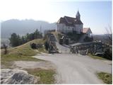
From the Ljubljana - Maribor motorway, take the Dramlje exit and follow the road towards Šentjurje, Rogaška Slatina and Rogatec. In Rogatec, the signs for Donačka gora direct you to the left. Just a little further on, you reach the next crossroads, where you continue to the right, again in the direction of Donačka gora. Continue towards the village of Sveti Jurij (do not follow the signs for Donačka gora). In the village of Sveti Jurij, turn left uphill towards the church of St. George, by which you park. You can park a little further down the road in the parking lot.
Path description:
From St George's Church, continue up the road. After 100 m walk, you will reach a crossroads where you turn left. After a further few dozen steps, you reach a farm where a marked footpath turns right uphill and initially climbs across a meadow, then turns right where it crosses lane of bushes and then, at a cross, leads to the next farm.
Here we continue up the marked cart track, which soon leads us over a scenic slope to a marked crossroads.
Continue straight ahead in the direction of Rudi's home and St Donat's, and after a few minutes' further walking the slope eases and the path turns left. There is a short crossing of the slopes to the west to the Church of St Donatus.
From the church, continue in the direction of Rudi's home, following the path into the forest. The path initially crosses the western slopes of Donačka gora and then climbs for a short distance up a steep and, especially in the wet, dangerously slippery slope. The path then leads to a farm, after which you enter a road, where you continue to the right. The road, which continues the climb, leads us after a good 5 minutes of further walking to Rudi's home.
From Rudi's house, continue towards the Donačka gora summit, initially walking along the macadam road. The road first branches off to the right to an easier path to Donačka gora, and we continue along the road to a left serpentine, where we leave the road and continue straight on, following the cart track, which crosses the northern slopes of Donačka Gora. There is a short cross-climb and we ascend to an unmarked saddle at Joški vrh, where we leave the marked path. Go left here and in two minutes you reach the unmarked Joški vrh.
Starting point - Rudijev dom 0:50, Rudijev dom - Joški vrh 0:15.

Pictures:
 1
1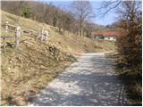 2
2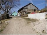 3
3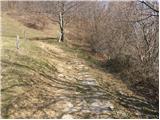 4
4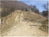 5
5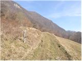 6
6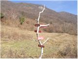 7
7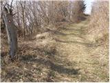 8
8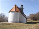 9
9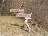 10
10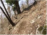 11
11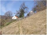 12
12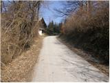 13
13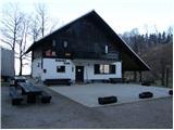 14
14 15
15 16
16 17
17 18
18 19
19 20
20 21
21 22
22 23
23 24
24 25
25 26
26
Discussion about the trail Sveti Jurij - Joški vrh