Tacen - Šmarna gora (Partizanska steza)
Starting point: Tacen (303 m)
| Lat/Lon: | 46,1183°N 14,4615°E |
| |
Name of path: Partizanska steza
Time of walking: 1 h
Difficulty: easy marked way
Altitude difference: 366 m
Altitude difference po putu: 366 m
Map: Ljubljana - okolica 1:50.000
Recommended equipment (summer):
Recommended equipment (winter): ice axe, crampons
Views: 21.572
 | 1 person likes this post |
Access to the starting point:
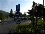
a) From the Ljubljana - Jesenice motorway, take the Ljubljana - Šmartno exit and then continue to Tacno. When you reach the bridge over the Sava River, turn right at the junction in the direction of Vikrče and Pirnič. Just after the crossroads, turn right again into a large marked parking area.
b) From Celovška cesta in Ljubljana, just after the entrance to the Gorenjska motorway, the road to Vižmary and Tacno turns right (if you are coming from the Medvo side, just before the entrance to the motorway, turn left). Continue driving towards Tacno, and then, just after crossing the bridge over the Sava River, park in the large parking lot.
Path description:
At the beginning of the parking lot, you will see the mountain signs for Šmarna gora, which first lead you along the pavement and then direct you to the right onto Thumova Street. After a few minutes of easy walking, we reach the intersection of Thumova Street and Ulica Janeza Rožiča, and we continue straight along the narrow mountain path. After a short, gentle climb, we reach a road, but we just cross it and continue our ascent along the increasingly steep mountain path. The path, which continues through the forest, lies higher and leads us to the plain of Spodnja Kuhinja.
At Spodnja Kuhinja there is a marked crossroads, and we continue to the right in the direction of the Pilgrims' Way and the Partizanská steza (left Mazi's Way to Grmada, straight Sedlo). The path continues to climb crosswise to the right, and then joins the path from Šmartno. Here continue slightly left and climb up to the nearby chapel. At the chapel, continue to the right, and the path quickly leads to the next crossroads, where you continue left up the Partizanska cesta to Šmarna Gora.
From the crossroads onwards, the path becomes steeper and passes onto significantly steeper slopes, which are dangerous for slipping, especially in snow and ice. Next, we climb up the steep slope in circuits, and after a while the well-maintained path leads us to a bench, from which we have a beautiful view of the valley. Above the bench, the path passes onto a ridge, which we climb just below the top of Šmarna Gora. Here, the path goes from the ridge to a slope, over which we climb to the top of Šmarna Gora in a few 10 steps of further walking.

Pictures:
 1
1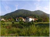 2
2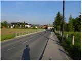 3
3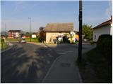 4
4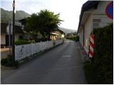 5
5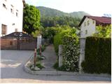 6
6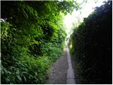 7
7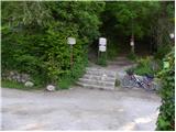 8
8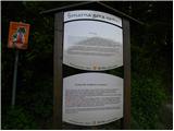 9
9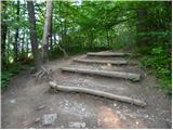 10
10 11
11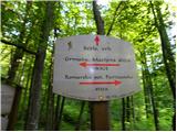 12
12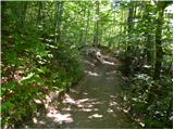 13
13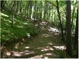 14
14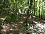 15
15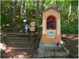 16
16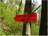 17
17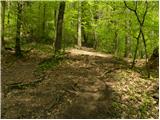 18
18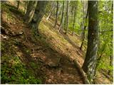 19
19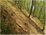 20
20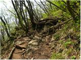 21
21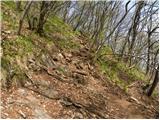 22
22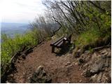 23
23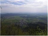 24
24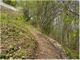 25
25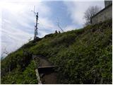 26
26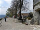 27
27 28
28
Discussion about the trail Tacen - Šmarna gora (Partizanska steza)
|
| sla23. 05. 2012 |
Jaz sem pa že 25. decembra videla helikopter, ki je poškodovanko odpeljal v Lj. (dotična oseba bi sicer rabila dereze ali pa vsaj vele opevane ketne za na čevelj...).
|
|
|