Tolminska korita - Grušnica (through Tolminska korita and over Tolminske Ravne)
Starting point: Tolminska korita (210 m)
| Lat/Lon: | 46,1977°N 13,7397°E |
| |
Name of path: through Tolminska korita and over Tolminske Ravne
Time of walking: 4 h 15 min
Difficulty: partly demanding marked way, easy unmarked way
Altitude difference: 1360 m
Altitude difference po putu: 1420 m
Map: Julijske Alpe - zahodni del 1:50.000
Recommended equipment (summer):
Recommended equipment (winter): ice axe, crampons
Views: 952
 | 1 person likes this post |
Access to the starting point:
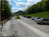
Take the Tolmin, then continue towards Zatolmina from the traffic lights. When you arrive in Zatolmin, follow the signs for Čadrg and Tolmin gorges. Just before entering the TNP, you will see a large parking lot near the entrance to the Tolmin trough.
Path description:
From the starting point, walk to the entry point to Tolmin gorges, where you have to pay an entrance fee (adults €4. 00, children €2. 00, students, pensioners, adult groups €3. 20, children groups €1. 60 - April 2016). The path to the troughs is at first steep, but then begins to descend steeply down the stairs. As you approach the confluence of the Tolmin and Zadlaščice rivers, the path turns left and then crosses the Tolminko river via a small bridge. From the little bridge we have a nice view of Hudičev most and Tolmin gorges below, and we continue right after the bridge (left hot water spring in Tolmin gorges) and quickly reach the lowest point of the TNP (the confluence of Zadlaščice and Tolmin (180 m)). At the next two crossroads we continue left (the first fork to the right Žabče and Tolmin, the second fork to the right Medvedova skala), and then climb up to the road, where we join the trail over Hudičev most.
The road continues past the entrance to the Zadlaško (Dante's) Cave and then gradually moves away from both watercourses, Tolmin and Zadlaščice. Higher up, you pass a few houses, and after them you come to a marked crossroads, from where you continue to the right in the direction of Zadlaz and Koča na planini Razor (Čadrg on the left). There is a slight uphill crossing, with the narrow road leading you past a number of individual houses along the way (Čadrg on the left). When the road turns sharp left at a higher point, leave it and continue straight ahead along the marked path in the direction of the Hut na mountain pasture Razor. The way ahead takes us mostly through the forest, but continues to cross the slopes to the right. During the crossing we cross a few ravines, one of which is a little more exposed, but the fixed safety gear are helpful, so the crossing is not particularly difficult, but some caution is still needed. There is some cross-country descent, ending at the crossing of the Jelovšček stream. On the other side of the stream, a cross-climb to the right, and then you reach an asphalt road leading to Tolminm Ravne. Continue ascending along the road, which leads first over the right-hand and then over the left-hand serpentine. After the left serpentine, the markings for mountain pasture Razor direct us to the right, onto a path which takes a few steps to reach the mulatier. The mulatier ascends crosswise at first, and then leads over a short jump in a few serpentines. Above the jump, the path passes into a dense forest, and higher up it returns to the road, which is then followed all the way to Tolminski Raven, where, just beyond the chapel, we reach a marked crossroads from which we continue left in the direction of mountain pasture at Kal and the huts at mountain pasture Razor.
The way forward leads us first through the pasture fence, then we continue along the cart track, which continues across the meadow, and from it we have a beautiful view of the Tolminski Migovec. Cart track soon turns to the right and leads to a stone enclosure where it splits into two parts.
Continue along the upper left cart track in the direction of mountain pasture on Kal (slightly right Koča na planini Razor), which climbs gently. A little higher, at an older water tower, continue right, then cross a torrent. Soon you will reach the next crossroads, where continue left in the direction mountain pasture on Kal and Tolminski Migovec. The old mulatier continues for some time along or slightly to the right of the nearby torrent, and then at a small man's house, the path branches off from the mulatier slightly to the left, which continues along the torrent and leads further towards the saddle between the Javor peak on the left and Grušnica on the right, while we continue to follow the mulatier.
Higher up, we reach the next marked crossroads, where another path branches off to the right towards mountain pasture Razor, and we continue to the left and continue for a short time on a slight incline. A minute or two further on, we leave the gently sloping path and continue slightly to the right in the direction of mountain pasture on Kal (we arrive directly at the aforementioned saddle from which we can continue to Javor or to the village Čadrg, with another branch to mountain pasture on Kal in between). After a short, slightly steeper climb, we return to the mulatier, where we also join the route from Čadrgo.
Continue to the right and follow the mulatier up to mountain pasture on Kal, where a few old bytes stand to the right of a small saddle.
From the saddle, from where we have a nice view towards the valley Tolmin, Vrh nad Peski, and also a nice view of the peaks above Tolminske Ravne, which we have seen from time to time during the ascent, we continue slightly left of the ridge Grušnica, along a well-traced path. After a short traverse, we reach the east ridge of Grušnica, from where we have a fine view to the south. Here the trail turns slightly to the right, and within a few minutes of increasingly scenic walking, we reach an overlooking peak, from which we have a fine view of the surrounding mountains.
Description and figures refer to the situation in 2016 (April).

Pictures:
 1
1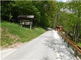 2
2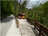 3
3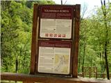 4
4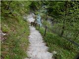 5
5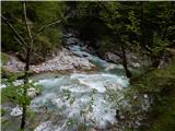 6
6 7
7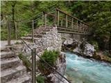 8
8 9
9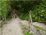 10
10 11
11 12
12 13
13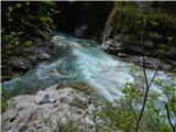 14
14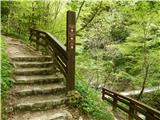 15
15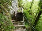 16
16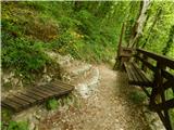 17
17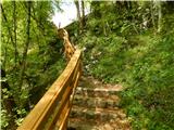 18
18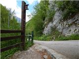 19
19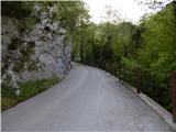 20
20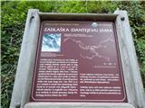 21
21 22
22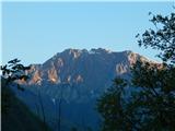 23
23 24
24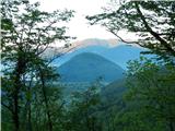 25
25 26
26 27
27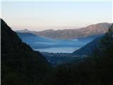 28
28 29
29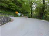 30
30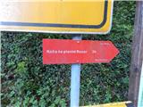 31
31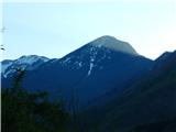 32
32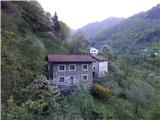 33
33 34
34 35
35 36
36 37
37 38
38 39
39 40
40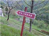 41
41 42
42 43
43 44
44 45
45 46
46 47
47 48
48 49
49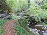 50
50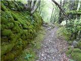 51
51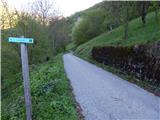 52
52 53
53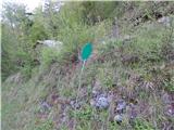 54
54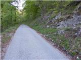 55
55 56
56 57
57 58
58 59
59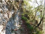 60
60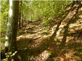 61
61 62
62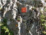 63
63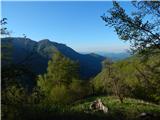 64
64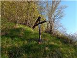 65
65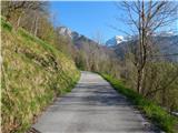 66
66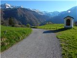 67
67 68
68 69
69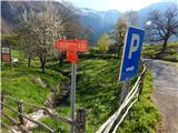 70
70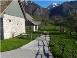 71
71 72
72 73
73 74
74 75
75 76
76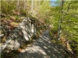 77
77 78
78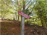 79
79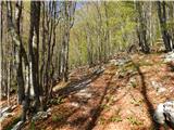 80
80 81
81 82
82 83
83 84
84 85
85 86
86 87
87 88
88 89
89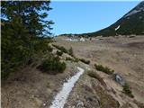 90
90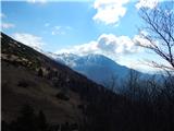 91
91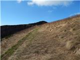 92
92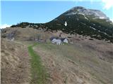 93
93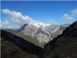 94
94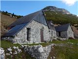 95
95 96
96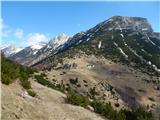 97
97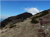 98
98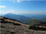 99
99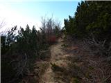 100
100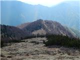 101
101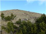 102
102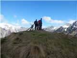 103
103 104
104
Discussion about the trail Tolminska korita - Grušnica (through Tolminska korita and over Tolminske Ravne)