Tolminske Ravne - Žabiški Kuk (on mule track)
Starting point: Tolminske Ravne (924 m)
| Lat/Lon: | 46,2294°N 13,7715°E |
| |
Name of path: on mule track
Time of walking: 3 h 45 min
Difficulty: easy unmarked way
Altitude difference: 920 m
Altitude difference po putu: 970 m
Map: TNP 1:50.000
Recommended equipment (summer):
Recommended equipment (winter): ice axe, crampons
Views: 2.090
 | 1 person likes this post |
Access to the starting point:
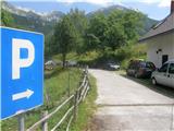
Take the Tolmin, then continue in the direction of Žabč and Zadlaz (the turn-off from the main road is on the left bank of the Tolminka River). When you arrive in Žabče, at a small crossroads, turn slightly right towards Zadlaz. At Zadlaz-Žabče the road descends a little, where it crosses the Zadlaščica River via a bridge, and then starts climbing steeply again on a narrow, but constantly asphalted road. After about 12 km from the main road, you reach a marked parking area in Tolminske Ravne, where you park.
Path description:
From the parking lot, follow the path in the direction of Koča na planini Razor and mountain pasture at Kal. Initially, follow cart track, which continues from the nearby house and leads you across a meadow with a view. On the other side of the meadow, cross a pasture fence and the path leads to a marked crossroads, where you continue along the bottom right-hand cart track (slightly left-hand mountain pasture on Kal).
Continue along cart track, which descends gently to the right, then lays down and continues for a few minutes without any major changes in elevation. After the concrete trough, the path splits again and we take the lower lay-by (slightly steep left), which continues along the wide cart track. A little further on, after crossing a pasture fence, cart track turns into a mulatier, and soon we go slightly left from it, onto a marked footpath which intersects a longer bend in the mulatier. After a few minutes of climbing, we return to the mulatier, which is reached just at a small crossroads. Take the upper right-hand path, which ascends diagonally to the right, but soon turns sharply to the left. The mulatier continues to climb gently to moderately, leading crosswise to the left, gradually changing to quite steep slopes, where the passage is not difficult, as the path is quite wide throughout. As the higher slope flattens out, the mulatier turns slightly to the right and leads us out of the forest to the south-western part of the mountain pasture Razor. From here there is a short moderate climb and the path leads us to the cheese cottage and about a minute further on to the hut at mountain pasture Razor.
From the hut, continue in the direction of Globoko, Vogel, Vrch nad Škrbino. . . along the path which crosses the lane of a forest and then splits on a grassy slope.
From the crossroads, continue right (straight ahead Vrh nad Škrbino and Dom na Komni) and start climbing moderately. The path quickly returns to the forest and leads to the next crossroads.
Continue right again towards Vogel (left Globoko) and gradually start climbing steeply. Leave the forest quickly and then start climbing up the gradually steeper slope. With fine views of the Tolmin region, higher up you reach the south-western spine of Vrh Krnic, where the trail transitions and turns left. The path continues to climb crosswise and leads above Cirque and along the slopes of Vrch Krnic. After crossing a small valley, where an unmarked path branches off to the left, leading to a saddle between the summit and Vogel, the path passes to the slopes of Vogel, where it climbs steeply across the steep slope. Higher up, the ridge of Vogel is reached, and we continue right on an unmarked path which descends in a few steps to the pass between Vogel and Žabiská Kuk. The way forward takes us along the Žabiški Kuk ridge for a while, and then, when the ridge becomes precipitous, the path retreats to the right side. We continue to climb crosswise along the path, where the cairns are helpful for orientation. Higher up on the right hand side we pass a larger cave, which is located just off the ridge, and beyond it on the left is corner 1881, which is the highest point of ridge Žabiški Kuk, and the summit is located a little further on at 1844 metres. After the 1881 corner, the route, which bypasses the highest point, returns to theTolminske Ravne - mountain pasture Razor 1:45, mountain pasture Razor - Žabiški Kuk 2:00.
Description and figures refer to the situation in 2016 (July).

We can extend the trip to the following destinations: Vogel
Pictures:
 1
1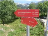 2
2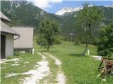 3
3 4
4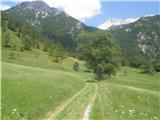 5
5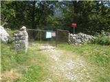 6
6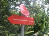 7
7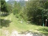 8
8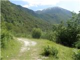 9
9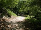 10
10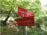 11
11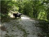 12
12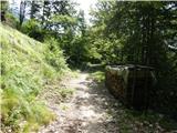 13
13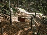 14
14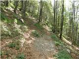 15
15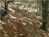 16
16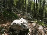 17
17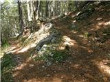 18
18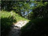 19
19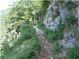 20
20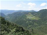 21
21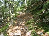 22
22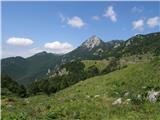 23
23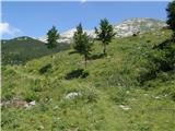 24
24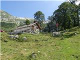 25
25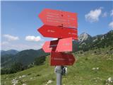 26
26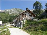 27
27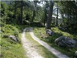 28
28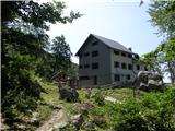 29
29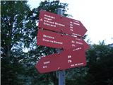 30
30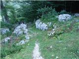 31
31 32
32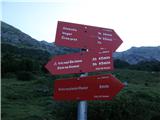 33
33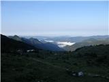 34
34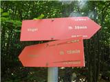 35
35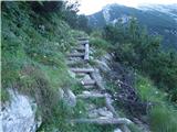 36
36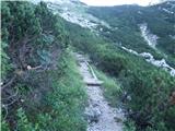 37
37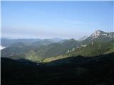 38
38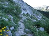 39
39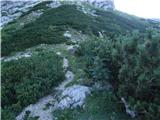 40
40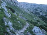 41
41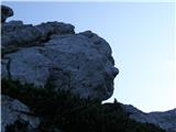 42
42 43
43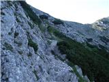 44
44 45
45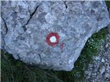 46
46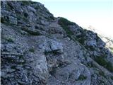 47
47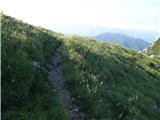 48
48 49
49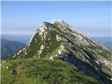 50
50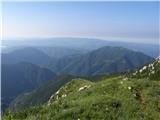 51
51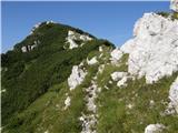 52
52 53
53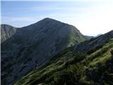 54
54 55
55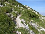 56
56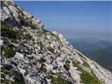 57
57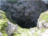 58
58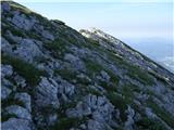 59
59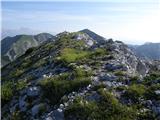 60
60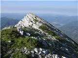 61
61 62
62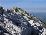 63
63 64
64 65
65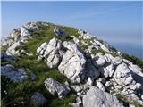 66
66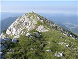 67
67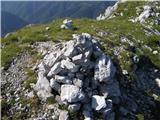 68
68 69
69
Discussion about the trail Tolminske Ravne - Žabiški Kuk (on mule track)
|
| bogdan ž.k.28. 10. 2021 16:06:34 |
Zelo lep, a žal premalo poznan hrib. Ravno prav vsega- trav, gozdov, skal in jam. Podobno, kot na drugi strani Razor planine Tolminski Migovec. Pa lepa krožna pot (sicer malo dolga, a za poleti, ko so dnevi daljši. super): T. Ravne, Migovec, Podrta gora, Vrh nad Škrbino (lahko tudi le spodaj pod plato), Planina Razor, Žabijski Kuk, T. Ravne..  srečno
|
|
|
|
| miri28. 10. 2021 18:24:10 |
Ni ravno malo znan.Je kar obiskan in opisan.
|
|
|