Tolminske Ravne - Zeleni vrh (via planina Razor)
Starting point: Tolminske Ravne (924 m)
| Lat/Lon: | 46,2294°N 13,7715°E |
| |
Name of path: via planina Razor
Time of walking: 4 h 20 min
Difficulty: difficult marked way
Altitude difference: 1128 m
Altitude difference po putu: 1245 m
Map: TNP 1:50.000
Recommended equipment (summer):
Recommended equipment (winter): ice axe, crampons
Views: 2.410
 | 1 person likes this post |
Access to the starting point:
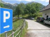
Take the Tolmin, then continue in the direction of Žabč and Zadlaz (the turn-off from the main road is on the left bank of the Tolminka River). When you arrive in Žabče, at a small crossroads, turn slightly right towards Zadlaz. At Zadlaz-Žabče the road descends a little, where it crosses the Zadlaščica River via a bridge, and then starts climbing steeply again on a narrow, but constantly asphalted road. After about 12 km from the main road, you reach a marked parking area in Tolminske Ravne, where you park.
Path description:
From the parking lot, follow the path in the direction of Koča na planini Razor and mountain pasture at Kal. Initially, follow cart track, which continues from the nearby house and leads you across a meadow with a view. On the other side of the meadow, cross a pasture fence and the path leads to a marked crossroads, where you continue along the bottom right-hand cart track (slightly left-hand mountain pasture on Kal).
Continue along cart track, which descends gently to the right, then lays down and continues for a few minutes without any major changes in elevation. After the concrete trough, the path splits again and we take the steep left path (the path that continues straight ahead also leads to the mountain pasture Razor, but the path is longer, but not technically difficult).
The way ahead starts to climb again, and climbs mostly to the right, with only a serpentine here and there. Higher up, we move to steeper slopes, and a little further on to an exposed but, apart from the first few steps, well protected ledge. When the traverse ends, the path returns to the forest, through which it climbs more steeply, and then emerges from the forest and the path is laid. From here it is a few minutes' walk with beautiful views of the mountains rising above the Zadlaščice basin, and the path leads past the cheese cottage to the hut at mountain pasture Razor.
From the hut we continue in the direction of Globoko, Vogel, Vrh nad Škrbino. . . along the path which crosses the lane of a forest and then forks on a gently sloping grassy slope.
This time continue straight on in the direction of Vrch nad Škrbino and Dom na Komni (to the right Vogel, Globoko and Črna prst), along a path which turns slightly to the left and continues climbing up a dwarf pines vegetated slope. After a few minutes, the path is gently laid and then, after a short moderate climb, it leads to the next crossroads, north of the undistinguished Kopecko peak. Continue left in the direction of Stubble Saddle (right Vrh nad Škrbino - southern route). The route soon afterwards emerges from dwarf pines onto interesting slopes, where we will see steep rock slabs on our right, forming an interesting wall for climbers, but not too steep. The route then ascends crosswise over scree to the saddle of Škrbina, which is situated at 1910 m. When we get to Škrbino, a beautiful view of the Bohinj side opens up, and we continue left at the crossroads in the direction of Kuka (right Vrh nad Škrbino, straight down Dom na Komni and the ski slope Vogel). The way forward starts to climb crosswise over steep slabs, and then both the path and the slope are slightly lowered. The path then passes under the shorter face of Kont Peak, and then begins to descend gently over occasional steeper scree. The path continues along the coastal side, crossing Podrta gora and Mali vrh, before returning to the main ridge of the Lower Bohinj Mountains, which it reaches just at the saddle between Mali vrh and Zeleni vrh. From here, continue in the same direction, except that the path moves from the slopes to a ridge that is exposed in places. Follow the marked trail, which occasionally climbs quite steeply, then, with increasingly beautiful views, all the way to the grassy Green Peak.
Tolminske Ravne - mountain pasture Razor 1:15 mountain pasture Razor - Škrbina 2:00, Škrbina - Zeleni vrh 1:05.

Pictures:
 1
1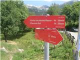 2
2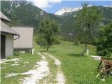 3
3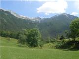 4
4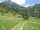 5
5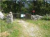 6
6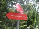 7
7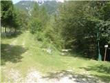 8
8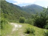 9
9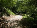 10
10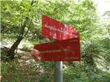 11
11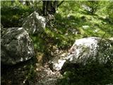 12
12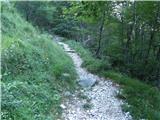 13
13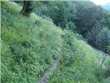 14
14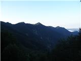 15
15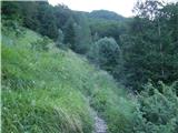 16
16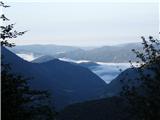 17
17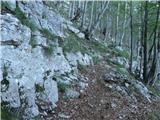 18
18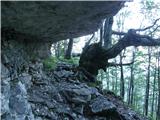 19
19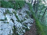 20
20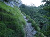 21
21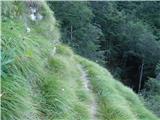 22
22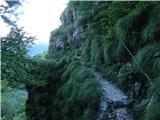 23
23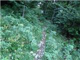 24
24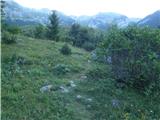 25
25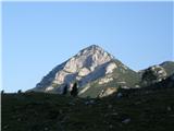 26
26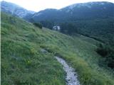 27
27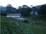 28
28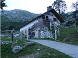 29
29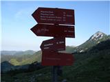 30
30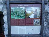 31
31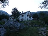 32
32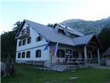 33
33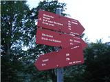 34
34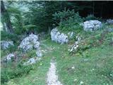 35
35 36
36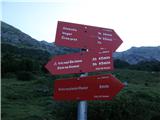 37
37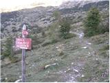 38
38 39
39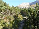 40
40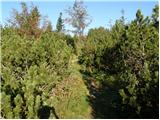 41
41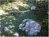 42
42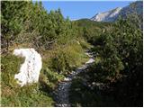 43
43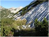 44
44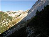 45
45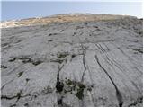 46
46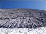 47
47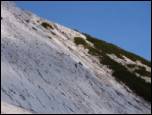 48
48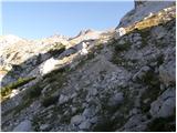 49
49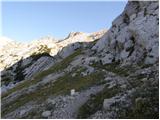 50
50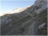 51
51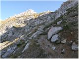 52
52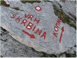 53
53 54
54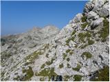 55
55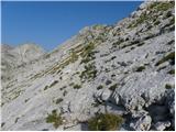 56
56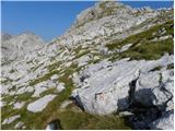 57
57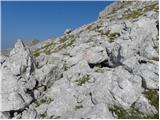 58
58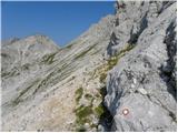 59
59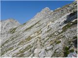 60
60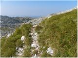 61
61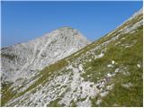 62
62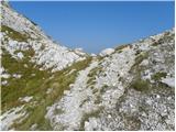 63
63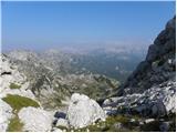 64
64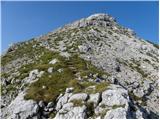 65
65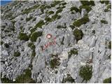 66
66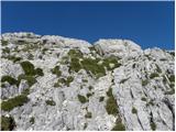 67
67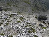 68
68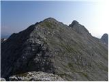 69
69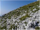 70
70 71
71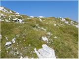 72
72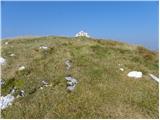 73
73 74
74
Discussion about the trail Tolminske Ravne - Zeleni vrh (via planina Razor)
|
| darinka42. 03. 2022 07:19:30 |
Poleti mi je poznana ta pot. A sedaj v snegu pa ne . Midva sva se izognila planini Razor in krenila v strmino po krajši poti . Pod Škrbinsko ploščo, sva zavila levo v smeri Kuka. Zimski Zeleni vrh je cilj za smučarje. Pa tudi peš se da lepo priti po zimski poti, če je le sneg pravšen za hojo. In včeraj je bil.
|
|
|
|
| darinka410. 01. 2023 21:44:15 |
Hja danes sva šla po poznani poti. Po sneženju sva približno vedela da bo treba gazit. Da bo veter na vrhu so včeraj vremenarji povedali. In zadnji del leden in zahteven. Razgledi pa danes prekrasni. Sneg se prične pri tabli. Kar nekaj ga je nametalo. Razmere pa mešane . Srečala nisva nikogar.
|
|
|