Trbovlje - Špicberg (circular path)
Starting point: Trbovlje (310 m)
Name of path: circular path
Time of walking: 1 h
Difficulty: easy unmarked way
Altitude difference: 180 m
Altitude difference po putu: 180 m
Map:
Recommended equipment (summer):
Recommended equipment (winter):
Views: 4.508
 | 1 person likes this post |
Access to the starting point:
If you arrive in Trbovlje from the route of the train station, follow the main road all the way to the Spar shop and turn left at the crossroads. At the top of the street, where the crossroads are again, follow the road uphill. Follow this road until you reach a crossroads where you will see a sign for the village of Klek. Before this sign, turn left onto the road leading to the left. Follow this road to a crossroads, where you will again turn left. The road, which becomes macadam, leads past private houses to a meadow where you can see a small ski jump.
Path description:
At the starting point, a sign is placed on a tree in a clearing or meadow, with the route mapped out from the very beginning. You can turn left and first cross the entire ridge of Špicberg and then return along the path just below the ridge, thus crossing the circular route.
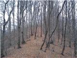
Take the dirt track that leads to the left side of the ridge. As you approach the trees, keep your eyes peeled and you will find a path that will take you up to the ridge. Alternatively, you can follow the dirt track to the other side of the ridge where, just around the bend, there is another path that will take you straight up the ridge to the first peak. Once on the ridge, most of the climb is behind us. All the time we follow the path, which ascends and descends gently to the individual less distinct peaks. Soon we reach the highest part of the trail, where the inscription Vrh 490 m is carved into a tree and a plastic marker is attached to the tree above it.
Continue along the trail, and after a while the path crosses a short narrow passage, which is slightly precipitous on both sides, but which, with a careful step, presents no difficulty to even the most untrained hiker. The path passes through trees and bushes throughout, so the view is very limited. Slowly the vegetation begins to thin out and the path descends. The view opens up and the path descends more and more. We have reached a place where a path joins us from the right, which takes us back to the starting point. In front of us is a tiny hill with a bench on which we can rest.
You can return to the starting point by following the path that goes under the ridge, or you can go back the same way. From this point, there is also a trail to Bevško, which is marked by a direction sign with the inscription. The circular route takes approximately one hour on normal walking.

Pictures:
 1
1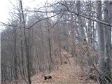 2
2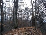 3
3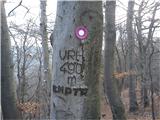 4
4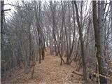 5
5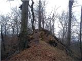 6
6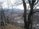 7
7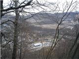 8
8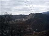 9
9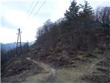 10
10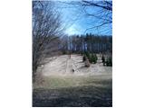 11
11 12
12
Discussion about the trail Trbovlje - Špicberg (circular path)