Tremerje - Veliki Slomnik (through gorge Potoki)
Starting point: Tremerje (231 m)
| Lat/Lon: | 46,19538°N 15,23067°E |
| |
Name of path: through gorge Potoki
Time of walking: 1 h 15 min
Difficulty: easy unmarked way, easy marked way
Altitude difference: 378 m
Altitude difference po putu: 390 m
Map: Celjska kotlina, 1:50000
Recommended equipment (summer):
Recommended equipment (winter):
Views: 1.560
 | 2 people like this post |
Access to the starting point:
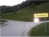
Tremerje is a settlement between Celjem and Laško. From the route of Celje, on the way to Laško, before the Hochkraut Inn, turn right at the crossroads towards Tremerjem. In the opposite direction of the turn at the junction is a bridge over the Savinja, where the central wastewater treatment plant Celje, financed by European funds, is located on the other side of the Savinja, as shown on the notice board. From the route of Laško, turn left at this junction. Immediately after the turn, the settlement is marked with a sign "Tremerje". Continue along the main road to the left turn, then straight on through the settlement for about 1 km southwards until you reach a large parking lot on the left hand side just next to the railway. Near the parking lot, on the opposite side of the road, there is a sign for Žerdoner's mountain trail to "Veliki Slomnik". Even otherwise, it is no longer viable to continue the route by car, as the flat part of the road ends about 300 metres further on, and there used to be an underpass Tremerje, which has been flooded several times.
Path description:
From the parking place, follow the asphalt road south towards Laško for only about 30 metres, until the first turn off to the right into the forest, where we are also directed by the signpost for Veliki Slomnik. The trail starts on a macadam forest road, which runs alongside a stream in a gorge called Potoki, which is joined by smaller streams from Maly Slomnik on the left and Veliki Slomnik on the right. Follow the marked path for only about 100 metres until you reach a fork where the trail continues to the right. Zerdoner's path to Veliki Slomnik. Continue straight along the stream through the gorge. The road slowly turns into cart track, which starts to climb moderately. After 1,45 km walk from the starting point, about 200 metres before the end of the gorge and just before the power line above us, a small path branches off from cart track slightly upwards to the right, and a stone cairn is placed at this crossroads for visibility. Continue along the smaller path, and after a sharp left turn, a view of Mali Slomnik opens up from the pylon of the power line. Continue to the right, slightly downhill for a few metres, and then, again after a sharp left turn, an even better view of the southern hills opens up, as well as of the aforementioned transmission line pylon. Continue to the right and slightly upwards until you reach a crossroads with a cross, from where a marked path runs from the left along the forest road from Liboje in the direction of Veliki Slomnik.
Continue to the right along the marked path. Soon you will be greeted by a new pylon of the aforementioned power line on your left. The forest road becomes a narrower forest path, where we continue our ascent higher up the slightly rockier world. Soon we reach the beautiful lookout point Liboje stena, where we can rest our eyes with beautiful views of the surrounding area and also of the slightly distant area. After the views, a few more minutes of pleasant easy eastward ridge-climbing and we reach the top of Veliki Slomnik, where we are greeted by a table with benches, new signposts (2020), a registration book and a stamp.

Pictures:
 1
1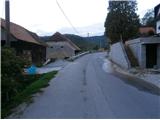 2
2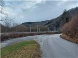 3
3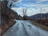 4
4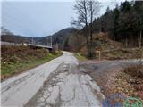 5
5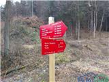 6
6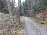 7
7 8
8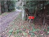 9
9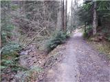 10
10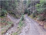 11
11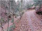 12
12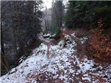 13
13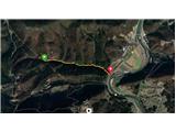 14
14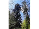 15
15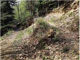 16
16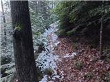 17
17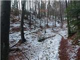 18
18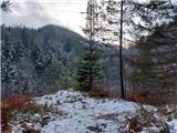 19
19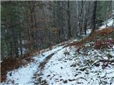 20
20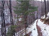 21
21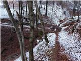 22
22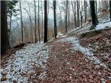 23
23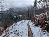 24
24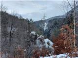 25
25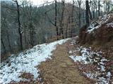 26
26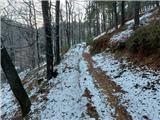 27
27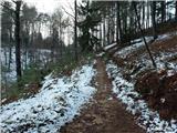 28
28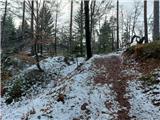 29
29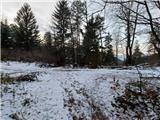 30
30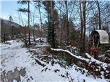 31
31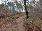 32
32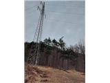 33
33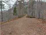 34
34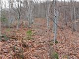 35
35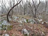 36
36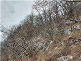 37
37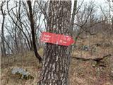 38
38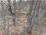 39
39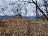 40
40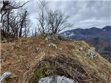 41
41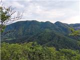 42
42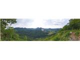 43
43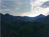 44
44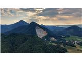 45
45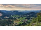 46
46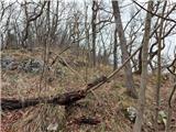 47
47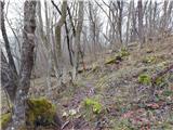 48
48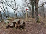 49
49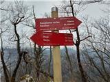 50
50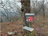 51
51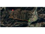 52
52
Discussion about the trail Tremerje - Veliki Slomnik (through gorge Potoki)
|
| janez52011. 03. 2021 |
Sicer sem našel odcep na sliki 13, ampak nadalevanje poti ne ustreza opisu in slikam. Prideš do nekega potoka, kjer se pot konča.
Pa tudi ta pot je zelo zaraščena z smrekami, očitno noben ne vzdrzuje poti.
|
|
|
|
| zdejan11. 03. 2021 |
Hm. Ta opisana pot je še sveža, tako da do danes ni mogla postati zaraščena. Ni pa markirana, tako da ste verjetno pomotoma zavili na kakšen drug manjši odcep. Če nadaljuješ po kolovozu naravnost do konca grabna, pa se lahko gre le levo v hrib, kjer se višje pot priključi na markirano pot Tremerje - Šmohor.
|
|
|
|
| zdejan26. 04. 2021 09:43:00 |
Zaradi boljše razpoznavnosti sem na razpotju na sliki 13 postavil kamnitega možica, na slikah 14-16 pa razpotje še bolj natančno prikazal. Srečno vsem pohodnikom!
|
|
|