Untere Wolayeralm - The lake Wolayer See
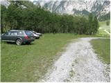
Starting point: Untere Wolayeralm (1218 m)
| Lat/Lon: | 46,6422°N 12,8653°E |
| |
Time of walking: 2 h 15 min
Difficulty: easy marked way
Altitude difference: 733 m
Altitude difference po putu: 733 m
Map:
Recommended equipment (summer):
Recommended equipment (winter): ice axe, crampons
Views: 4.594
 | 1 person likes this post |
Access to the starting point:
Cross the Korensko sedlo border crossing and descend into Austria, then turn left at the first major crossroads towards Podklošter/Arnoldstein. In the village you will come to a roundabout, where you continue to the right in the direction of "Hermagor". Continue along the wide road that leads through the Zilj valley. At Mauthen, turn left towards the Plockenpass and then, after a few 100 m, turn right towards the Lesachtal valley. Continue along a narrower and rather winding road, which you follow until the road forks off to the left towards the village of Wodmaier. The road loses its tarmac surface shortly after the village, and we follow it towards the Wolayer See at the next junctions. We then follow this very bad and sometimes quite steep road to the parking lot at mountain pasture Untere Wolayeralm.
Path description:
From the parking lot, continue along the forest road, which is closed to traffic and soon starts to climb steeply. The road, which is quite scenic and serpentine, leads you higher up to the beautiful Hildenfall waterfall.
After the waterfall, the road enters a lane of sparse forest, and after a few minutes of further walking, it climbs a little higher, crosses a grazing fence and leads to mountain pasture Obere Wolayeralm, where there is a slightly larger shepherd's hut (it takes 1. 5 hours to get here).
From mountain pasture, where cattle graze in summer, continue along a slightly worse mountain road which, after a short climb, leads to the beautiful high mountain cirque. At the end of cirque the road turns slightly to the right and climbs steeply. Follow this road (you can also follow a marked path higher up) to the mountain lodge at Wolayer See.
Pictures:
 1
1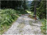 2
2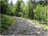 3
3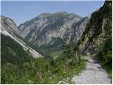 4
4 5
5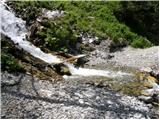 6
6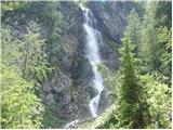 7
7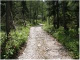 8
8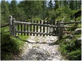 9
9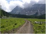 10
10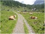 11
11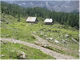 12
12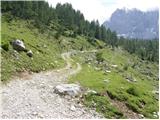 13
13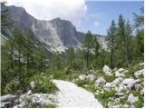 14
14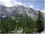 15
15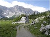 16
16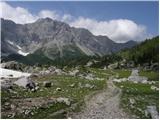 17
17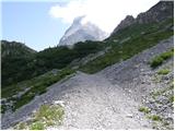 18
18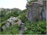 19
19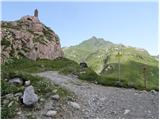 20
20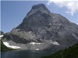 21
21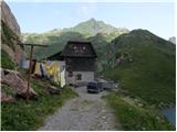 22
22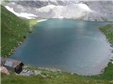 23
23
Discussion about the trail Untere Wolayeralm - The lake Wolayer See