Vent - Similaun (normal approach from Vent)
Starting point: Vent (1895 m)
| Lat/Lon: | 46,8605°N 10,91494°E |
| |
Name of path: normal approach from Vent
Time of walking: 6 h
Difficulty: easy marked way, partly demanding unmarked way
Altitude difference: 1711 m
Altitude difference po putu: 1711 m
Map: Ötztaler Alpen Weißkugel, 30/2 1:25.000
Recommended equipment (summer): ice axe, crampons
Recommended equipment (winter): ice axe, crampons
Views: 1.330
 | 3 people like this post |
Access to the starting point:
From Ljubljana, take the motorway past Salzburg towards Munich. At the Dreieck Inntal multi-level junction, take the A93 towards Innsbruck/Kufstein/Brenner. On returning to Austria, follow the A12 motorway past Innsbruck, Telfs and Mötz, then turn off at exit 123 near Ötztal Bahnhof onto the B186/B171/Ötztal/Haiming. The B186 road into the Ötztal valley passes Oetz, Längenfeld and the centre of the valley, Sölden. Just a few kilometres further on from Sölden, at the village of Zwieselstein, turn onto the fast climbing but comfortable asphalted road towards Vent. In the tourist village of Vent, park in one of the many (paid) car parks. The parking fee in Vent is €5/day in 2020.
Path description:
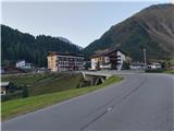
From one of the car parks in Vent, head through the village to its south-western edge, where you will see signs leading you over a small bridge in the direction of Martin-Busch-Hütte and Similaunhütte. Follow the rather sloping path, which in the first part of the trip follows the route of a minor dirt road, to a small private hut, shortly after which take a slightly narrower path to the east, which leads through a small canyon of the Niedertalbach river. After about fifteen minutes of further walking, follow the track over an iron bridge to join back to the mountain road. Follow the road, which ascends barely perceptibly and on which you will often encounter cyclists in the warm summer months, around a bend below the northernmost slopes of the Hintere Schwärze to the Martin-Busch-Hütte.
The path between Martin-Busch-Hütte and Similaunhütte mostly follows a relatively gentle, open grassy slope below the expanses of the Marzellferner and Niederjochferner glaciers. The easy path, which is exposed to the summer heat, initially leads past a crossroads where the direct approach to the Ötzi Monument branches off, but later winds past small glacial lakes and climbs slightly steeper to the Similaunhütte hut. From Venta it is about 4 hours' walk to the hut below Similaun, and the whole route is marked accordingly.
The trail from Similaunhütte to the summit is no longer marked, but is reasonably clearly indicated due to the numerous footprints and the cairns. First, descend over rubble into a small basin below the edge of the Niederjochferner glacier, then climb up to the glacial outlet. Here we are offered two possibilities to continue the route:
- the orientationally straightforward route continues directly on the Niederjochferner glacier, which is quite steep and cracked in places in the lower part. The permanent glacier trace initially runs eastwards, then turns southwards and crosses under the ridge over which the alternative described below passes to the path joining in the early part of the glacier. I advise against ascending or descending this route in late summer afternoons;
- slightly easier is the annual variant, which, near the outlet of the glacier, uses individual cairns and a trail of predecessors to lead us over sometimes unfavourable rubble to an attractive lake under the largely land-locked cliffs of the western ridge of the Similaun Ridge for most of the year. From the lake, follow the obvious, easy and moderately steep path over part of the western ridge of the Similaun massif to the trail junction.
After returning to the glacier, cross the glacier eastwards to the western flanks of the Similaun summit head; the glacier is flatter and without visible crevasses in this part, making the crossing relatively easy.
At the end of the ascent, follow the unmarked but obvious ridge path over the Similaun rock building. The moderately steep path is a little exposed in places, which is particularly tricky at times when patches of snow remain on the path - in this case it is advisable to wear full winter gear, even on the final ascent. The key part of the route is revealed in the early part of the ridge ascent, where, after crossing a small plain, you cross aerially over the precipitous Similaun Vespasas. After entering the summit of the mountain, the relatively wide ridge can be followed without much difficulty to the spacious and scenic summit with its large cross.
Despite the fact that the ascent of Similaun is a full-day high-mountain tour, with a serious glacial environment in the final part, the route is one of the easiest of its kind, due to its relative technical superiority and the favourably placed stops along the way. Even if part of the route passes over a glacier, winter equipment is not usually needed in the high mountain season due to the clear tracks and the lack of steepness and glacial crevasses - but it is essential if you decide to climb over the whole glacier and if conditions in the final part are not optimal.
For these reasons, the summit is frequently visited, and the Similaunhütte hut, which offers comfortable accommodation above 3000 m, contributes to this.
However, it should be noted that the description refers to the approach during the peak of the high mountain season, which generally runs from August to mid-September; when the final ridge is still under snow, the difficulty of the tour increases.

Pictures:
 1
1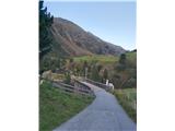 2
2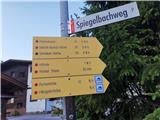 3
3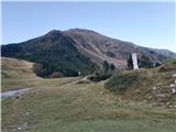 4
4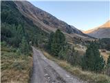 5
5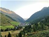 6
6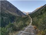 7
7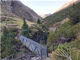 8
8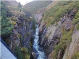 9
9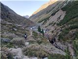 10
10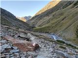 11
11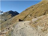 12
12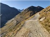 13
13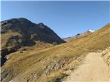 14
14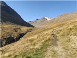 15
15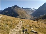 16
16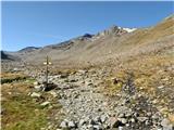 17
17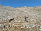 18
18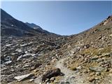 19
19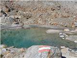 20
20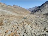 21
21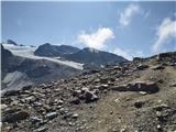 22
22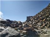 23
23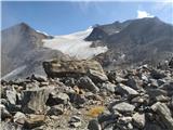 24
24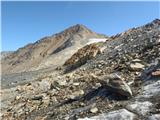 25
25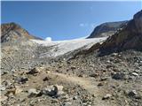 26
26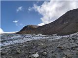 27
27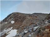 28
28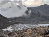 29
29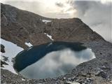 30
30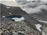 31
31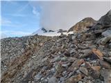 32
32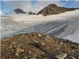 33
33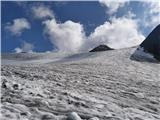 34
34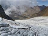 35
35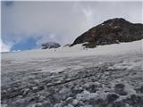 36
36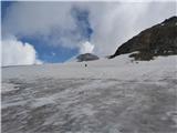 37
37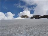 38
38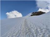 39
39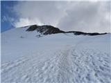 40
40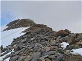 41
41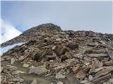 42
42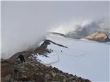 43
43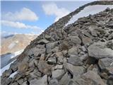 44
44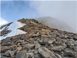 45
45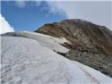 46
46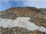 47
47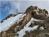 48
48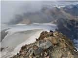 49
49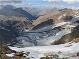 50
50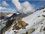 51
51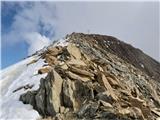 52
52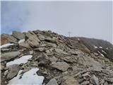 53
53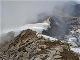 54
54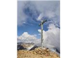 55
55
Discussion about the trail Vent - Similaun (normal approach from Vent)