Zgornja Kostrivnica - Boč (via Koča Velikonočnica)
Starting point: Zgornja Kostrivnica (297 m)
| Lat/Lon: | 46,26147°N 15,59192°E |
| |
Name of path: via Koča Velikonočnica
Time of walking: 2 h
Difficulty: easy marked way
Altitude difference: 681 m
Altitude difference po putu: 700 m
Map:
Recommended equipment (summer):
Recommended equipment (winter):
Views: 8.750
 | 2 people like this post |
Access to the starting point:
Exit the Styrian motorway at the Slovenska Bistrica-South junction, from where follow the signs for Poljčane. These direct you out of the town, from where you follow the main road in the direction of Boč, which is clearly visible from here. After Zgornje Poljčane, do not turn onto Boč, but continue in the direction of Rogaška Slatina, crossing the Pečica Pass. When you come down from Pečica, continue straight on the main road until you reach the point of Podplat. There, just before the main crossroads, turn left at the small crossroads by the Kostrivnica signpost and continue along the smaller local road. This road soon leads to Kostrivnica or Zgornja Kostrivnica, which is recognisable by the church on the hill. Then park in a suitable place, for example in front of the church or at the small shop and pub in the centre of the town.
Path description:
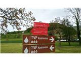
In the centre of the town, at the crossroads, a mountain signpost leads us to Boč, both to the left and to the right. We choose the left direction (Gabrovec at Kostrivnica) and continue along the asphalt road. Soon we reach a crossroads where we turn left, despite the Boč road sign pointing to the right. You will then reach the hamlet of Gabrovec at Kostrivnica, where a mountain signpost points right uphill (Direction Drevenik). Follow the asphalt road, which is initially quite flat and then starts to climb steeply. Follow the road through the forest. After leaving the forest, you will come to a sharp bend where a marking on a building points to the left. With a bit of luck, you can see several deer behind the fence, as it is a breeding ground. At the end of the sharp bend, leave the road for a short distance and turn right along the fence into the forest. There you will be greeted by a sign "Path to Boč", past which you continue left down the stairs. At the end of the stairs, you will rejoin the asphalt road and continue right uphill. Then follow the road as it steepens. Soon you will come to a sharp bend under a mighty rock wall, where a sign warns you that you are approaching the Velikonočnica hut. The road narrows a little towards the end and just before the Velikonočnica hut it turns into a macadam road in a sharp right-hand bend. We arrive at the hut, which is closed on Sundays but open for snacks and drinks on other days.
Pass the hut and continue straight into the forest along the forest path. This leads past several cottages and through the woods, gradually becoming an ever-widening dirt road. Soon we reach a meadow of Easter-eyes in the meadows below Boč. Continue past the plantations on the right and you will reach the Mountain Home at Boč.
From the home, past the outer shank, continue along the clearly visible path into the forest, which immediately leads to a crossroads, after which continue to the right and follow the clearly visible path along the road, which leads us to a crossroads where the asphalt road meets the macadam path to Donačka Gora. Here turn left into the forest onto the Senčna trail. The path immediately changes from macadam to a wide hiking trail, which climbs gently at first and then steeply. After a few minutes of walking, you reach a section where the path becomes steeper and zigzags upwards. There are a number of shortcuts here, so make sure you follow the signs. There are also a number of fallen trees along this stretch, so extra care is needed. The path continues to zigzag between the trees to a small ridge, where you turn left and follow the path as it gently slopes down. The path keeps pulling us slightly to the right until we reach a natural tunnel made of young trees, after which we turn left and climb to the top ridge of Boč. Turn left here again and follow the visible path along the top of the ridge, but it is very rocky, so caution is needed here. In a few minutes you will reach the lookout tower at the top of Boč.

Pictures:
 1
1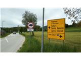 2
2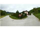 3
3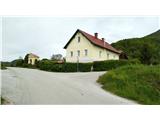 4
4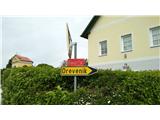 5
5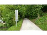 6
6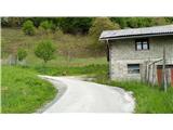 7
7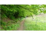 8
8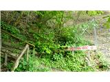 9
9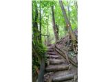 10
10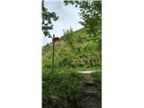 11
11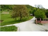 12
12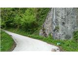 13
13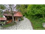 14
14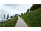 15
15 16
16 17
17 18
18 19
19 20
20 21
21 22
22 23
23 24
24 25
25 26
26 27
27 28
28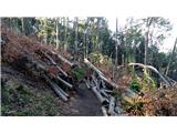 29
29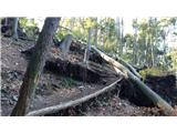 30
30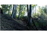 31
31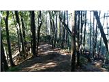 32
32 33
33 34
34 35
35 36
36 37
37 38
38 39
39
Discussion about the trail Zgornja Kostrivnica - Boč (via Koča Velikonočnica)