Koča pri Savici - Tolminski Kuk (via Dom na Komni and Škrbina)
Starting point: Koča pri Savici (653 m)
| Lat/Lon: | 46,2896°N 13,8022°E |
| |
Name of path: via Dom na Komni and Škrbina
Time of walking: 6 h 45 min
Difficulty: partly demanding marked way
Altitude difference: 1432 m
Altitude difference po putu: 1750 m
Map: TNP 1:50.000
Recommended equipment (summer):
Recommended equipment (winter): ice axe, crampons
Views: 8.414
 | 1 person likes this post |
Access to the starting point:
From the motorway Ljubljana - Jesenica, take the Lesce exit and follow the road towards Bled and on to Bohinjska Bistrica. Continue driving towards Bohinjsko jezero (Ribčev laz), at which you will come to a crossroads, where you will continue straight along the left (south) side of the lake in the direction of Ukanec and the Savica waterfall. Follow this increasingly narrow road to the large parking lot at the Savica Cottage. There is a charge for parking.
Path description:
From the parking lot, follow the wide footpath towards the Savica and Dom na Komni waterfalls. After a short ascent, the path leads us to a marked crossroads where the tourist path to the right branches off towards the Savica waterfall, and we continue slightly left or straight along the wide path in the direction of Komna. The path continues to climb for a short time along Savica, and then leads us to the first of the 48 marked serpentines. After an hour and a half of moderate ascent through the forest, the path leads us to the 48 serpentine from which we have a beautiful view of Bohinjsko jezero. Here the trail turns slightly to the right and passes into the valley called Pekel, where it climbs gently for a while, then turns to the right and climbs slightly steeper again. After only a few 10 paces, the path turns left again and continues to climb parallel to the valley. The path, which is steep to moderately steep, gradually turns into a more sparse forest, from which you can soon see the Dom na Komni. The way forward leads us past a small man-made cave, and higher up, past a natural abyss, which is fenced off to prevent any of the hikers from falling into it. Next, the path climbs a little more and after a few steps of further walking leads us to a crossroads where the path to the right branches off to the Black Lake.
Continue straight ahead on the wide path (mulatjeri), which takes you just a little higher to the next crossroads. Continue left again (right Koča pri Triglavskih jezerih) along the path, which climbs a little more steeply and after a few minutes of further walking leads to Dom na Komni.
From home, continue left in the direction mountain pasture Govnjač, Vogel and Mahavščka (right Bogatinsko sedlo and Krn) along the path, which starts to descend more steeply shortly after the hut. The path soon becomes flat and after 5 minutes from Dom na Komni leads to a marked crossroads, where you continue to the right in the direction of mountain pasture Govnjač and Vogla (at the crossroads you can also continue straight along a slightly shorter, but in parts quite overgrown path that intersects the mountain pasture Govnjač). The trail continues along an old military causeway and, with the exception of a few short ascents, descends. After about 30 minutes of walking from Dom na Komni, you will reach the information board at the mentioned mountain pasture. From mountain pasture Govnjač continue sharp left in the direction of Vogel (straight Mahavšček, right Koča pod Bogatinom) and follow the wide track ascending gently eastwards. There is a short descent and then the path begins to cross moderately steep and dwarf pines slopes above the pastures of the area called Krošnja. Here, the previously mentioned and approximately 15 minutes shorter path from Dom na Komni joins us from the left, and we continue straight ahead and cross the saddle between the peaks of Mohor and Pleše. Here we cross a pasture fence and leave the Spodnja Komna plateau. The path continues on to the eastern slopes of the Mohor peak, and from the path, which descends moderately for a while, we have a beautiful view of Bohinjsko jezero and the Ski Hotel on the Vogel. When the descent ends, the path turns slightly to the right and begins to climb through lane of bushes. Higher up, the slope flattens out and the scrub is replaced by dwarf pines, and the track turns slightly to the left. A few minutes of easy walking on the path follows, which leads us past some karst potholes and fissures to mountain pasture behind Migovec, which is recognisable by an old abandoned caravan, a larger meadow and a less visible crossroads, where an unmarked path from Ukanška Suhe or Ukanca joins us from the left.
Follow mountain pasture straight on along the waymarked path towards Vogel. After a few metres of downhill, the path begins to climb and leads to a marked crossroads where you leave the path leading to Vogel. Here, continue to the right in the direction Koča na planini Razor, following the path which begins to climb crosswise to the right. After a short crossing, the path leads us past a small valley where we step off the slopes of Bohinj Migovec onto the rockier slopes of Vrch nad Škrbino. Here the path turns slightly to the right and leads us over a small rough scree slope to a small ravine, after which we enter a very short lane of dwarf pines. Above dwarf pines, the path climbs steeply for a short time, then lays down and crosses a steep scree slope to the right (this part is usually still snow-covered in early summer, so snowshoes and snowshoes are compulsory then). The path continues on the left, passing a small crater, which is snow-covered all year round. On the other side of the conte, the path starts to climb steeply towards Škrbina, which is reached after about 15 minutes of further ascent. When we get to Škrbino, we get a nice view of the coastal side, and at the crossroads we continue to the right in the direction of Kuka (left Vrh nad Škrbino, straight down Koča na mountain pasture razor). The way forward starts to climb crosswise over steep slabs, and then both the path and the slope are slightly lowered. The path then passes under the shorter wall of Kont Peak, and then begins to descend gently over occasionally steeper scree. The trail continues on the coastal side, crossing Podrta gora and Mali vrh, before returning to the main ridge of the Lower Bohinj Mountains, which it reaches just at the saddle between Mali vrh and Zeleni vrh. From here, continue in the same direction, except that the path moves from the slopes to a ridge that is exposed in places. Follow the marked path, which occasionally climbs quite steeply, then, with increasingly beautiful views, all the way to the grassy Zeleni vrh.
From Zelená vrh, follow the marked path as it descends steeply to the west. The slope we are descending quickly narrows and the path leads us to a narrow and slightly exposed ridge. Here the path is laid, and we quickly reach a saddle from which we begin to climb towards Tolminski Kuk. A short steep climb awaits us above the saddle, and then the path switches to a ridge, along and along which we climb to the highest peak of the Lower Bohinj Mountains.

We can extend the trip to the following destinations: Podrta gora
Pictures:
 1
1 2
2 3
3 4
4 5
5 6
6 7
7 8
8 9
9 10
10 11
11 12
12 13
13 14
14 15
15 16
16 17
17 18
18 19
19 20
20 21
21 22
22 23
23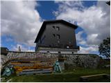 24
24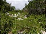 25
25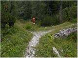 26
26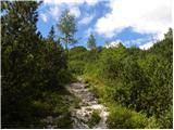 27
27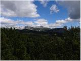 28
28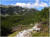 29
29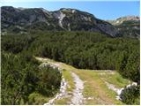 30
30 31
31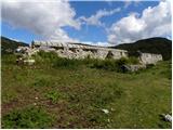 32
32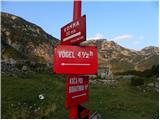 33
33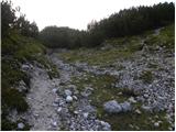 34
34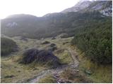 35
35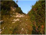 36
36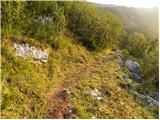 37
37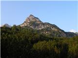 38
38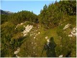 39
39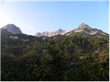 40
40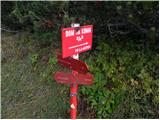 41
41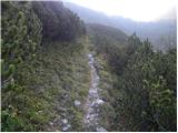 42
42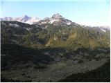 43
43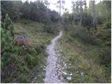 44
44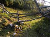 45
45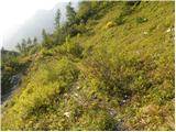 46
46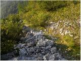 47
47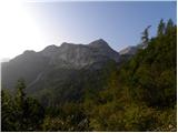 48
48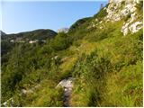 49
49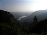 50
50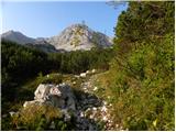 51
51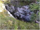 52
52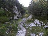 53
53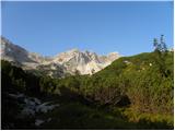 54
54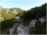 55
55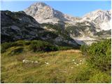 56
56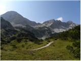 57
57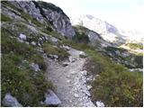 58
58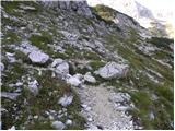 59
59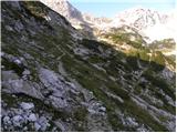 60
60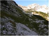 61
61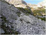 62
62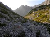 63
63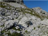 64
64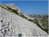 65
65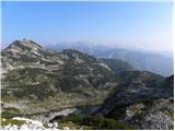 66
66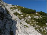 67
67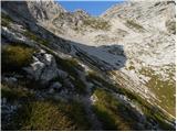 68
68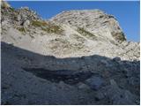 69
69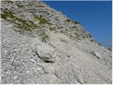 70
70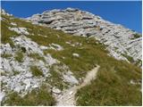 71
71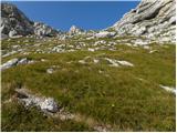 72
72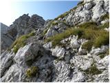 73
73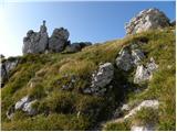 74
74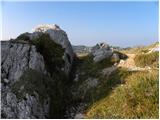 75
75 76
76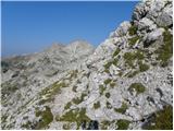 77
77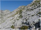 78
78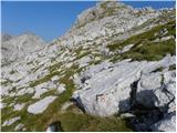 79
79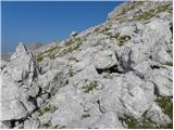 80
80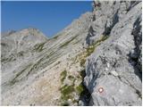 81
81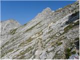 82
82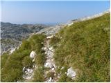 83
83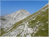 84
84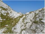 85
85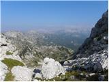 86
86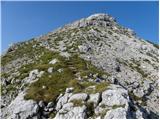 87
87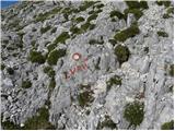 88
88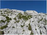 89
89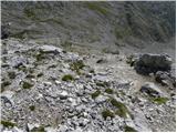 90
90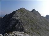 91
91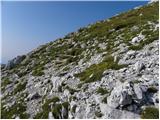 92
92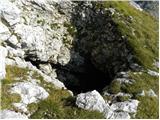 93
93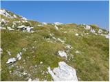 94
94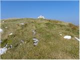 95
95 96
96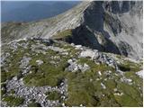 97
97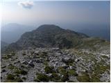 98
98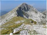 99
99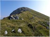 100
100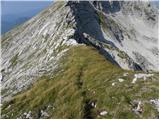 101
101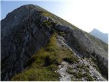 102
102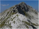 103
103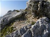 104
104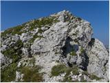 105
105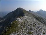 106
106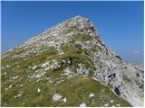 107
107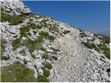 108
108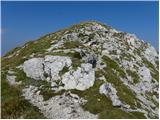 109
109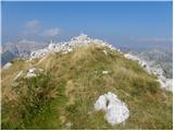 110
110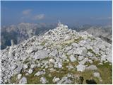 111
111 112
112
Discussion about the trail Koča pri Savici - Tolminski Kuk (via Dom na Komni and Škrbina)
|
| FrancB7. 08. 2013 |
Prosim za informacijo Načrtujem krožno turo na Tolminski Kuk čez Vrh Planje in povratek čez Škrbino. Zanima me, ali je prehodna pot pod električnim vodom označenim na zemljevidu Štajerci iščemo bližnjice pri povratku, ker imamo še kar nekaj poti do doma. Planinski pozdrav
|
|
|