Mojstrana - Risnati rob (Polevec)
Starting point: Mojstrana (670 m)
| Lat/Lon: | 46,4556°N 13,9357°E |
| |
Time of walking: 2 h
Difficulty: easy pathless terrain
Altitude difference: 768 m
Altitude difference po putu: 768 m
Map: Kranjska Gora 1:30.000
Recommended equipment (summer):
Recommended equipment (winter): ice axe, crampons
Views: 860
 | 5 people like this post |
Access to the starting point:
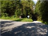
From the Jesenice - Kranjska Gora road, take the Mojstrana road, then follow the signs for Krma and Radovna. When Mojstrana ends, a macadam road soon turns off to the right towards the Mlačca gorge, and park a little further along the tennis court.
You can also park lower down in Mojstrana in the parking lot next to the ski slope or somewhere else in a suitable place, which will make the route a little longer.
Path description:
From the starting point, walk to the main road and then continue the ascent on the asphalt road. Shortly after the sign marking the start of the Triglav National Park, red mountain signs direct you left to cart track in the direction of Jerebikovec. Cart track, which we continue on, quickly turns into a steep footpath, which leads us along an unmarked valley to a lookout point with a bench, where we are joined on the left by an unmarked and even slightly steeper path leading over the slopes of Na tnalu.
From the bench, which offers a fine view in the direction of Kepa and its neighbouring peaks, continue along the marked path, which climbs steeply up the north-western slopes of Mežakla. Higher up, the slope becomes quite steep, so there is a risk of slipping in places, especially in wet weather. The steep climb reaches an altitude of approximately 1300 metres, and then the path becomes steeper and leads to the edge of the Mažakla plateau, where the marked path leaves at the NOB memorial.
After the monument, turn right onto the trackless road, where you will quickly reach the crest of the Great Wall. The ridge climbs steeply at first, but higher up it lays down and we continue along the older logging trail. We continue to follow the ridge, where we can enjoy a beautiful view of the Julian Alps from the occasional piers. Risnati rob or Polevec is reached after a few minutes of further walking and can be identified by a marked stone.
Description and pictures refer to July 2020.

Pictures:
 1
1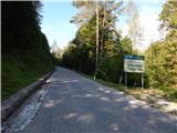 2
2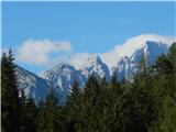 3
3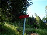 4
4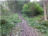 5
5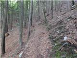 6
6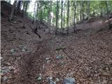 7
7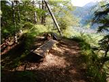 8
8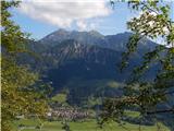 9
9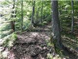 10
10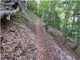 11
11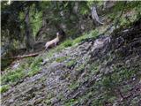 12
12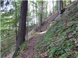 13
13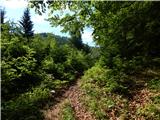 14
14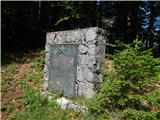 15
15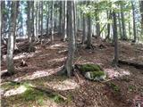 16
16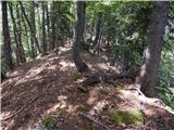 17
17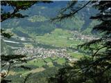 18
18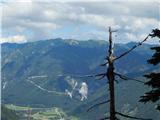 19
19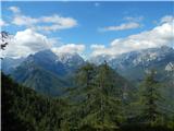 20
20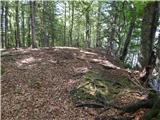 21
21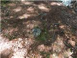 22
22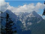 23
23
Discussion about the trail Mojstrana - Risnati rob (Polevec)
|
| Jusk30. 07. 2020 |
Zanimivo,bo treba preverit  Hvala za opis Lp
|
|
|