Planina Kuk - Vrh nad Škrbino (direct way)
Starting point: Planina Kuk (1150 m)
| Lat/Lon: | 46,2112°N 13,7872°E |
| |
Name of path: direct way
Time of walking: 3 h 15 min
Difficulty: partly demanding marked way
Altitude difference: 904 m
Altitude difference po putu: 915 m
Map: TNP 1 : 50.000
Recommended equipment (summer):
Recommended equipment (winter): ice axe, crampons
Views: 20.442
 | 2 people like this post |
Access to the starting point:
Between Most na Soči and Tolmin the road to Poljubinj branches off. From Poljubinj continue towards the village of Ljubinj, where after the church turn left towards mountain pasture Razor and Stador. The road leads to a parking area at mountain pasture Stador, where there is a mountain lodge nearby. We drive on to mountain pasture Lom and continue along the road following the signs mountain pasture Razor. At a height of 1150m you reach mountain pasture Kuk, where there is a parking lot. Further driving is forbidden.
Path description:
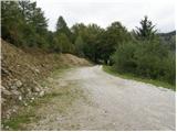
From the parking lot, continue along the road closed to traffic, which after a few dozen steps leads you to the mountain pasture Kuk, where you can buy homemade dairy products (sour milk, cheese, cottage cheese) in the summer.
The road continues to climb steeply and after a while leads to the next ramp. After the ramp, the path goes into the wods and climbs almost insignificantly, and occasionally the path even descends slightly. After an hour's walk, the path leads us to mountain pasture Razor, where the mountain lodge is located.
From the hut, we focus on the path in the direction of Škrbine and Vogel. After a few minutes of walking, the path leads us to the next crossroads, where we continue straight in the direction of Škrbine (right Vogel).
The path ahead turns slightly to the left and climbs moderately over slopes covered with dwarf pines. When the path leads to the next crossroads at an altitude of about 1500m, continue to the right following the Vrh nad Škrbino markers. The left-hand path leads to the saddle of Škrbina. The path then climbs gently through dwarf pines and turns slightly to the left. Once out of dwarf pines, continue climbing gently and cross the grassy slopes below the ridge. The path then crosses some scree and shortly afterwards turns right and starts to climb quite steeply up the grassy slopes. The path over the steep grassy slopes leads us to the ridge where we join the climbing route from the saddle of Škrbina. On the ridge, turn right and within a few metres reach the summit.
Planina Kuk - mountain pasture Razor 1:00 mountain pasture Razor - Vrh nad Škrbino 2:15.

Pictures:
 1
1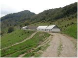 2
2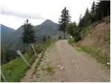 3
3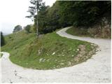 4
4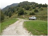 5
5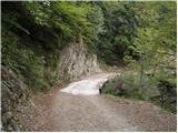 6
6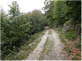 7
7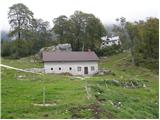 8
8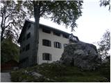 9
9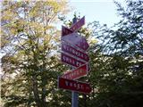 10
10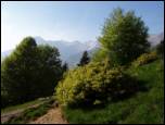 11
11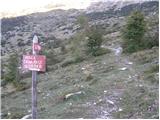 12
12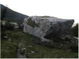 13
13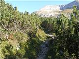 14
14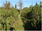 15
15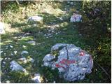 16
16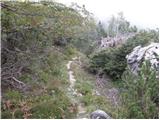 17
17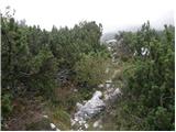 18
18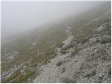 19
19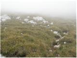 20
20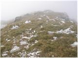 21
21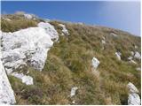 22
22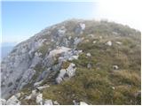 23
23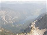 24
24 25
25
Discussion about the trail Planina Kuk - Vrh nad Škrbino (direct way)
|
| LISO2. 07. 2008 |
LEp izlet! Cestitam dekleti ki so v soboto 28.Junija kar po krajsenci vdarle na vrh. Res pravi gamsinji.
|
|
|
|
| jax24. 06. 2012 |
Pot ima na mestu, kjer zaključi s prečenjem, en malo zoprn krušljiv žleb, ki je zavarovan z zajlo, in zaradi tega si po moje zasluži oznako za delno zahtevno. Tudi na kažipotu je označena s trikotnikom.
|
|
|
|
| bosketi24. 08. 2012 |
Jutri grem po tej poti 
|
|
|
|
| Enka13. 10. 2019 |
Pot je na planinskem kažipotu res označena kot zahtevna, vendar se mi zdi oznaka delno zahtevna kar prava. Ko pridemo iz ruševja in pustimo za sabo del, v katerem prečimo strme trave, pridemo v gruščnat in višje delno skalnat svet, ki ga v opisu ni. V tem delu je pot večinoma nadelana z nekaj klini, lesenimi stopnicami, ki zadržujejo grušč, ter s kar nekaj zajlami. Jeklenica se pri vzponu zdi skoraj odveč, a pri spustu je človek kar zadovoljen, da je tam. Nasploh je pri spustu malo za gledat pod noge, ker je grušč zoprno drsljiv. Je pa to ena lepa, ravno prav razgibana pot na vrh z veličastnimi razgledi, ki na obe strani kar vabi h grebenčkanju  .
|
|
|
|
| DVas20. 05. 2024 08:36:13 |
Kakšna je cesta do parkirišča?
|
|
|
|
| miri20. 05. 2024 08:42:16 |
Asfalt,makadam.In veliko previdnosti zahteva.
|
|
|
|
| DVas20. 05. 2024 08:48:45 |
Torej ni najbolj primerna za nizek avto ali gre?
|
|
|
|
| miri20. 05. 2024 08:51:07 |
Peugeot 206, npr.,pelje lepo.
|
|
|
|
| DVas20. 05. 2024 09:06:03 |
Super, potem bi moglo it, hvala
|
|
|