Dom Trilobit - Kamnitnik (Za Kraševcem)
Starting point: Dom Trilobit (939 m)
| Lat/Lon: | 46,4579°N 14,1031°E |
| |
Name of path: Za Kraševcem
Time of walking: 2 h 45 min
Difficulty: easy unmarked way, easy pathless terrain
Altitude difference: 919 m
Altitude difference po putu: 919 m
Map: Karavanke - osrednji del 1:50.000
Recommended equipment (summer):
Recommended equipment (winter): ice axe, crampons
Views: 2.920
 | 1 person likes this post |
Access to the starting point:
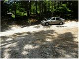
From the motorway Ljubljana - Jesenice take the exit Lipce and follow the road towards Jesenice. When you reach the semaphoreised junction where you join the old road, turn right in the direction of Žirovnice. Follow this road for only a short distance, as at the next slightly larger junction (traffic lights) continue left in the direction of Javorniški Rovt. The road then passes through an underpass (railway) and then turns left (right Koroška Bela). Follow the road, which starts to climb steeply higher, in the direction of Javorniški Rovt, but only until the crossroads, where a sharp left turn to the right (straight) leads to the Trilobit home and the Javornik spring (no buses). A little further on, the road leads to the above-mentioned home and the storage lake at the Javornik hydroelectric power station. Park in the unregulated parking lot behind the lake and the Trilobit home (parking in front of the home is not allowed).
Path description:
From the parking lot, take the cart track towards the nature and mining trail. Cart track immediately starts climbing quite steeply on the left side of the stream that you can hear in the vicinity. Soon, however, the path leads to a wooden pole, where a signpost for mountain pasture Stamare directs us to the right (straight mountain pasture Seča). Continue to the right and the dirt track leads you in a few minutes to the interesting spring of the Javornik stream.
The ascent continues along the cart track, which has a few minor forks, but if you follow the signs of the mining trail you will not have any major problems with orientation. Cart track then turns into a less visible footpath, which joins the wide cart track just a little higher up, which is followed to the left.
Follow the often quite muddy cart track, then pass a large rock (boulder) to look out for it. About 3 minutes' walk from the boulder, the track turns right, and we leave it just at this bend and continue straight ahead on a barely visible path that initially climbs through a rather sparse forest. The path, which is less and less visible, then leads us into a dense forest, where it starts to climb steeply along small streams (orientation in this part is quite difficult). Higher up, the path becomes easier to follow and, after a few minutes of further walking, leads us to a grazing fence. Continue "crossing" the fence and in a few further steps reach the mountain pasture of Stamare (the shepherd's hut is located at the eastern end of mountain pasture).
Continue on the left side of mountain pasture and after a few steps the path leads into the forest, where a slightly worse path joins from the right, coming from the eastern part of mountain pasture. Continue straight ahead on a relatively steep path which, higher up, emerges from the forest onto slopes covered with dwarf pines and turns slightly to the left. There is a slight cross-climb and the path leads to Hrašenska planina, where a shepherd's hut can be seen.
Here, before crossing the pasture fence, turn right and ascend the initially easy-to-follow path. After a short climb through dwarf pines, the trail passes onto a gently vegetated grassy slope, where it begins to disappear. A little further on, you reach an unmarked and barely visible crossroads where the "path" splits into two parts. Continue along the upper left path (slightly to the right shepherd's hut on Belska planina and the bivouac on Belščić), along which you will see unofficial markings (red dots). Continue following the above-mentioned dots, which lead us across the slope and upwards. Higher up, on the left side, we see the indistinct peak Kamnitnik, which we climb up to on an easier trackless path (the peak is located only a few 10 m away from the marked trail leading from Kahlkogel towards Stol).
Dom Trilobit - mountain pasture Stamare 1:15, mountain pasture Stamare - Hrašenska planina 45 minutes, Hrašenska planina - Kamnitnik 45 minutes.

Pictures:
 1
1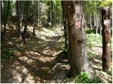 2
2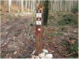 3
3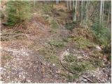 4
4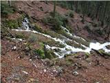 5
5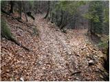 6
6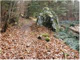 7
7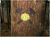 8
8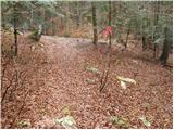 9
9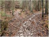 10
10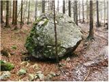 11
11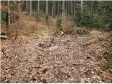 12
12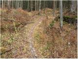 13
13 14
14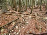 15
15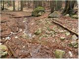 16
16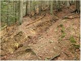 17
17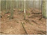 18
18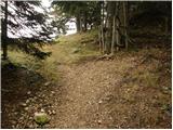 19
19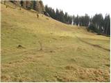 20
20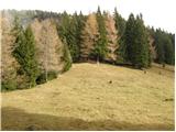 21
21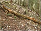 22
22 23
23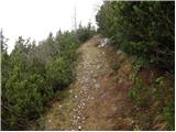 24
24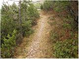 25
25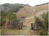 26
26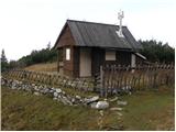 27
27 28
28 29
29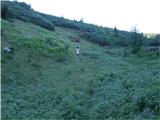 30
30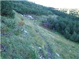 31
31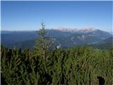 32
32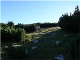 33
33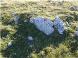 34
34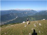 35
35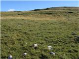 36
36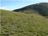 37
37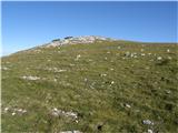 38
38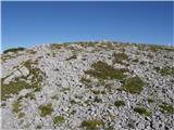 39
39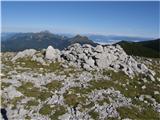 40
40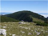 41
41
Discussion about the trail Dom Trilobit - Kamnitnik (Za Kraševcem)
|
| KarmenT16. 10. 2021 19:22:44 |
Del poti do planine Stamare je v živo veliko bolj urejen kot je razvidno iz slik. Pot je ves čas označena z rumenimi označbami in dobro sledljiva. 
|
|
|