Zgornje Poljčane - Sveta Marjeta na Boču (by road)
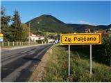
Starting point: Zgornje Poljčane (270 m)
Name of path: by road
Time of walking: 1 h 45 min
Difficulty: easy marked way
Altitude difference: 385 m
Altitude difference po putu: 460 m
Map: Posavsko hribovje Boč - Bohor 1:50.000
Recommended equipment (summer):
Recommended equipment (winter):
Views: 1.359
 | 2 people like this post |
Access to the starting point:
a) From the route of Maribor, leave the motorway at Slovenski Bistrica, where signs direct you to Poljčane. Continue through the centre of Poljčane in the direction of Zgornje Poljčane, where you can park in the centre of the village, a suitable place is the parking space next to the cemetery.
b) From the direction of Ljubljana, leave the motorway in Slovenske Konjice and drive through Žič, Loč and Zbelovego to Poljčane. At the crossroads, turn right in the direction of Zgornje Poljčane for a few hundred metres, where you can park in the centre of the village; a suitable place is the parking space next to the cemetery.
Path description:
After a short visit to the centre of Zgornje Poljčane, continue across the Bela stream by the parish church, slightly up the road. On the left side of the path you reach the entrance to the church, with a relief of two Romans on the facade. After the visit, continue left towards Podboč along the asphalt road, also the Formila cycle path. Soon you reach the pleasant, small settlement of Podboč and to the left along the path the Černogova yew tree and a fountain restored by the locals.
Continue right up the road, now entering the Boč & Plešivec Landscape Park. The asphalt surface turns into a forest road. The view to the left is also a view lower down to the surroundings of Poljčany and the bed of the flooded river Dravinja between fields and meadows. The road turns into a forest and soon reaches a grassy plateau where the road is laid.
On the grassy plain there is a small warehouse with a field on the right and vineyards on the left. Continue through the forest again and the road winds pleasantly left, right. . . At the end of the flat part, continue right up the forest road, while the path from Studenice joins sharply on the left.
Follow the forest road and at the first major crossroads/fork continue to the right, the road to Makoli leads off to the left. Continue along the road to the right to reach the log cabin of the hunters of LD Poljčane on Golnik.
Continue along the road, which levels out for a few metres. After a short flat area, continue ascending and soon reach a crossroads, where you turn left onto a narrow forest road, to the right the path continues towards the tower at Boč. Following the narrow forest road between Kisovec to the left and Drevesnica to the right, you soon reach the 645-metre high pass above Formila. Continue downwards, Formila is already in sight to the right of us, soon joined by a marked mountain path from Makoli on the left.
Formila is reached and there is a short extension to the crossroads, left for the partisan hospital, Gavez, Grillo's chapel, Plešivec. . . and right for the mountain lodge at Boč. The crossroads is also the contact with the Styrian - Zagorje or ,,B,, - Brother trail.
After a short visit, continue along the forest road to the right in the direction of the Boč mountain lodge. At the first crossroads, go sharp left up the forest road, with the inscription Donačka gora and markings on the tree trunk. Follow the road higher into the forest and soon reach the grassy meadow to the east below Hrastovec. At a crossroads, turn right and follow the forest road downhill. Soon we reach the destination of today's route, the Church of St. Marjeta below one of the lower peaks of Boč, 791 metres high Hrastovec, which rewards us with views of Obsotelje, Kozjansko, Croatian Zagorje and more. The length of the route from Studenice is about 8500 metres, 460 positive vertical metres and 70 negative vertical metres. The highest point of the route is 700 metres above sea level.

Pictures:
 1
1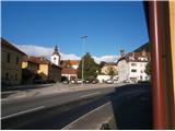 2
2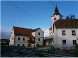 3
3 4
4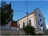 5
5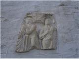 6
6 7
7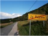 8
8 9
9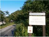 10
10 11
11 12
12 13
13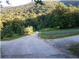 14
14 15
15 16
16 17
17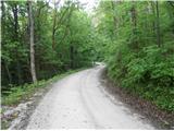 18
18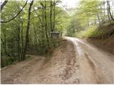 19
19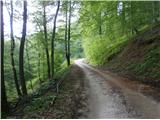 20
20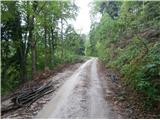 21
21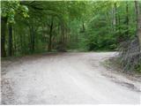 22
22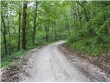 23
23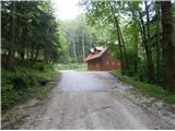 24
24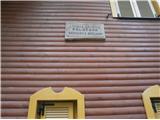 25
25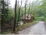 26
26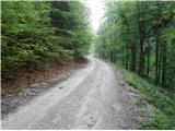 27
27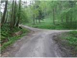 28
28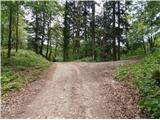 29
29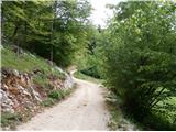 30
30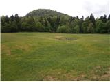 31
31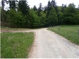 32
32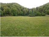 33
33 34
34 35
35 36
36 37
37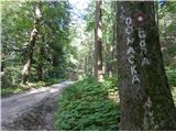 38
38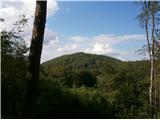 39
39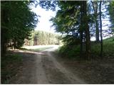 40
40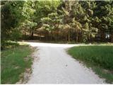 41
41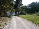 42
42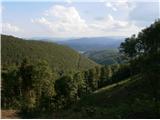 43
43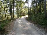 44
44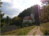 45
45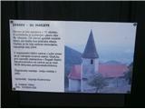 46
46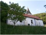 47
47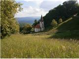 48
48
Discussion about the trail Zgornje Poljčane - Sveta Marjeta na Boču (by road)
|
| bruny4. 11. 2014 |
Ker je pot bila danes objavljena...  ponovitev v večerni pohodniški iz Poljčan/Zgornjih Poljčan globoko na kostrivniški del Boča do cerkvice Sv. Marjete in po enaki trasi poti nazaj. Natančno sledil poti po opisu tja in nazaj. Pot enostavna, bolj primerna celo za kolo ampak danes pohodniško. Močan veter na trenutke, silovit med jaso Formilo in Sv. Marjeto predvsem med vrhovoma Kisovec in Drevesnica je zaznamoval pot. Skupna dolžina poti je bila 17,78 kilometra. Najvišja točka poti okoli 700 metrov odmeri je na sliki 41. Prijetno je bilo... Trasa poti: Boč/Sv. Marjeta iz Zgornjih Poljčan,04.11.2014
|
|
|