Srednji Vrh - Vošca (via Jureževa planina)
Starting point: Srednji Vrh (960 m)
| Lat/Lon: | 46,4894°N 13,8371°E |
| |
Name of path: via Jureževa planina
Time of walking: 2 h 5 min
Difficulty: easy unmarked way
Altitude difference: 777 m
Altitude difference po putu: 777 m
Map: Kranjska Gora 1:30.000
Recommended equipment (summer):
Recommended equipment (winter): ice axe, crampons
Views: 11.721
 | 1 person likes this post |
Access to the starting point:
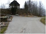
From the motorway Ljubljana - Jesenice, take the exit Jesenice - west (Hrušica) and continue in the direction of Kranjska Gora. When you reach Gozd-Martuljek, turn right in the direction of Srednji Vrho and follow the narrow and steep road to the above-mentioned place. When the road levels out a bit, you will come to a crossroads of several roads and a turning point. Park here in a suitable space at the junction.
Path description:
From the crossroads, continue along the ascending road on the left, where you will see the signs "Trupijevo poldne". Follow this road, which leads you past the cheese cottage Pr' Hlebanju and the trail to Techantinger Mittagskogel, to the end of the road at the farm Jurež (Organic farm at Merklen). Continue past the outbuilding, then just before the dwelling house, take a sharp right onto cart track, which climbs between the two buildings. Continue on cart track, which climbs over a hay field, then turns left and gradually passes into the forest, through which it takes some time to climb. The path soon crosses a small well and then quickly leads to a crossroads of two cart tracks. Continue along the right one (the left one ends at a destroyed bridge), which leads us just a little further out of the forest onto grassy slopes. Here the track loses its way a little, and we keep to the right edge of the grassy slope throughout the ascent. Higher up, we step onto the road leading from the Korensko sedlo border crossing and follow it to the right, which leads us to Jureževo mountain pasture after a good 5 minutes of further walking.
From the hunting lodge on Jureževa planina, continue for another 10 m along the forest road, then leave it and continue left along the ascending and often muddy cart track. The cart track climbs through the lane of the forest, and then leads to the top grassy slopes of Voška. Here the path turns to the left and then ascends crosswise towards the summit, which can already be seen in front of you, and which is reached after about 10 minutes of further walking.

Pictures:
 1
1 2
2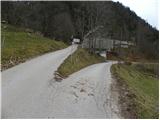 3
3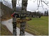 4
4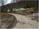 5
5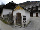 6
6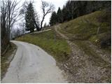 7
7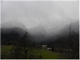 8
8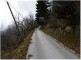 9
9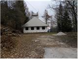 10
10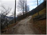 11
11 12
12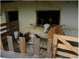 13
13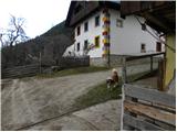 14
14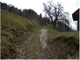 15
15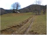 16
16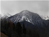 17
17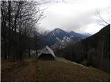 18
18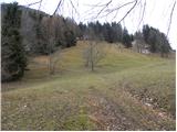 19
19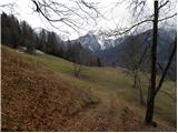 20
20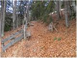 21
21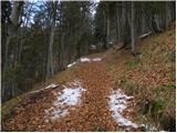 22
22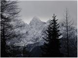 23
23 24
24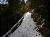 25
25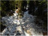 26
26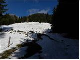 27
27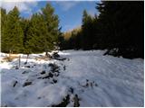 28
28 29
29 30
30 31
31 32
32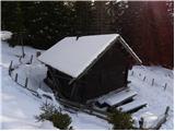 33
33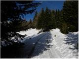 34
34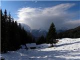 35
35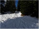 36
36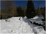 37
37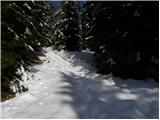 38
38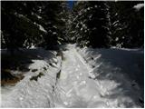 39
39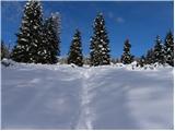 40
40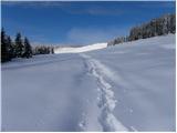 41
41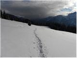 42
42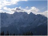 43
43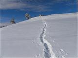 44
44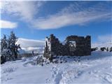 45
45 46
46
Discussion about the trail Srednji Vrh - Vošca (via Jureževa planina)
|
| tuna.iris18. 10. 2014 |
Cudovito vreme, prijetna pot, lep razgled, dobra duzba = cudovito prezivet dan.
|
|
|
|
| Sreb16. 10. 2017 |
V soboto po poti na vrh, razgled fantasticen!
Moram pa opozoriti, da se krave, ovce in koze trenutno se pasejo nad Jurezevo kmetijo (ne planino), tako da gre pot cez njihove pasnike. S psom si nismo upali mimo, tako da smo naredili detour okoli po desni strani in se glavni poti pridruzili po precenju gozda okoli 100, 150 visinskih metrov visje.
|
|
|
|
| Majdag23. 03. 2022 15:53:00 |
21.3. ....Do ceste za Jureževo planino ni veliko snega. Potem je snežna odeja ponekod še kar debela. Globoke luknje so v snegu, tudi sledi krpelj so bile vidne. Čez belo planjavo proti vrhu, bi kar prav prišle. Krasni razgledi, uživala sem kot že dolgo ne. Nikogar nisem srečala, čudovit dan. Je pa strmina od Jureževe domačije pa do vrha vso pot kolenagriz. Le po cesti se malo oddahneš.  https://jelenkamenmajdag.blogspot.com/2022/03/na-vosco-grem.html https://jelenkamenmajdag.blogspot.com/2022/03/na-vosco-grem.html
|
|
|