Starting point: Jureževa planina (1488 m)
| Lat/Lon: | 46,5029°N 13,8254°E |
| |
Time of walking: 35 min
Difficulty: easy unmarked way
Altitude difference: 249 m
Altitude difference po putu: 249 m
Map: Kranjska Gora 1:30.000
Recommended equipment (summer):
Recommended equipment (winter): ice axe, crampons
Views: 15.879
 | 3 people like this post |
Access to the starting point:
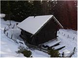
From Kranjska Gora, drive towards Rateče, but only as far as the village of Podkoren, where you turn right towards the Korensko sedlo border crossing. Just 100m before the crossing, a forest road turns sharp right and you follow it past a number of streams to a crossroads. Continue straight ahead (sharp left Jerebikovec). Shortly after this the road makes a sharp right turn and leads us in just over 100m to another crossroads, where we continue slightly left (right Brvogi) along the road, which begins to descend. Then we drive for quite some time and come to the third crossroads where we go slightly right (sharp left Dolič). The road crosses a torrent shortly afterwards and we follow it for another 100m to Jureževa planina, where we park in a suitable place slightly above the hunting lodge.
Path description:
From the hunting lodge at Jureževa planina continue along the forest road for another 10 m, then leave the forest road and continue left along the ascending and often muddy cart track. The cart track climbs through the lane of the forest, and then leads to the top grassy slopes of Voška. Here the path turns to the left and then ascends crosswise towards the summit, which can already be seen in front of you, and which is reached after about 10 minutes of further walking.
Pictures:
 1
1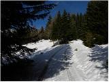 2
2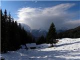 3
3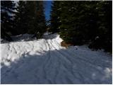 4
4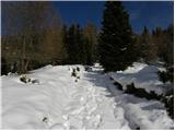 5
5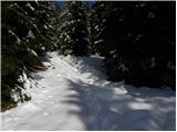 6
6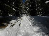 7
7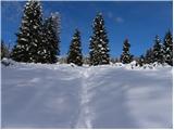 8
8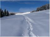 9
9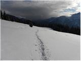 10
10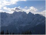 11
11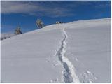 12
12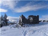 13
13 14
14
Discussion about the trail Jureževa planina - Vošca
|
| Kriška6. 11. 2006 |
Na Vošci sem bila poleti, bil je krasen, jasen dan, razgledi čudoviti. Pohodnikom je družbo delalo tudi kar nekaj kolesarjev.
|
|
|
|
| Guest22. 11. 2006 |
Tudi jesenska tura na Voščo je lepa.Macesni v žlati barvi .Vsekakor je priporočljivo peš z Srednjega vrha in potepanje je lahko še lepse saj imano več možnosti. 
|
|
|
|
| PUHIPUHI24. 10. 2017 |
Ali kdo ve v kakem stanju je cesta do Jureževe planine? Normalno prevozna z osebniv avtom?
Hvala, LP; P
|
|
|
|
| bostjan858. 05. 2018 |
Kako je cesta do Jureževe planine,hvala.
|
|
|
|
| PUHIPUHI23. 05. 2018 |
Tudi mene zanima, če je bil kdo zadnje dni na Jureževi planini z avtom. V kakšnem stanju je cesta?
|
|
|
|
| janez.novak24. 05. 2018 |
Jaz grem pa na Vošco kar peš iz Srednjega vrha. Pot je v redu. Pa še to: če se pripelješ na Jureževo planino, je to le sprehod in ne tura. Drugo pa je, če so poleg otroci ali planinci, ki težko hodijo in jim ta varianta približa tisto, kar sicer ne bi mogli več doseči.
|
|
|
|
| Doohan12. 05. 2022 14:41:14 |
Midva sva šla kar peš po gozdni cesti do Jureževe planine, 8 km. Do vrha Vošce sva rabila dobre tri ure, nazaj dobri dve. Lepo preživetih pet ur v naravi s čudovitimi razgledi na Julijce.
Cesta je sicer v zelo dobrem stanju.
|
|
|