Erjavčev Rovt - Huhnerkogel/Gubno
Starting point: Erjavčev Rovt (1065 m)
| Lat/Lon: | 46,4792°N 13,9636°E |
| |
Time of walking: 2 h 30 min
Difficulty: easy marked way, easy unmarked way
Altitude difference: 970 m
Altitude difference po putu: 970 m
Map: Kranjska Gora 1:30.000
Recommended equipment (summer):
Recommended equipment (winter): helmet, ice axe, crampons
Views: 11.562
 | 3 people like this post |
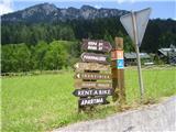
Access to the starting point:
Take the Dovje and follow the road up through the village. Shortly after the village you will come to a crossroads where the road to Kepa branches off to the left and the road to Dovško Baba to the right. Here, take the road to the left and follow it to the next crossroads, where you continue to the right and then park at one of the roadside car parks (there is a stream called Mlinca near the car park).
Path description:
Start by crossing the stream and gently start climbing towards Kepe. After 10 minutes of walking, the steep part of the trail begins, which runs through the forest and leads us after 20 minutes of good warming up to a nice sloping trail, which after less than 15 minutes leads us to the Brvog hunting lodge and then we also see Huhnerkogel in all its glory for the first time. The path ahead turns to the right and again climbs gently on a beautiful and wide path. After 25 minutes of further walking, you reach a crossroads where you turn left (right saddle Mlinca and Frauenkogel) in the direction of Kepe. After a few minutes on a steep path through low bushes, slowly reach the grassy slopes (possibility of slipping), which are crossed and after an hour's walk with a beautiful view of the Julian Mountains, you reach the base of Huhnerkogel, which you cross and before the end of the slope turn sharp right (continue to Dovška Mala Kepa and Kepa), and after a few minutes on an unmarked path you reach the summit of the summit. The summit is marked by a steel cable and a boundary stone.

Pictures:
 1
1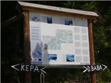 2
2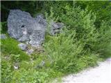 3
3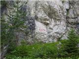 4
4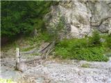 5
5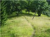 6
6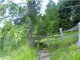 7
7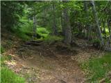 8
8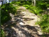 9
9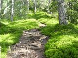 10
10 11
11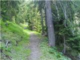 12
12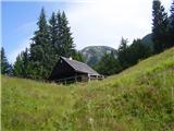 13
13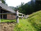 14
14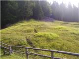 15
15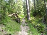 16
16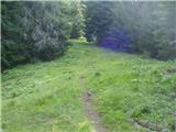 17
17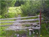 18
18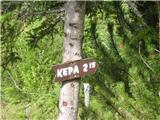 19
19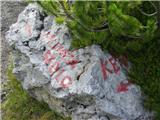 20
20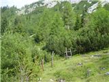 21
21 22
22 23
23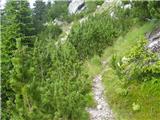 24
24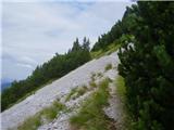 25
25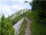 26
26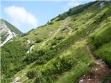 27
27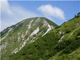 28
28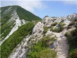 29
29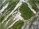 30
30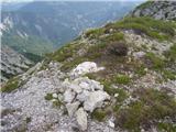 31
31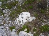 32
32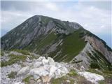 33
33
Discussion about the trail Erjavčev Rovt - Huhnerkogel/Gubno
|
| heinz24. 11. 2009 |
Gre za eno najlepših in najmirnejših poti v zahodnih Karavankah. Ni ravno najlažja, a ni zahtevna. Zagotovo srečaš gamse.
Glede razgledov v vse smeri, Gubno ne zaostaja kaj dosti za dominantno sosedo Kepo.
|
|
|
|
| ben27. 11. 2009 |
Zakaj pa je to neoznačena steza? Razen zadnjih pet minut pred vrhom je pa ja vse označeno ali se motim?  LP B
|
|
|
|
| heinz28. 11. 2009 |
Verjetno gre za podobno načelo, kot pri zahtevostih poti; če je le del te tako težaven, da terja določeno tehnično znanje in opremo, se šteje celotna pot za zahtevno, čeprav je ves ostali del nezahteven, ipd..
Je pa res, da bi bila lahko pot na Gubno poimenovana kot "označena", saj zanjo to velja skoraj v celoti, le označen odcep na njenem koncu pač manjka.
Torej, za tiste, ki se boje neoznačenih poti, dodajmo, da gre v glavnem (99%) za "LEPO označeno pot"..
|
|
|
|
| grega_p18. 07. 2011 |
Zanimiva, raznolika in ob teh temperaturah kar naporna pot, vsekakor pa ni (več) mirna. Včeraj se je trlo pohodnikov, tako, da je bilo spodaj kar težko najti prostor za avto. Žal, gamsov od nikoder pa vseeno lepo in razgledno!
|
|
|