Tinčkova koča - Pautz/Zelenjak (via Zagon)
Starting point: Tinčkova koča (1070 m)
| Lat/Lon: | 46,4228°N 14,1991°E |
| |
Name of path: via Zagon
Time of walking: 3 h 25 min
Difficulty: very difficult unmarked way
Altitude difference: 954 m
Altitude difference po putu: 1050 m
Map: Karavanke - osrednji del 1:50.000
Recommended equipment (summer): helmet
Recommended equipment (winter): helmet, ice axe, crampons
Views: 870
 | 1 person likes this post |
Access to the starting point:
From the Ljubljana - Jesenice motorway, take the Lesce exit and follow the road towards Žirovnica and Jesenice. After a few km of driving, you will come to a crossroads where the road to Žirovnica and Moste turns right (from Jesenice, left). Just a few metres further, at the next crossroads, turn left into Moste (right into Žirovnica). Continue past the memorial to the fallen fighters, where the road starts to climb uphill under the railway line. At the top of the hill, turn right (at the Vila Karin sign) and we continue towards Završniškem jezero and Valvasor's home. The road then bends and leads to a crossroads where the road to Valvasor's home branches off to the left, and we continue straight ahead on the initially still asphalted road. The road soon becomes macadam, and we follow it to a parking area near Tinček's hut. The road is often in a rather bad condition in the upper part.
Path description:
From the starting point, the signs for Valvasor's House and Hochstuhl direct us left to the wide cart track, which turns into a forest. After a few 10 metres, the marked path towards Valvasor's House and Hochstuhl turns left, and we continue slightly to the right, following cart track, which leads us past a few more huts. We continue along the unmarked cart track, which climbs moderately at first, but relatively steeply higher up, through the forest. A little further on, cart track turns into a forest track, which splits into two parts before crossing a torrent. Continue on the lower right-hand path, which crosses the torrent and then climbs gently through the forest for a few minutes. The path soon becomes quite steep and a little difficult to follow in parts. The path through the Zagon valley has a few forks in the upper part, and we take right forks at all of them (even if we continue straight on one of them, we join the path leading from the Šija saddle towards Hochstuhl higher up, only to reach it further west).
Higher up, at an altitude of about 1500 metres, the trail takes us right into a valley, from which it soon recedes slightly to the right. At this point, we reach another less prominent crossroads, where we go right again, and continue ascending cross-country with fine views of Hochstuhl, Srednja peč and the surrounding mountains. The trail, which is traceable but more overgrown in parts, gradually flattens out and returns to the torrential valley. Climb for a short distance along a small torrent before reaching the lower trail to Stol.
Follow this path slightly to the right to a nearby fallen concrete bay, and from there to the right in the direction of the Šija and Zelenice saddles. There is a short climb, then the path turns left and continues cross-climbing along the north-western slopes of Srednji vrh. After a few minutes, the crossing ends and the path leads to the Šija saddle, where there is a marked crossroads.
Continue left in the direction Vertatscha (right Srednji vrh, straight Dom pri izviru Završnice) along the path which ascends through lane of dwarf pines and after a few minutes of further walking leads us to the upper path Zelenica - Stol.
Here continue right towards Zelenica and initially walk through dwarf pines. After a few minutes, the dwarf pines ends and the cross path leads to a marked crossroads, where you continue straight on (sharp left Vrtača). Continuing on a gentle downhill, you cross mostly the southern slopes of Vertatscha, and the scenic route leads you through scree, grassy slopes, and occasionally through a narrow lane of forest. A little further on, one of the paths leading to Dom pri izviru Završnice branches off to the right, and we walk along the marked path towards the Lodge on Zelenica for a few more minutes. When we re-enter the forest, the path leads us into a small, undistinguished valley, where an unmarked path branches off to the left into the valley of Suhe dwarf pines (there is usually a cairn at the crossroads). The path to Suho dwarf pines first climbs through the forest and then passes between dwarf pines, where it is well beaten, and dwarf pines, where it is beaten. There is a short steeper climb where, looking back, a fine view of Begunjščica opens up, with Vertatscha ahead to the left, Pautz straight ahead, Selenitza to the right, and the ridge of Na možeh. Higher up, the track flattens out a little and becomes a high mountain valley, which gradually narrows. A little further on, the path turns right and then joins the path that leads along the scree below the Na možeh ridge (this path is more suitable for descending than ascending, and leads us a little closer to Zelenica than the path we climbed). Continue to the left and start climbing across the scree, following this path all the way to the Gully, which is located between Pautz and Palec.
From the Gutter, from where a fine view of Austria opens up, continue to the left (right Selenitza) and climb cross-climbing to the notch between Pautz and Vertatscha, where the relatively easy route ends.
Here we continue sharp right into the cliffs of Pautz, where a fainter path has already emerged since the previous ones, and the individual cairns are an additional orientation aid. Right from the stumps onwards we climb steeply, and due to the considerable steepness we have to help ourselves with our hands in many places. Higher up, the "track" sometimes disappears completely, and we continue to climb up the slope, which is dangerous for slipping. After a steep climb of just over 10 minutes, we reach the top of Pautz, which offers a fine view of the central Karavanke Mountains.

Pictures:
 1
1 2
2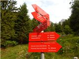 3
3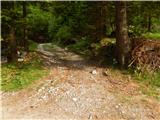 4
4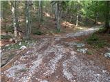 5
5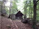 6
6 7
7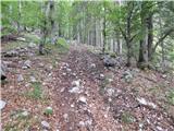 8
8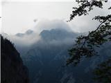 9
9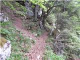 10
10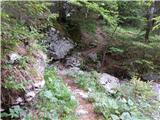 11
11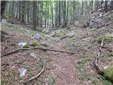 12
12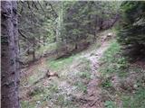 13
13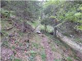 14
14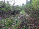 15
15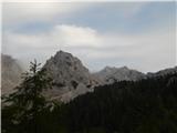 16
16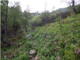 17
17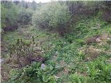 18
18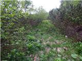 19
19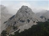 20
20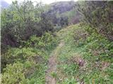 21
21 22
22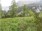 23
23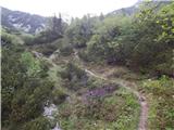 24
24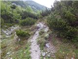 25
25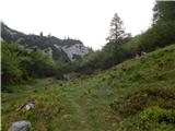 26
26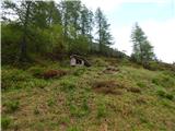 27
27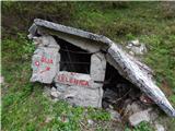 28
28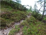 29
29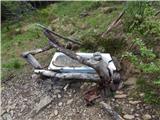 30
30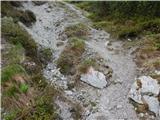 31
31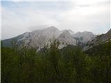 32
32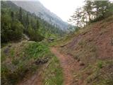 33
33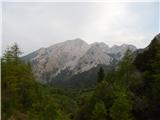 34
34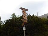 35
35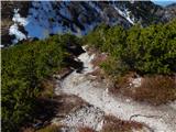 36
36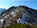 37
37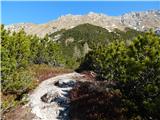 38
38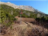 39
39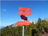 40
40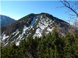 41
41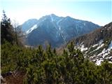 42
42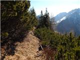 43
43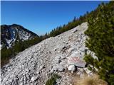 44
44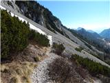 45
45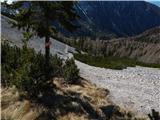 46
46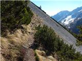 47
47 48
48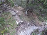 49
49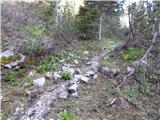 50
50 51
51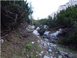 52
52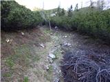 53
53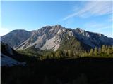 54
54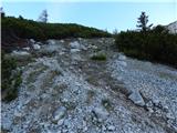 55
55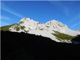 56
56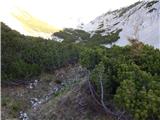 57
57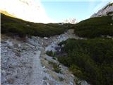 58
58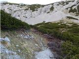 59
59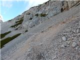 60
60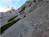 61
61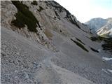 62
62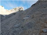 63
63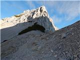 64
64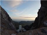 65
65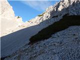 66
66 67
67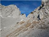 68
68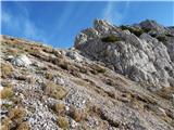 69
69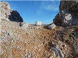 70
70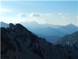 71
71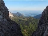 72
72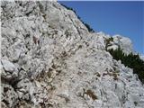 73
73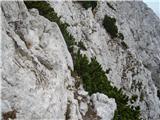 74
74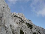 75
75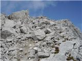 76
76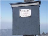 77
77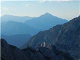 78
78
Discussion about the trail Tinčkova koča - Pautz/Zelenjak (via Zagon)