Vitovlje - Čaven (via Vitovlje Lake)
Starting point: Vitovlje (360 m)
| Lat/Lon: | 45,9342°N 13,7695°E |
| |
Name of path: via Vitovlje Lake
Time of walking: 2 h 40 min
Difficulty: easy unmarked way
Altitude difference: 825 m
Altitude difference po putu: 860 m
Map: Goriška 1:50.000
Recommended equipment (summer): helmet
Recommended equipment (winter): helmet, ice axe, crampons
Views: 10.230
 | 2 people like this post |
Access to the starting point:
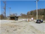
a) From the expressway Vipava - Nova Gorica take the exit Selo and then continue on the regional road to Nova Gorica and Šempas. After a few kilometres, you will reach the village of Vitovlje, where you will turn right in the direction of the farm Maloščevo. A little further on, the road splits into two parts (Vitovska Circular Route), and we continue to the right, keeping to the left at the next junctions. The relatively steep road leads us higher up through the hamlet of Vožice, where it turns slightly more to the left. From the hamlet we drive for a short distance and then arrive at a large event space and sports ground in Vitovlje, where we park.
b) From Nova Gorica, drive to Šempas, and from there continue along the old road towards Ajdovščina. When you reach the village Vitovlje, turn left in the direction of the farm Maloščevo. A little further on, the road splits into two parts (Vitovska Circular Route), and we continue to the right, keeping to the left at the next junctions. The relatively steep road leads us higher up through the hamlet of Vožice, where it turns slightly more to the left. From the hamlet we drive for a short distance and then arrive at a large event space and sports ground in Vitovlje, where we park.
Path description:
From the parking lot, first walk to the asphalt road and follow it to the left. After a minute or two, you will reach a marked crossroads, where you continue to the right in the direction of the Vitov Church and Vitovlje Lake.
From the crossroads, continue along a less good macadam road, which quickly turns into a forest, through which it climbs gently to moderately. It does not take long before you reach the next well-marked crossroads, where you continue straight on in the direction of Lake Vitovsko (on the left, the western path to Vitovski hrib (signs for the Vitov church)). The road gradually changes to cart track, which initially leads you across a hayfield. A little further on, cart track turns left, and two paths branch off to the right to the nearby Vitovlje Lake, which is only a 2-minute walk away (worth a look, as Vitovlje Lake is the only natural lake in or above the Vipava valley). Further on, the path leads past a few more well-marked crossroads, and at all of them we continue to the left in the direction of the Vítov church. Just below the summit, we join the cart track, which quickly takes us to the scenic summit.
From the top, descend back to the crossroads, then continue the ascent in the direction of Čavno and Sekulak along the old Napoleon route. Soon we reach the next crossroads, where the path to Skozno branches off to the left, and we continue to the right towards Čavno. Continuing on the Napoleon route, we soon reach the steep rock cliffs of the High Wall. The wide path leads us over an artificially carved lookout ledge (danger of falling rocks), after which the path returns to the forest and leads us to the place where the path to Kopitnik branches off to the left.
Continue slightly right in the direction of Čavna and Sekulak along a slightly narrower path, which initially leads us through some small clearings to a steeper part. The way ahead climbs steeper and leads us only slightly higher to the next crossroads, where we continue to the right in the direction of the viewpoint (Kopitnik on the left). The ascent continues along the gently sloping path, which leads us in 5 minutes of further walking to the Sekulak lookout point, from which we have a view over most of the Vipava valley. The path to the left continues towards Kopitnik, and we continue to the right, where after a few metres we see signs for Veliki Rob. We continue our ascent towards Veliki Rob on a trail that is at first noticeably less visible. The path higher up becomes more distinct and after a while leads us to a lookout point from which we have a view of the Vipava valley, Trstelj, the Gulf of Trieste and the Dolomites.
We continue along the marked path, which begins to climb steeply, and leads us to a steeper part below the peak of Čavna (1185 m). When the path becomes more steep, we leave it and, after a few steps on the pathless path, we climb to the top of Čavno.
Vitovlje - Vitovski hrib 40 minutes, Vitovski hrib - Sekulak 1:00, Sekulak - Čaven 1:00.

Pictures:
 1
1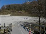 2
2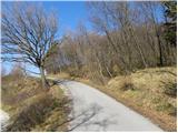 3
3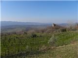 4
4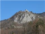 5
5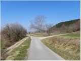 6
6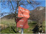 7
7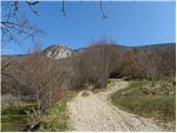 8
8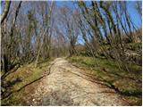 9
9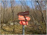 10
10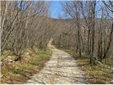 11
11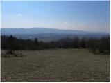 12
12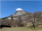 13
13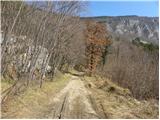 14
14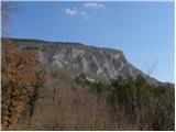 15
15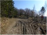 16
16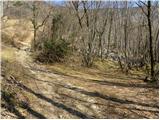 17
17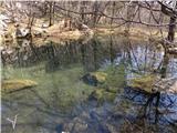 18
18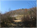 19
19 20
20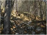 21
21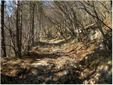 22
22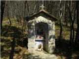 23
23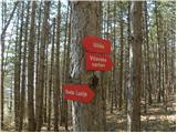 24
24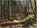 25
25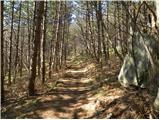 26
26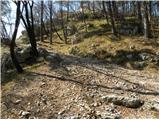 27
27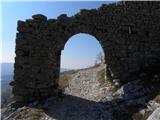 28
28 29
29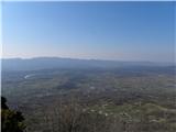 30
30 31
31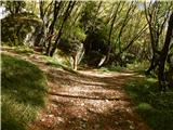 32
32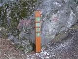 33
33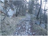 34
34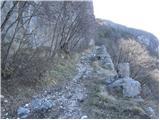 35
35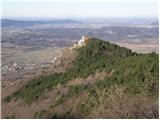 36
36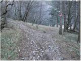 37
37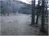 38
38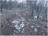 39
39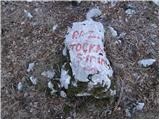 40
40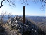 41
41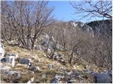 42
42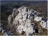 43
43 44
44 45
45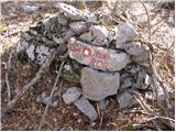 46
46 47
47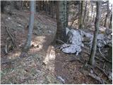 48
48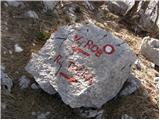 49
49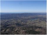 50
50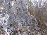 51
51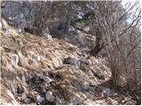 52
52 53
53
Discussion about the trail Vitovlje - Čaven (via Vitovlje Lake)
|
| akvarij10. 11. 2017 |
Zalo lep izlet v vseh letnih časih. Veliko ljudi misli, da je Čaven vrh tam, kjer je koča Antona Bavčerja, še domačini ne vejo, kje je zares vrh Čaven  Zanima me, če mogoče kdo ve, kaj pomenijo napisi na kamnih na vrhu (slika 53)?
|
|
|
|
| akvarij10. 11. 2017 |
Pri razpotju na sliki 33 lahko skrenemo na desno stezico, pa nekaj deset korakih smo pri Sveti Luciji... zanimiva skala, ki skriva kotanjo, v kateri voda nikoli ne presahne... nato se po isti potki vrnemo nazaj...
|
|
|