Lokavec - Kucelj na Čavnu
Starting point: Lokavec (170 m)
| Lat/Lon: | 45,902°N 13,8813°E |
| |
Time of walking: 3 h 15 min
Difficulty: easy marked way
Altitude difference: 1067 m
Altitude difference po putu: 1170 m
Map: Goriška - izletniška karta 1:50.000
Recommended equipment (summer):
Recommended equipment (winter): ice axe, crampons
Views: 10.301
 | 2 people like this post |
Access to the starting point:
Take the expressway from Razdrteg to Nova Gorica or vice versa and take the Ajdovščina exit. Then turn left at the crossroads in the route Nova Gorica and drive to the village of Cesta, where the sign for Lokavec directs you to the right. Follow this road to the large parking area by the church in the village Lokavec, where there are also signs for Čaven.
Path description:
From the parking lot, continue along the road towards Čavna. The road climbs gently between the houses and soon leads to a small crossroads near a small stream. Here we continue along the left-hand road and the left-hand side of the stream, which leads us at the end of the village to cart track, which we then climb. Continue along cart track, which slowly turns into a footpath. The path crosses a worse forest road after a while and shortly afterwards leads to a crossroads, where we continue straight in the direction of Čavna. The path then leads to a small spring and then climbs steeply for a few dozen steps. The way forward leads us to uncultivated slopes, which offer a beautiful view of the Nanos, Vipava valley and the surrounding hills. A little further on, the path again crosses a porer forest road and climbs parallel to it for a short distance. Just a little further on we come to a wider road, which we follow to the right, but only for a few steps, and then the signs direct us up to the left. The path ahead starts to climb steeper and crosses a marked path a little higher up, starting at the "tunnels".
Here you continue straight up the path, which is getting very steep. A little further on, the path, which most of the time has been through the forest, crosses again some scenic slopes. A little further on, the path leads us to a ridge where we have two options for continuing. The left one runs just below the ridge and is less scenic than the one along the ridge, but it is more forgiving in the event of a strong storm. After 10 minutes, the two paths merge and lead to the uncultivated grassy slopes to the east of Mala Gora.
Here the steepness eases and the route continues through beautiful meadows where, in spring and summer, many mountain flowers are seen. A little further on, the path from Stomaž joins us from the left. Here we continue straight along the path, which leads us in a few minutes to the Cottage na Čavnu.
Behind the hut, the signs for Kucelj direct us slightly left on a footpath that starts to descend crosswise. The path crosses a short lane of forest, then turns to the right, where it continues to descend gently. The path then gradually enters the forest and the path from the village Kamnje joins us on the left (there are two turnoffs for Kamnje). Continue in the direction of Kuclja along the path, which gradually passes to the right side of the "Čavnov" ridge. The path continues through a large clearing, which opens up a view of the surrounding hills, and then returns to the forest. A little further on, leave the folded cart track and continue climbing to the left and on through the thick forest. The steepness soon gives way and the path leads us out of the forest onto increasingly scenic grassy slopes. A few minutes of easy walking follows, and then the path leads us under the very top of Kuclja, where it climbs steeply again. This path, which offers increasingly beautiful views, is then followed all the way to the top of Kuclja, which is reached after a few minutes of further walking.

Pictures:
 1
1 2
2 3
3 4
4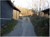 5
5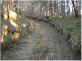 6
6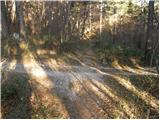 7
7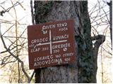 8
8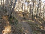 9
9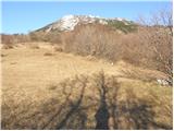 10
10 11
11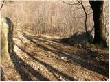 12
12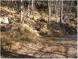 13
13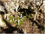 14
14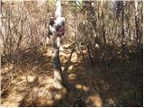 15
15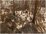 16
16 17
17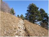 18
18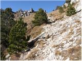 19
19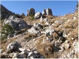 20
20 21
21 22
22 23
23 24
24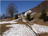 25
25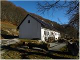 26
26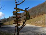 27
27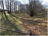 28
28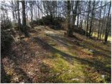 29
29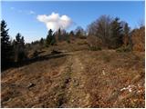 30
30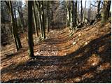 31
31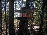 32
32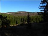 33
33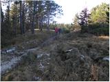 34
34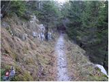 35
35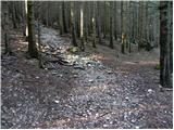 36
36 37
37 38
38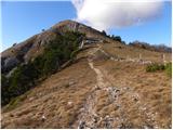 39
39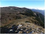 40
40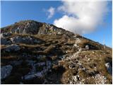 41
41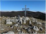 42
42 43
43
Discussion about the trail Lokavec - Kucelj na Čavnu
|
| BT8822. 12. 2010 |
Kucelj ni na Čavnu  po mojem mnenju je kucelj samostojni vrh na robu trnovske planote . . . al ne bo tako
|
|
|
|
| atoamac22. 12. 2010 |
Jasno, da je Kucelj samostojni vrh, a je tudi na Čavnu. Gre za dvojno poimenovanje: Čaven je sicer eden od vrhov, pa tudi celotno "gorovje". Na zemljevidu (glej geopedija) je Čaven tudi področje za Kucljem, nekako desno od vrha Čaven 1186, prek Velikega roba 1265, našega Kuclja, pa na drugo stran na Veliki in Mali Modrasovec 1306, ki mu v dolini pravijo Čaven. In iz doline se tudi jasno vidi, da sta Kucelj in Čaven (Modrasovec) dva samostojna vrhova, ki se ju lahko zamenja le v slučaju hude megle, sneženja ali teme. 
|
|
|
|
| BT8823. 12. 2010 |
Ok sam popravte naslov npr. Čez Čaven na razgledni vrh Kuclja
|
|
|
|
| BT8823. 12. 2010 |
Ma naj bo po vaše. Sam iz vasice Vrtovin se gre pol na Kucelj ali na Kucelj na Čavnu? 
|
|
|
|
| atoamac23. 12. 2010 |
Nejc Zaplotnik je zapisal, da je bolj kot cilj važna pot. Torej je važno, da se gre.
|
|
|
|
| BT8823. 12. 2010 |
Ja res je zapisal, da kdor najde pot bo vedno hodil po njej . . . kar pomeni da ne iskati poti ampak jo je treba najti
|
|
|
|
| atoamac23. 12. 2010 |
In kako se jo najde, ne da bi jo iskal?
|
|
|
|
| BT8823. 12. 2010 |
Atomac v življenju niso vse poti markirane  sej ti to veš je pa tale kuceljček o katerem govoriva mal moj faan hribček zato se potegujem zanj Capito 
|
|
|
|
| mirank23. 12. 2010 |
Vsi smerokazi na vseh dostopih (in teh ni malo) točno pišejo kam greš in mislim, da domačini najbolj vejo kako je hribu ime. Podobna štorija kot z nekim drugim vrhom kjer povsod piše Prisojnik, znajdeš pa se na Prisanku ali kako naj bi vrhu že bilo ime?...
|
|
|
|
| mirank23. 12. 2010 |
Vsi smerokazi na vseh dostopih (in teh ni malo) točno pišejo kam greš in mislim, da domačini najbolj vejo kako je hribu ime. Podobna štorija kot z nekim drugim vrhom kjer povsod piše Prisojnik, znajdeš pa se na Prisanku ali kako naj bi vrhu že bilo ime?...
|
|
|
|
| marjana25. 12. 2010 |
Bravo, mislim, da ste rešili problem.
|
|
|
|
| BT8827. 12. 2010 |
Mirank to je nekaj drugega to je Kucelj.
|
|
|
|
| brinta13. 05. 2012 |
Ali morda kdo ve če avriklju na Kuclju že cvetijo?
|
|
|
|
| čeveljc13. 05. 2012 |
27.4.12 smo iz šli iz Otlice do Otliškega vrha nato pa do Predmeje po "Poti po Robu" mal gor in mal dol do Čavna. Avriklji so na omenjeni poti po Robu že bili, pa tudi svišč. Krasen dan, krasna pokrajina, razgled in sploh vse. Cesta Col - Ajdovščina je bila zaprta, je pa bilo videti, da je cesta Ajdovščina - Predmeja precej nova (ali na novo obnovljena). Skratka, še en lep konec naše domovine.
|
|
|
|
| darinka410. 06. 2023 19:03:45 |
Kljub slabi napovedi sva z Maksijem danes šla z Lokavca, od cerkve do koče na Čavnu. Nato do vrha Kuclja. Sestopila na Malo goro in po poti vzpona v Lokavec. V zadnjem delu poti naju je ujel dež. In precej spolzko je bilo in vodnato ob sestopu.
|
|
|