Gornje Ležeče - Vremščica
Starting point: Gornje Ležeče (502 m)
| Lat/Lon: | 45,6648°N 14,0703°E |
| |
Time of walking: 1 h 40 min
Difficulty: easy marked way
Altitude difference: 525 m
Altitude difference po putu: 535 m
Map:
Recommended equipment (summer):
Recommended equipment (winter): crampons
Views: 22.708
 | 2 people like this post |
Access to the starting point:
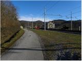
From the Ljubljana - Koper motorway, take the Divača exit and follow the road in the direction of Divača and Matavun. After about 1 km drive from the town, when you have left the AC turn left in the direction of the village Zavrhek and Ribnica. Continue through a few villages and then a little after Gornje Vreme continue left in the direction of Gornji Ležeč. Continue along a narrower and steeper road, which leads you higher up through an underpass to the railway station Gornje Ležeče. After the underpass, turn right (straight ahead Gornje Ležeče) and park in a suitable space next to the railway station.
Path description:
From the railway station, return to the underpass, then continue towards Gornje Ležeče village at the crossroads. After a short climb on the asphalted road, you will reach the beginning of the village, where you will see the first marking. After a good 10 minutes' walk from the starting point, we arrive above the village, where the signs for Vremščica direct us to the folded cart track, which crosses a short but scenic hayfield. Cart track then passes into first sparse, then denser lane wodland and gradually begins to climb more steeply. Cart track, which has a few junctions, but these are well marked, lies higher, passes to the other side of the indistinct Černý vrh (695 m) and, after a few steps downhill, leads to the road linking Divača with Pivka.
Cross the road and continue the ascent along the marked footpath in the direction of Vremščice. The way forward continues along the moderately steep cart track, which mostly crosses the slopes to the left. Higher up, the path leads us out of the forest, which begins to climb steeply. The path from which we have increasingly beautiful views of Slavnik, Čičarijo and Učka, but after a few minutes of further walking leads us to the top of Vremščice.
From the top, you can extend the trip to the nearby newly built church of St. Urban (direction Volče 5 minutes).

Pictures:
 1
1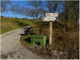 2
2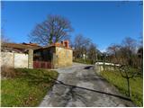 3
3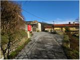 4
4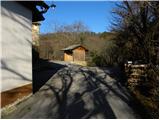 5
5 6
6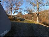 7
7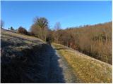 8
8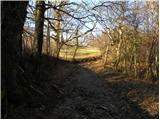 9
9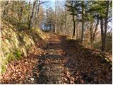 10
10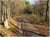 11
11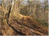 12
12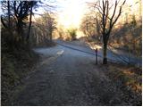 13
13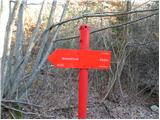 14
14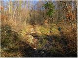 15
15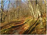 16
16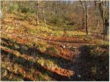 17
17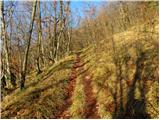 18
18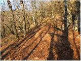 19
19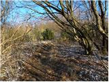 20
20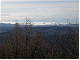 21
21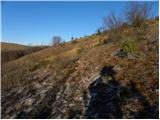 22
22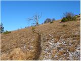 23
23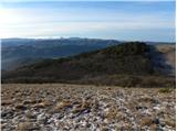 24
24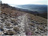 25
25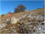 26
26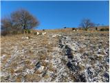 27
27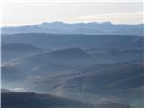 28
28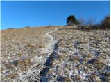 29
29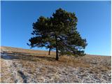 30
30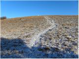 31
31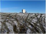 32
32 33
33
Discussion about the trail Gornje Ležeče - Vremščica
|
| B222. 04. 2011 |
Iz ŽP Gornje ležeče, takoj za postajo stopimo na ozko, asfaltirano vaško potko in gremo naravnost v hrib. Po kakih 200m vzpona se priključimo prej opisani trasi. S tem prihranimo okrog 600 m neprijetnega asfalta in polovico od te dolžine strmega vzpona. Na poslopju ŽP je tudi planinski smerokaz. Omenjena bližnjica je tudi markirana (zbledele markacije), pot v opisu zgoraj pa mimo žel.nadvoza ni bila nikoli markirana!
|
|
|
|
| tavzentroza20. 05. 2025 18:34:07 |
Namen moje objave je,da še koga navdušim,vzpodbudim in ga " obvestim" o lepotah v naši okolici.
Danes trajnostno na Vremščico.Z vlakom( bil je celo točen) do postaje Gornje Ležeče.
Potem pa rajski vrt...cvetja toliko, kot ga ne
premore marsikateri plačljiv park po svetu.
Narcise (Urbanščice) gredo h koncu, a je še nešteto drugih cvetov.
Prehodila sem cel greben Vremščice, da ja ne bi spustila kakšnega prelepega cveta, preko Gabrč v Senožeče in na bus domov.
možnost je pa tudi ,da se gre na bus že v Gabrčah. Nekaj jih ustavi tam.
Rada bi dodala nekaj slik ,samo ne vem kako to storiš.
|
|
|
|
| Tadej20. 05. 2025 18:43:29 |
|
|
|