Olševek - Štefanja gora (via Apnišče)
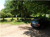
Starting point: Olševek (471 m)
| Lat/Lon: | 46,2791°N 14,4423°E |
| |
Name of path: via Apnišče
Time of walking: 1 h 15 min
Difficulty: easy unmarked way
Altitude difference: 277 m
Altitude difference po putu: 335 m
Map:
Recommended equipment (summer):
Recommended equipment (winter):
Views: 2.211
 | 1 person likes this post |
Access to the starting point:
a) From the motorway Ljubljana - Jesenice take the Brnik exit, and when you reach the road Mengeš - Kranj, turn left towards Kranj. Follow the main road towards Kranj to the first roundabout, from where you take the first exit to the right towards Šenčur. Continue on the main road through Šenčur, and when you reach the Kranj - Zgornje Jezersko road, turn right towards Jezersko. Leave the main road at Hotemaže and continue straight on (right off the main road) towards Olševek. When you arrive in Olševek, initially follow the main road, and from the junction of several roads, turn left onto the road in the direction of the sports club. Before the children's and sports playground, turn slightly left and then park behind the NOB memorial.
b) First take the Kranj, then continue driving in the direction of Zgornji Jezerski. Leave the main road at Hotemaže and continue straight on (right off the main road) towards Olševek. When you arrive in Olševek, initially follow the main road, and from the crossroads of several roads, turn left onto the road in the direction of the sports club. Before the children's and sports playground, turn slightly left and then park behind the NOB memorial.
c) b) From the motorway Jesenice - Ljubljana, take the exit Kranj West, then continue driving towards Kokrica, later Britof. At Kokrica, at an unmarked junction with a priority road, turn left, and when you reach Britof, follow the signs for Zgornje Jezersko. At Hotemaže, leave the main road and continue straight on (right off the main road) towards Olševek. When you arrive in Olševek, initially follow the main road, and from the crossroads of several roads, turn left onto the road in the direction of the sports club. Before the children's and sports playground, turn slightly left and then park behind the NOB memorial.
Path description:
From the starting point, continue along the road along which you parked, and initially the Olševek trail still runs alongside, so you will see some educational signs along the way. The trail turns left at the next junction, and we continue along the lower road, which continues straight ahead, with signs soon pointing us left into the forest. We continue our ascent through the dense forest, and the path leads us partly along forest tracks, partly along forest paths, and at crossroads we follow the signs. Higher up, the path leads us to a wider track, which we follow to the right, with some passing views. After the viewpoint, the track climbs steeply and then joins the marked path from Adergasa.
Continue to the left, where the path leads past the "stterna", and then the path a little further on is laid on a small pass, where there is a crossroads, with direction signs for Olševek, Adergas and Možjanco.
Continue along the left cart track (the rightmost path leads to the church of St. Stephen at Štefanja gora), from which you soon turn left onto a well-trodden but unmarked path. A little further on, the path leads us out of the forest to a meadow, which opens up a beautiful view towards Kalški greben and Krvavec. When the path returns to the forest, there is only a short climb and the path leads to the top of Apnišč.
From the top, continue straight ahead, following the path that begins to descend towards the pass between Apnišče and Štefanja gora. At first we descend through the forest, then across a meadow, then through the forest again. Once in the forest, join the track, which you follow to the right, and in a few further steps you will reach a marked crossroads.
From the crossroads, continue slightly right on the path, which is not marked (slightly left Štefanja Gora, sharp right Olševek and Adergas) and begins to climb.
The path continues to climb moderately along an undistinguished ridge, from which it almost imperceptibly transitions to a fairly gentle slope. A little further on, the path splits, and we choose the right path (the straight path leads past agritourism and is a little longer), which in a few minutes of further walking takes us up to the Church of St Stephen at the top of Štefanje gora. Description and figures refer to the situation in 2017 (May).

Pictures:
 1
1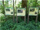 2
2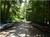 3
3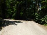 4
4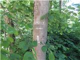 5
5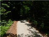 6
6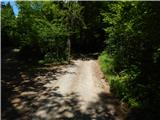 7
7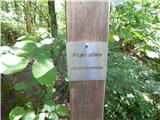 8
8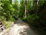 9
9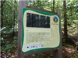 10
10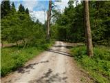 11
11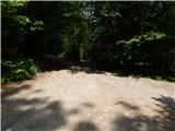 12
12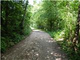 13
13 14
14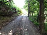 15
15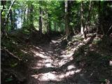 16
16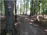 17
17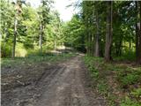 18
18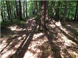 19
19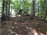 20
20 21
21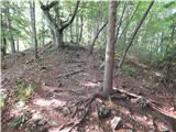 22
22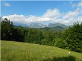 23
23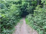 24
24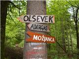 25
25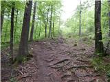 26
26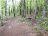 27
27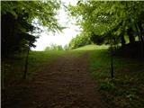 28
28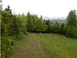 29
29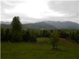 30
30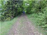 31
31 32
32
Discussion about the trail Olševek - Štefanja gora (via Apnišče)
|
| baloncek0518. 04. 2021 06:43:56 |
 top pot...lepo oznacena
|
|
|
|
| ŠIMETA21. 04. 2021 11:35:58 |
Pozdravljeni, opozorila bi na to, da opis poti ni skladen s slikami. Prvi del poti poteka kot je objavljeno pri opisu Olševek-Apnišče (zahodna pot), opis z vrha naprej pa je pravilen
|
|
|