Podljubelj (Lajb) - Dobrča
Starting point: Podljubelj (Lajb) (770 m)
| Lat/Lon: | 46,4151°N 14,2701°E |
| |
Time of walking: 4 h 30 min
Difficulty: partly demanding marked way
Altitude difference: 864 m
Altitude difference po putu: 1050 m
Map: Karavanke - osrednji del 1:50.000
Recommended equipment (summer):
Recommended equipment (winter): ice axe, crampons
Views: 10.461
 | 1 person likes this post |
Access to the starting point:
Leave the Gorenjska Motorway at the Podtabor junction and continue to Border crossing Ljubelj. Continue past the Bistrica pri Tržiču turnoff, and higher up, past the turnoff for Podljubelj. Just after the 4. 5 km marker, turn right after the underpass and then right again into Podljubelj. Park in a suitable place by the sign marking the start of Podljubelj.
Path description:
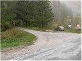
From the parking lot, continue along the road that crosses the narrow bridge (overbridge) and turns left at the other end. After a few dozen steps, you will see signs for Preval, Begunjščica and Dobrča along the road. Continue along the road as it climbs above the village and at the end of the village you will see a sign forbidding further traffic. The road, which climbs moderately, soon crosses a stream over a bridge and continues along a mostly vegetated slope. Somewhere halfway up to Preval, the road crosses some scenic slopes, then goes into the forest again, where we have two options for continuing. On the right side of the road we see a steep cart track, which soon leads us to Preval, or we can continue on a slightly more winding road, which leads us to Preval only about a minute later. At Preval, the two routes merge and there is only a short climb up to the hut, which is visible on the left-hand side.
From the hut, continue south in the route Dobrča. The path soon goes into the forest, where it initially descends slightly and after a few minutes leads us back to the ridge which we left shortly after Preval. Here the marker for Dobrča directs us to the western slopes. The way ahead crosses slightly steeper slopes in places without any major changes in altitude. After a while, however, the gently sloping path turns to the left and climbs steeply for a short time. The path then crosses the slopes again, which are slightly slippery in wet conditions. A little further on, the path again leads to the ridge in a gentle ascent. This is followed by a steep descent along the ridge for more than 100 vertical metres to the Vrh Luž prevala. Here the path climbs slightly and after a few minutes leads us to the next unmarked saddle, where we are joined on the left by the path from Belega potok. Continue straight ahead on the path, which occasionally climbs slightly more. There is a short descent and then the path begins to climb steeply up the increasingly steep slopes. The steepness of the slopes then eases and we see a pasture fence in front of us. Cross the fence and just a few metres after that the path leads to cart track, where you continue to the right to a forest road which leads up to a hut at Dobrča.
From the hut we go back a little way to mountain pasture, where the signs for Dobrča direct us across mountain pasture, past the houses upwards. The route over mountain pasture is slightly less visible but marked. When the path leads to the edge of the forest the path becomes clearly visible and crosses a grazing fence a little further on. A little higher the path crosses cart track and climbs to a crossroads where we join the path from Brezij pri Tržiču. The steepness eases here and in a few minutes the path from Lešanská mountain pasture joins us from the right. There is a five-minute climb up the forested upper slope of Dobrča, which also obstructs part of the view at the top. Lajb - Preval 1:30, Preval - hut at Dobrča 2:30, hut at Dobrča - Dobrča 30 minutes.

We can extend the trip to the following destinations: Šentanski vrh
Pictures:
 1
1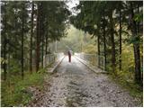 2
2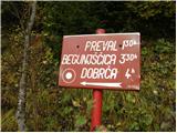 3
3 4
4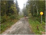 5
5 6
6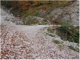 7
7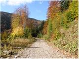 8
8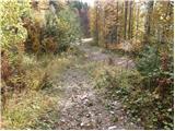 9
9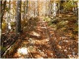 10
10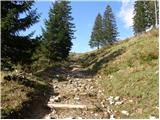 11
11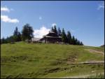 12
12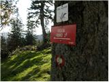 13
13 14
14 15
15 16
16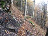 17
17 18
18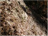 19
19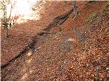 20
20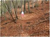 21
21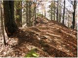 22
22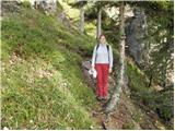 23
23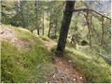 24
24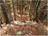 25
25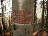 26
26 27
27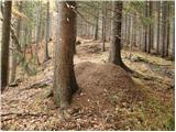 28
28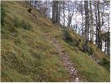 29
29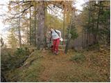 30
30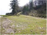 31
31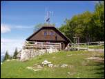 32
32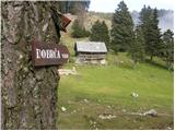 33
33 34
34 35
35 36
36 37
37
Discussion about the trail Podljubelj (Lajb) - Dobrča
|
| Gorazd G27. 02. 2010 |
Ob pripravi objave o Dobrči http://www.gore-ljudje.net/novosti/53063/ sem pogledal, kaj piše pri "konkurenci" in pri zgornjem opisu opazil netočnost, ki ji je verjetno botroval napis na drevesu na eni od fotografij. Prevala Dobrča po mojem mnenju ni. Na drevesu sta ob napisu "Preval" in "Dobrča" tudi puščici, ki kažeta desno (na Preval) in levo (na Dobrčo), ta preval pa se, tako piše tudi na zemljevidih in v vodnikih, imenuje Vrh Luž. Prav bi bilo, če bi se opis in podpisi k trem fotografijam ustrezno popravili.
|
|
|
|
| hostar28. 02. 2010 |
Ta Preval je mišljena planina Preval pod Begunjščico. 
|
|
|
|
| Kriška28. 02. 2010 |
... ki ji tod okrog večinoma pravijo Prevala .
|
|
|
|
| @rekar12. 07. 2014 |
Vse uporabnike poti Dobrča - Preval ali obratno obveščam, da je pot očiščena in prehodna brez problemov.
|
|
|