Starting point: Pred Belo (571 m)
| Lat/Lon: | 46,3188°N 14,6005°E |
| |
Time of walking: 6 h 45 min
Difficulty: difficult marked way
Altitude difference: 1779 m
Altitude difference po putu: 1870 m
Map: Grintovci 1 : 25.000
Recommended equipment (summer): helmet
Recommended equipment (winter): helmet, ice axe, crampons
Views: 9.541
 | 1 person likes this post |
Access to the starting point:
On 25. 08. 2008 I went from Kamniška Bistrica via Presedljaj and Korošica to Ojstrica. I went from Ljubljana by car, but otherwise it is important to drive to Kamnik. Take the bypass road through Kamnik and turn left at the end of Kamnik over the bridge for direction Velika Mountain pasture, Kamniška Bistrica. After a few 100 metres there is a roundabout where you have to go right for Velika Mountain pasture. Then you come to the village Stahovica (about 4 km from Kamnik) and at the beginning of this village turn left for the route Velika Mountain pasture. When you get to the parking lot under the bottom station of the cable car at Velika Mountain pasture, continue for another 1. 7 km and you will come to a bridge over the Kamniška Bela stream, drive for another 10 metres and at the end of the right turn you will see a parking lot for about 10 vehicles. Park here and start the hike.
Path description:
At 08:45 I started the trail up along the Kamniška Bela stream. The trail is quite flat at the beginning, which means that it will then start to climb. At 09:10 I came to a fork in the trail and there is no signpost for the trail to the left, but I believe that there is a fork in the trail to the Orglice waterfall and the partisan hospital. So, here is a criticism of whoever is responsible for putting up the route signs to the Orglice waterfall and to the Partisan Hospital, if it is still there. There is, however, a mountain sign pointing to the right and directing us on our way. For a few minutes the path is still fairly level, but then it starts to climb steeply through the forest. At 09:55 I reach a bench with a beautiful view. Loking at the map, I assume that this point is called the Resting Place. I continue on my way and at 10:45 I arrive at Presedljaj. This part of the route took me 2 hours.
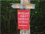
At Presedljaj there is a crossroads and you can go right towards the top of Konj and Velika planina. The crossing of Konj is very difficult. To the left, a sign directs you towards Korošice and the sign says that there are still two hours to go. The path from Presedljaj to Korošice leads mostly through low pine bushes and is almost level. You may also see many Neží prickly pears along the way, but of course do not pick them. I reach Kocbekov dom na Korošici at 11:45 so it took me only 1 hour. A few 100 metres before the lodge, just beyond the wire sheep fence, you get a very nice view of the kotanya where Kocbek's lodge is located.
At the Kocbek home I have goulash, bread and beer, for which I pay EUR 8. I have a few more minutes of rest and then at 12:25 I continue my journey to Ojstrica. The path to the top is quite steep and over rocks. I arrive at Ojstrica at 13:20, where I meet two Germans and a hunting dog. It took me less than an hour to get there.
At the top I have a beer from my rucksack, lie down and even doze a bit in the sun. The views from Ojstrica are magnificent, especially of the Logar valley. The waterfall you will see to the NW in the basin is the Rinka waterfall. I also found some snow on the top, which had fallen a few days ago. At 14:15 I continue my way eastwards, towards Mala Ojstrica, arriving at 15:05. At the top I am surprised by a miniature copy of the Aljaž Tower, built by the Slovenian Mountaineering Club SKALA.
I don't stay here, so I walk down the hill on the path and head south towards Presedljaj, passing Kocbek's home on the east side. At 15:20 I reach the crossroads above the Korošica cottage where I "tie a sausage" and head towards Presedljaj, arriving at 16:15. So it took me 2 hours to descend from Ojstrica via Mala Ojstrica to Presedljaj.
It takes me another 1 hour and 30 minutes to descend to the starting point, and I reach my car at 17:45. To be honest, I was quite tired, so it might be better if the less prepared split it over two days.
The route is suitable for children up to Kocbekov dom na Korošici, but it is very steep.
God luck.

Pictures:
 1
1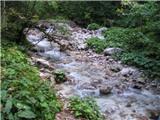 2
2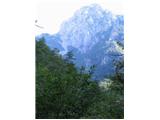 3
3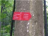 4
4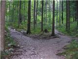 5
5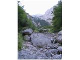 6
6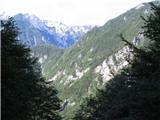 7
7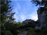 8
8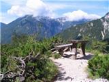 9
9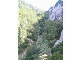 10
10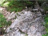 11
11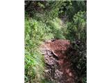 12
12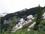 13
13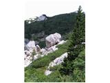 14
14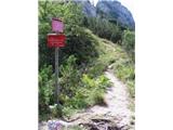 15
15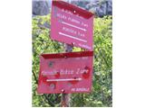 16
16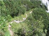 17
17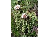 18
18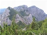 19
19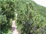 20
20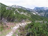 21
21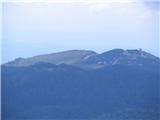 22
22 23
23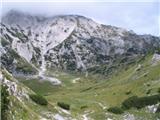 24
24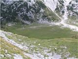 25
25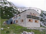 26
26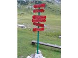 27
27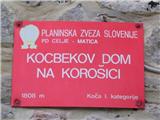 28
28 29
29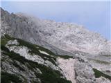 30
30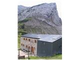 31
31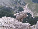 32
32 33
33 34
34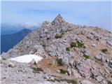 35
35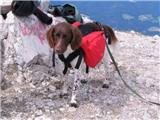 36
36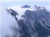 37
37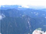 38
38 39
39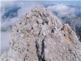 40
40 41
41 42
42 43
43 44
44 45
45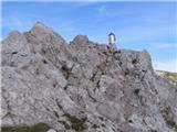 46
46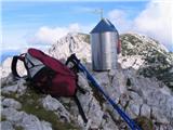 47
47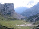 48
48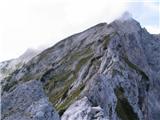 49
49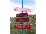 50
50 51
51 52
52 53
53
Discussion about the trail Pred Belo - Ojstrica