Starting point: Jekarica (994 m)
| Lat/Lon: | 46,3602°N 14,4244°E |
| |
Time of walking: 2 h 5 min
Difficulty: easy marked way
Altitude difference: 750 m
Altitude difference po putu: 750 m
Map: Karavanke - osrednji del 1:50.000
Recommended equipment (summer):
Recommended equipment (winter): ice axe, crampons
Views: 31.121
 | 1 person likes this post |
Access to the starting point:
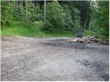
From the motorway Ljubljana - Jesenice take the exit Kranj - East and follow the road in the direction of Jezersko, but only as far as the Kanonir Inn, where you turn left and follow the asphalted road. At all junctions, follow the signs for Storžič. When the road makes a sharp right turn, you will see signs for Kališče and Storžič. Park in the parking lot near the signposts so as not to interfere with the forestry work. The road is CLOSED from 20. 7. to 20. 10. When the road is closed we park lower down, which extends the climb by one hour.
Path description:
At the bend, take the cart track, which is to the left of the signs. After a few metres, you will see a marking on a tree, which tells you that you are on the right track. After a good five minutes of walking, the signpost points to the left on the footpath. The path, which starts to climb moderately, soon leads us to cart track which we just cross. The path crosses cart track again only about a minute further on, and then climbs more steeply. The path slowly turns slightly to the left and leads to a small ridge, where we approach cart track. Climb for a while along cart track, and then the path leads to a viewpoint where a bench stands. The way forward leads to cart track again, but this time to the point where it ends. It is also possible to access the cart track (at all crossroads, keep to the left, but the start is the same). The way forward is a little more difficult to follow as large amounts of fallen trees make it impossible to climb the marked path, so it is necessary to find the crossings, which are only partially covered. Once this part is passed, the path is easier to follow again, but only for a short time. The way ahead approaches the clearing below Storžič and turns left between fallen trees. Again look for passages between the trees. A few metres before Praprotnikova koča, rejoin the marked path, which takes a few steps to reach the hut.
The path ahead climbs steeply again, then turns right and crosses the slopes in a gentle ascent to the debris carried by the torrent. The way forward takes us between two boulders and, after a few steps downhill, begins to climb again. Soon we come to the dwarf pines, where the view opens up. The path continues to climb under the Bašeljski vrh walls, which we go around on the underside. First we cross a small scree slope and then the path leads us into a ravine between dwarf pines. The ascent up the ravine is not difficult, but care is needed, especially when descending, because of the gravel on the rocky surface. The path out of the ravine leads to a pleasant meadow where we have a view of the south side. At the signposts at Bašeljski sedlo, turn left towards Kišče, but follow the path for only a few metres. Signs for Bašeljski vrh then direct us left into the grassy - rocky slopes. We climb up, slightly to the left, to a place where the crossing is stopped by dwarf pines. If you have missed the right path during the ascent, find it on the left. There is a short climb to the headland from which we see Bašeljski vrh. From the summit we have only one minute to walk along the ridge, which is slightly dangerous to slip in the snow. Jekarica - Bašelj saddle 1:45, Bašelj saddle - Bašelj summit 20 minutes.

Pictures:
 1
1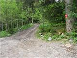 2
2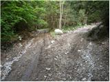 3
3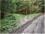 4
4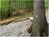 5
5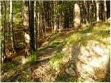 6
6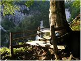 7
7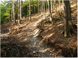 8
8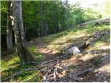 9
9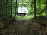 10
10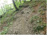 11
11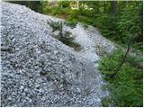 12
12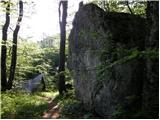 13
13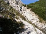 14
14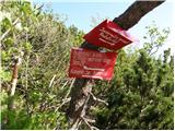 15
15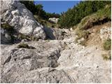 16
16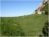 17
17 18
18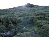 19
19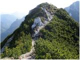 20
20 21
21
Discussion about the trail Jekarica - Bašeljski vrh
|
| velkavrh25. 06. 2010 |
Danes že ob sedmi uri zjutraj štartal z Jekarice. Rampa je dvignjena. Je pa znak prepovedan promet. Letos ni gor napisa kdaj je popolna zapora , samo znak , tako , da se verjetno tvega kazen , če te dobijo na koncu poti. Vreme zelo primerno, ne prevroče, ne prehladno. Pot kot vedno zelo prijetna , brez gneče , ki je tako značilna na poti iz Mač. Na Bašelskem sedlu si res v eni uri , nato pa še kratek vzpon na Bašelski vrh. To je res prijetno razgledišče na Storžič in dolino. Nato pa še spust do koče, kjer kot vedno prijazno postrežejo. Za začetek pohodniške sezone prijeten uvod!
|
|
|
|
| PINOKIO27. 03. 2017 |
Je kdo v zadnjem času prehodil to pot? Me zanima kako je s tisto zaporo ceste in pa kje je tista koča, ki jo opisuje "velkavrh" . Odgovor rabim takoj, ker nameravam jutri it po tej poti. Hvala za odgovor. 
|
|
|
|
| Daaam27. 03. 2017 |
Pod kočo je vrjetno mislil kočo na Kališču. Jutri je pomoje zaprta, tako da na kaksno postrežbo ne računaj. Glede zapore pa ne vem nič. ..lahko pa za vsak slucaj izberes drugo izhodisce. Lp
|
|
|
|
| PINOKIO27. 03. 2017 |
Hvala Daaam, glede postrežbe ni problem, za zaporo pa bomo videl kako in kaj. 
|
|
|
|
| PINOKIO30. 03. 2017 |
Dne 28.03.2017 sem prehodil opisano pot. Imam pa eno pohvalo in eno grajo:
- POHVALA PD Kranj za zelo dobro označeno pot,
- GRAJA PD Kranj, ker je vpisna knjiga na vrhu Bašeljskega vrha polna, pa tudi drugače že v zelo slabem stanju in bi bilo primerno, da se zamenja z novo.
|
|
|
|
| ucakakla1. 04. 2017 |
PINOKIO - kako je bilo potem z zaporo, kje ste parkirali? Kakšna pa je pot do vrha, povsem kopna?
|
|
|
|
| Anansie1. 04. 2017 |
Ni zapore...cesta pa je v presenetljivo lepem stanju.
lp
|
|
|
|
| SunnyDay17. 07. 2017 |
Cesta je uradno zaprta - dovoljeno samo za uporabnike/lastnike gozdnih zemljišč, vendar je bila rampa 15. 7. še dvignjena (na "parkirišču" ob izhodišču opisane ture smo bili trije avtomobili). Od 20. 7. naprej velja popolna zapora.
Sicer pa dokaj strma, odlično označena in nezahtevna, večinoma senčna pot, na kateri smo srečali samo enega pohodnika.
Sestopili smo čez Javorški preval; torej Jekarica-Bašeljski preval in vrh-Dom na Kališču-Bašeljski preval-Javorški preval-Jekarica.
|
|
|