Ravenska Kočna - Kokrska Kočna (past the cableway and on Kremžarjeva pot)
Starting point: Ravenska Kočna (1000 m)
| Lat/Lon: | 46,3773°N 14,5353°E |
| |
Name of path: past the cableway and on Kremžarjeva pot
Time of walking: 5 h 30 min
Difficulty: very difficult marked way
Altitude difference: 1520 m
Altitude difference po putu: 1580 m
Map: Kamniške in Savinjske Alpe 1:50.000
Recommended equipment (summer): helmet, self belay set
Recommended equipment (winter): helmet, self belay set, ice axe, crampons
Views: 24.305
 | 4 people like this post |
Access to the starting point:
From the motorway Ljubljana - Jesenice take the exit Kranj - East and follow the road towards Jezersko. At Zgornje Jezersko, just past the petrol station, you will see a road that branches off the main road to the right (towards Planšarsko jezero). The road then takes you past the lake and climbs steeply behind it for a short distance. Higher up, the road flattens out and loses its asphalt surface at the beginning of a large meadow. The dirt road is then followed to a marked large parking lot.
Path description:
From the parking lot, continue along the macadam road following the signs "Češka koča, Ledine" and after about 15 minutes' walk you will reach the cargo cableway.
At the cable car, the path goes behind the lower station of the cable car in the direction of Češka koča and initially climbs steeply up a wide path, which leads us to a larger clearing in a few minutes. The path across this clearing is usually quite muddy so take care. After 20 minutes of walking, the path leads us to a nondescript ridge where there is a bench. The path then continues through the forest and after a further 20 minutes leads us to a crossroads where we are joined on the right by a path from the meadow (lower starting point). Continue to the left and after a few more steps we are at the next crossroads, where the path from Makekova Koča (neighbouring valley) joins us from the right. The path then passes out of the forest onto the viewing slopes, where with the help of a few rope ladders and a ladder we climb up towards Češka koča (Hudičevi klanci). This part of the trail is not difficult in dry conditions and does not pose any major danger (more caution is needed in late autumn when the ravines are icy and in winter when there is snow). The trail then lays down and leads to the Mrzla dolina (1500m), where the cold air often lingers. A moderate climb of just over 5 minutes follows and the path leads to the Češka hut on Spodnje Ravne.
From the hut, continue right along the path in the direction of Koča, Grintovec and Vratca (to the left Kranjska hut via Žrelo). After a short climb, you will reach flat ground marked H (for helicopter landing). The path continues along the initially folded scree, which is partly covered with dwarf pines. In the lower part of the scree, the path to Vratca branches off to the right, and we continue straight on in the direction of Kočna and Grintovec. After about half an hour's walk from the hut, we reach the next crossroads. Continue to the right in the direction of Koča (left Grintovec via Mlinarsko sedlo) and continue climbing on the partly vegetated scree to Zgornje Raven. At Zgornje Ravne the path turns sharp right and climbs over scree. Higher up, the path, which continues to turn right, leads to the side ridge of the central Grintovci. Here we have a beautiful view to the north, where we can see most of the peaks surrounding Jezersko. Here, where we turn sharp left, the climbing part of the route begins. The well-guarded and not to difficult climbing route in the dry, with beautiful views and passing a natural window that we will notice on the right side, leads us after almost three hours of walking from the Czech Hut to the main ridge of the Grintovci (Zdolška škrbina), where there is a crossroads. Continue sharp right in the direction of Jezerska Kočna (left Grintovec, straight Cojzova koča) along a path that quickly leads to one of the most interesting passages in the Slovenian mountains. The path leads us to a belly-shaped passage through which we have to crawl. The path goes on to a short scree slope, after which we step onto a steeper path, where we are helped by a few wedges and rocks. This increasingly scenic route is then followed to a little spacious summit. Descend a few metres from the summit and continue along the ridge path towards Kokrska Kočna (marked). The path, which initially descends into the gully between the two peaks, is well protected with rungs and pitons. From the ravine the path starts to climb again and with the help of fixed safety gear leads us to the vast summit of Kokrska Kočna.
Ravenska Kočna - Češka koča 1:30, Češka koča - Zdolška škrbina 2:45, Zdolška škrbina - Jezerska Kočna 45 minutes, Jezerska Kočna - Kokrska Kočna 30 minutes.

Pictures:
 1
1 2
2 3
3 4
4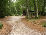 5
5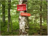 6
6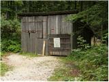 7
7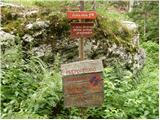 8
8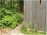 9
9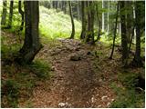 10
10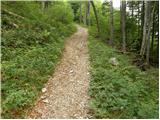 11
11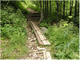 12
12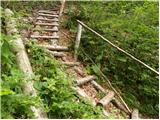 13
13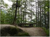 14
14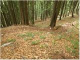 15
15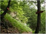 16
16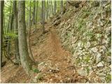 17
17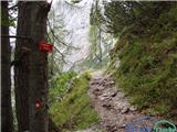 18
18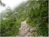 19
19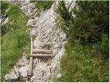 20
20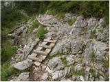 21
21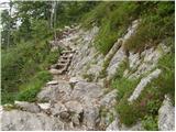 22
22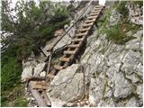 23
23 24
24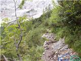 25
25 26
26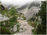 27
27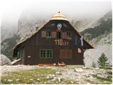 28
28 29
29 30
30 31
31 32
32 33
33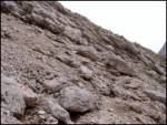 34
34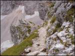 35
35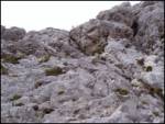 36
36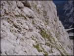 37
37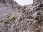 38
38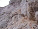 39
39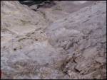 40
40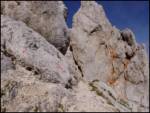 41
41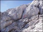 42
42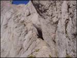 43
43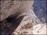 44
44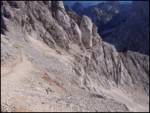 45
45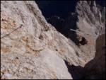 46
46 47
47 48
48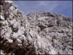 49
49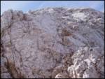 50
50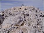 51
51
Discussion about the trail Ravenska Kočna - Kokrska Kočna (past the cableway and on Kremžarjeva pot)
|
| Damijan13. 05. 2007 |
Prijatelj prav, da kdor še ni bil na Kokrski Kočni ni taprav planinc.  Pa naj drugi povejo, če je to res.
|
|
|
|
| Damijan24. 05. 2007 |
Ne na tem odseku ni klinov. Na tem odseku se moraš kakšnih 10m plazit in porivat svoj ruzak pred sabo, ker je tako nizko in ozko. Niti ni tok težko kot zgleda.
|
|
|
|
| Guest6. 06. 2007 |
Celotna pot je lepa in polna prijetnih presenečenj. Najlepši pa je omenjeni prehod, le kdo si ga je omislil?
|
|
|
|
| fpetel112. 04. 2008 |
A je tut žig oz. vpisna knjiga v skrinjici na Kokrski Kočni. Kako je pa pot čez Grdi graben na Kokrsko? Dobr zavarovana, lepa? pa srečno na poteh po naših hribih
|
|
|
|
| andrej jerina12. 04. 2008 |
LP. Skupaj s prijateljem Petrom sva lani opravila turo tovorna žičnica(pod Kokrškim sedlom)-Kokrško sedlo-Jezerska Kočna-Kokrska Kočna in zatem sestop v dolino spet preko Kokrškega sedla.Jaz poti ne bi podcenjeval, na poti od zgoraj omenjenega preduha do vrha obeh Kočen in do sestopa do bivaka pod Kokrško Kočno svetujem uporabo čelade, saj je mimo naju kar nekajkrat močno zažvižgalo. Pot je označena kot zelo zahtevna, kar je lahko subjektivna ocena, pa vendar... Po pameti. Žig je na obeh Kočnah. Zelo lepa tura.
|
|
|
|
| velkavrh2. 07. 2008 |
Danes šel na Kokrško Kočno iz Kokre od Suhadolnika,na Taško,na Grdi graben,na bivak .Vračal sem se prek Jezerske Kočne in po meliščih nazaj do bivaka in v dolino.Sicer malo naporna ,a lepa tura .Svojevrstno doživetje je tudi obisk bivaka pod goro.
|
|
|
|
| NEIC0088. 08. 2008 |
Po isti poti dne 7.8.2008.. Zdi se mi, da kakšna jeklenica t.j. dodatno varovanje ne bi bilo odveč?? 
|
|
|