Suhi Dol - Sivka (through forest)
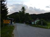
Starting point: Suhi Dol (681 m)
| Lat/Lon: | 46,0502°N 14,2013°E |
| |
Name of path: through forest
Time of walking: 1 h 30 min
Difficulty: easy marked way
Altitude difference: 253 m
Altitude difference po putu: 300 m
Map: Škofjeloško in Cerkljansko hribovje 1:50.000
Recommended equipment (summer):
Recommended equipment (winter):
Views: 4.331
 | 1 person likes this post |
Access to the starting point:
a) First, drive to Horjul (to get here from Dobrova near Ljubljana or Vrhnika), then continue driving to Vrzdenc, Šentjošt and Gorenjska vas. At Vrzdenec, the road starts to climb steeply, then a little further on it leads to a serpentine, in the middle of which the road to Šentjošt and Smrečje branches off to the left. Continue right along the main road, which soon leads to a small pass, at the end of which the road branches off to the right towards the village of Samotorica. Continue straight ahead and the road starts to descend steeply and after a short descent leads to the hamlet of Ljubljanica (lower part of Butajnova), where you reach the next crossroads. Continue left in the direction of Gorenje vas and follow the road to Suhe Dola, where you can park in a suitable place.
b) Take Polhov Gradec and then continue driving towards Gorenjska vas. Follow the road to Gorenjska vasa to Suhi Dol, where you will park in a suitable place at the pass.
c) Drive into the Poljanska valley, more precisely to the roundabout in Gorenjska vas, from where you continue to Lučine and Vrhnika. Follow the asphalt road ascending at the crossroads in the direction of Horjul and Vrhnika, and shortly after the settlements Lučine and Dolge Njive, you will reach the settlement of Suhi Dol, where you will park at the pass in a suitable place.
Path description:
From the pass at Suhem Dol, follow the asphalt road in the route Planina nad Horjulom, but soon the asphalt road splits. Continue on the road slightly to the right, which leads us between houses and where we are accompanied by markings. The two roads merge at a higher point and we continue to the right, continuing to climb cross-country. A few minutes higher, leave the road and continue slightly left on cart track, which climbs parallel to the road, and follow the markings through the forest at the crossroads. The path continues along the right-hand side of the meadow, where it turns to the left, and then ascends through a short lane of woodland to a larger hayfield, where it continues along its upper edge. On the other side of the meadow, the markings direct you back into the lane of the forest, and as you leave the forest, the track in the meadow starts to disappear. Continue in roughly the same direction, but now descending moderately, and the track soon reappears. Lower down, we reach an undistinguished ridge where the path leads us past a sign, and we continue north to north-east. At the sign we return to the lane of the forest, then quickly leave it and continue along the upper edge of the meadow, where we are joined by a path that leads past the Mountain pasture above Horjul.
Continue straight ahead or slightly right before the forest, where a wide track appears. The path continues through the forest, walking along and along the ridge of Zlatný vrh, with the Gabrovo hill with the quarry on the right. There is a slight downhill and past a large chapel we reach an asphalt road, which we cross at a crossroads and continue on the path in the direction of the hiking trail (left down Lučine, left up a few farms slightly right Lomovec and Sivka on the road - there is no road to the top), at which higher up we see a few signs with the inscription "Friends of Sivka" (Friends of Sivka) written on them. After a few minutes of climbing, the forest ends and we are only a short walk away from the top of the mountain on the scenic top slope.
To the right of the summit is the mountain registration box, to the left of the summit is the registration box of the Friends of Sivka.
Description and pictures refer to June 2020.

Pictures:
 1
1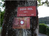 2
2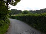 3
3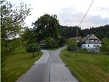 4
4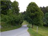 5
5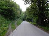 6
6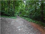 7
7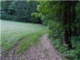 8
8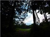 9
9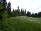 10
10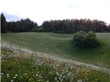 11
11 12
12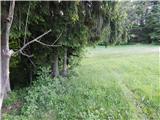 13
13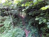 14
14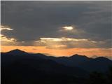 15
15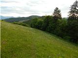 16
16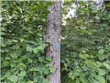 17
17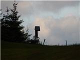 18
18 19
19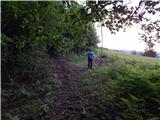 20
20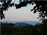 21
21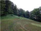 22
22 23
23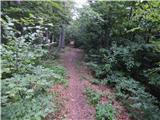 24
24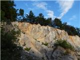 25
25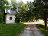 26
26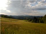 27
27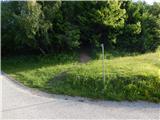 28
28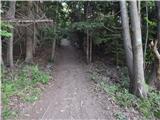 29
29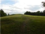 30
30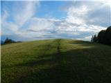 31
31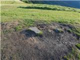 32
32 33
33
Discussion about the trail Suhi Dol - Sivka (through forest)
|
| J.P.28. 02. 2021 |
Tale mali vrh ima najlepši razgled v Polhograjskem hribovju, naj me nekdo popravi... Super izbira za hiter skok v naravo, pot je tudi lepo sledljiva. Lp
|
|
|