Starting point: Mala voda (420 m)
| Lat/Lon: | 46,0454°N 14,2709°E |
| |
Time of walking: 1 h 15 min
Difficulty: easy unmarked way
Altitude difference: 368 m
Altitude difference po putu: 375 m
Map: Škofjeloško in Cerkljansko hribovje 1:50.000
Recommended equipment (summer):
Recommended equipment (winter):
Views: 4.629
 | 2 people like this post |
Access to the starting point:
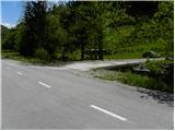
From Horjul or Dobrova, drive to Polhov Gradec, then continue to Gorenjska vas. Continue through Briše and then along the Mala voda river. At the road marker between 4 and 3. 5 km, you will see a road on your left, which crosses the aforementioned river via a small bridge. Take the road and park in a suitable parking space just after the bridge.
Path description:
From the bridge, continue along the macadam road, which climbs gently parallel to the river. Continue past a dwelling house on the left, the road makes a left turn at a trestle and then climbs cross-country across a grassy hillside with a view. Higher up, the road passes into wods and then climbs moderately to an unmarked crossroads. At the crossroads, continue left along the road, which flattens out for a short distance and then climbs gently to the next crossroads. Here continue right (left down Koreno) and follow the moderately ascending road, which opens up a fine view of Koreno, to the next junction at which you will see the first direction signs and a lone marker on a tree.
The ascent continues in the direction of Samotorica (right farm Prevalca) along the road, which leads us in a moderate ascent to a lonely farm at which there is a marked crossroads. Continue in the direction of Kožljek (left Koreno and Horjul) and continue the ascent along the road, which at the next crossroads receives an asphalt coating. At the crossroads, continue left and continue the ascent along the asphalt road, which, after a few minutes of further walking, leads to a small pass, at which you can see a chapel and, next to it, mountain direction signs.
At the chapel, leave the road and continue ascending to the right (direction Kožljek) along a less visible path that climbs moderately over a grassy hayfield. After a short climb, you reach the edge of the forest, where the markers for Kožljek direct you right into the dense forest. The path then climbs steeply through the lane of the coppice, then gradually descends and leads to a partly grassy ridge. This sometimes quite scenic path is then followed all the way to the top of the 788 m high Kožljek.

Pictures:
 1
1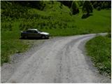 2
2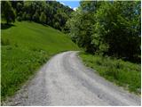 3
3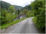 4
4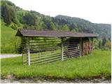 5
5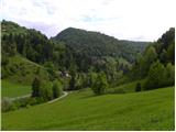 6
6 7
7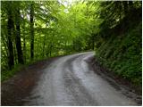 8
8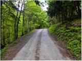 9
9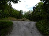 10
10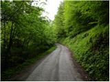 11
11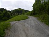 12
12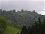 13
13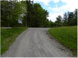 14
14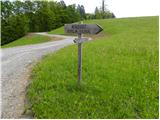 15
15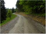 16
16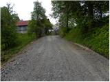 17
17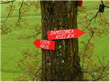 18
18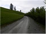 19
19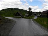 20
20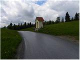 21
21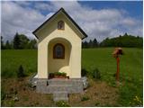 22
22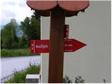 23
23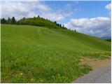 24
24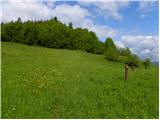 25
25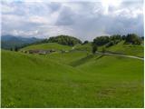 26
26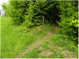 27
27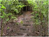 28
28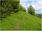 29
29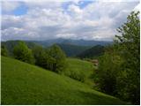 30
30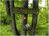 31
31 32
32
Discussion about the trail Mala voda - Kožljek
|
| Lisica5. 05. 2018 |
Zelo lep izlet kljub temu da se hodi po cesti, avtov skoraj ne srecas. Ker je bil dan lep sem nadaljevala na Koreno in naredila krozno pot. Vecinoma ni markirana ampak orientacijsko ni zahtevna.
|
|
|