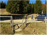
Starting point: Dom na Smrekovcu (1375 m)
| Lat/Lon: | 46,4131°N 14,8997°E |
| |
Time of walking: 2 h
Difficulty: easy marked way
Altitude difference: 309 m
Altitude difference po putu: 425 m
Map: Kamniške in Savinjske Alpe 1:50.000
Recommended equipment (summer):
Recommended equipment (winter): ice axe, crampons
Views: 25.054
 | 2 people like this post |
Access to the starting point:
From the Ljubljana - Maribor motorway, take the Mozirje exit and follow the road towards Logarska dolina. In the village Ljubno ob Savinji, the sign for Smrekovec points to the right. The road then takes you through the centre of the village, where you turn left again after the Smrekovec sign. The road then leads to Ljubenske Rastke, where you continue to the right. Follow the road, which is still asphalted at first, towards Smrekovec (the lodge at Smrekovec) and follow it to the parking lot near the mountain lodge.
Path description:
From the house, continue left along the path towards Smrekovec. The path climbs moderately at first over a grassy slope, then goes into the forest, where it climbs steeply for a short time. The steepness quickly subsides and the path leads to a crossroads where you continue along the lower path in the direction of Komno (Smrekovec on the right). The path then soon leads us to Krumpaško mountain pasture, which is located to the west of Smrekovec. Follow the almost horizontal path and it will soon lead you to the other side of the old fence. On the other side of the fence, an unmarked path from the top of Smrekovec joins us from the right. Continue straight on the path, which passes to cart track which leads us to a slightly steeper path. The path climbs for a while through the forest and leads us again to wide meadows. Cart track ends and the path leads us back to the crossroads. Continue straight on in the direction Raduha (slightly to the right Krnes) along the path that runs along the south side of Krnes. The path leads us to a crossroads where the path from the top of Krnes joins us from the right. Continue in the direction of Raduha, the path then begins to climb moderately and after a short climb through the forest leads us to the wide meadows below the summit of Komnos. Here the path initially descends gently to the signposts. Continue to the right (straight ahead Raduha and Travnik), initially gently across the meadow, then the path climbs steeply and quickly leads us to a scenic peak.

Pictures:
 1
1 2
2 3
3 4
4 5
5 6
6 7
7 8
8 9
9 10
10 11
11 12
12 13
13 14
14 15
15 16
16 17
17 18
18 19
19 20
20 21
21 22
22 23
23 24
24 25
25 26
26 27
27 28
28 29
29 30
30 31
31 32
32 33
33 34
34 35
35 36
36 37
37 38
38 39
39 40
40
Discussion about the trail Dom na Smrekovcu - Komen