Koroška Bela (RC Kres) - Alničje (hunting path)
Starting point: Koroška Bela (RC Kres) (630 m)
| Lat/Lon: | 46,4307°N 14,0982°E |
| |
Name of path: hunting path
Time of walking: 1 h 20 min
Difficulty: easy unmarked way
Altitude difference: 515 m
Altitude difference po putu: 515 m
Map: Karavanke - osrednji del 1 : 50.000
Recommended equipment (summer):
Recommended equipment (winter): ice axe, crampons
Views: 1.320
 | 2 people like this post |
Access to the starting point:
From the motorway Ljubljana - Jesenice take the exit Lipce (Jesenice East) and turn right towards Jesenice. At the first traffic lights (Slovenski Javornik) turn right towards Lj. Followed by a second traffic-lighted junction, turn left and go under the railway underpass, and at the next smaller junction turn right towards Koroška Bela. Go past the last bus stop (the shop on the left) into the village. Look for the crossroads in the centre of the village, where there is a church memorial. From here, follow the main road through the village, which leads uphill to the north. After about 100 m, you will see a bridge on the right, but go straight on for another 50 m, where you will come to a left fork in the road. Take this road, cross another (Koroška) street and continue uphill (the church is lower on the left) until you reach a space outside the village where you come across the abandoned tennis courts (RC Kres).
Path description:
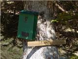
At the first chestnut tree on the roadside (about 50 m from the village), on the right, you can see the forest logging trail, which measures back towards the east. Follow it for a short distance to a left fork, initially a logging trail-like path, which climbs steeply up the slope. Soon the path narrows into a track that climbs in a few switchbacks up the eastern slope of hill Gank (the summit of Alnič-ev). Shortly you come across a makeshift bench, and continue along the path to the north-east. Higher up, the path becomes slightly more gentle, and after a while leads to a fork, where we turn left uphill, along the slope (the right path descends slightly). After a few steps, we reach a steep grassy slope, slightly to the left, and our path turns right and climbs more steeply uphill (the right path descends slightly). A little higher up, the forest thins out and we walk along a grassy slope. After two roundabouts, the slope drops slightly twice in succession, then climbs again moderately to steeply in a left-hand arc. After the path has almost flattened out, it climbs again slightly to the left, through hazel bushes. After a short grassy section the path seemingly disappears. Here it turns perpendicularly left onto the slope, and a little higher up it resumes the same course as before, to the next place by the scraggly trees, where it turns left (backwards) in a fork. After the fork that follows, the path climbs up the slope to the right again, and after a while it leads us back to the next (last) double fork. This is followed by some more traversing of the steeper grassy slope, after which the slightly more difficult to follow path leads us in a moderate ascent to the forest. Here it continues at about the same height and soon becomes well-traced. This part of the wooded slope is quite steep, so caution is not superfluous (slip hazard in wet conditions!). The path soon leads out of the woods to a grassy saddle below Debeli brdo, where there is a bench and a box with a registration book under a spruce tree on the right. A view of the Julijce Mountains opens up if you climb a few 10 m up the grassy slope. To visit the 1145 m high summit of hill Alničje, climb up to its ridge, where there is a path that will take you to the highest point in a few minutes.

Pictures:
 1
1 2
2 3
3 4
4 5
5 6
6 7
7 8
8 9
9 10
10 11
11 12
12 13
13 14
14 15
15 16
16 17
17 18
18 19
19 20
20 21
21 22
22 23
23 24
24 25
25 26
26 27
27 28
28 29
29 30
30 31
31 32
32 33
33 34
34 35
35 36
36 37
37 38
38 39
39 40
40 41
41 42
42 43
43 44
44 45
45 46
46 47
47 48
48 49
49 50
50 51
51 52
52 53
53 54
54 55
55 56
56 57
57 58
58
Discussion about the trail Koroška Bela (RC Kres) - Alničje (hunting path)