Sveta Barbara (Logar) - Tošč (via farm Vodnik)
Starting point: Sveta Barbara (Logar) (466 m)
| Lat/Lon: | 46,1151°N 14,3136°E |
| |
Name of path: via farm Vodnik
Time of walking: 1 h 40 min
Difficulty: easy unmarked way, easy marked way
Altitude difference: 555 m
Altitude difference po putu: 555 m
Map: Ljubljana - okolica 1:50.000
Recommended equipment (summer):
Recommended equipment (winter): ice axe, crampons
Views: 2.040
 | 1 person likes this post |
Access to the starting point:
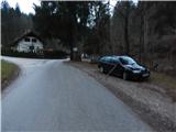
a) From the road Medvode - Škofja Loka, at the beginning of Škofja Loka, turn in the direction of Poljanska dolina, then after the Sten tunnel turn right towards Puštal. A little further on, take another right, then pass through Puštal and the Hrastnice valley. Follow the asphalt road along the valley floor to the eco-island at Logar Homestead, where you can park in a suitable place.
b) From the Poljanska valley, drive towards Škofja Loka, then turn left before the Sten tunnel towards Puštal, and at the next crossroads turn right. Continue through Puštal and the Hrastnice valley. Follow the asphalt road along the valley floor to the eco-island at Logar Homestead, where you can park in a suitable place.
Path description:
From the starting point, continue along the road on the left in the direction of the farms Hribernik, Kogovšek, Bernik. . . (right Selo, Polhov Gradec and Sv. Ožbolt), where you will first pass a few houses and then climb along the Kozjekov graben stream. A little further on, the road to Guzlju (sale of farm machinery) branches off to the right, and a few minutes higher up, also to the right, the road to the Vodnik farm.
Continue right towards the Vodnik farm (straight ahead to the Kozjek farm), which is reached by an ascending asphalt road. Continue through the courtyard of farm Vodnik, then before the hayloft turn left onto cart track, which crosses the hayfields to the left. Cart track quickly splits and we take the right-hand one, which starts to climb. After a short climb, cart track turns to the right, and then, with fine views, leads us to the nearby transmitters, where cart track splits again. Take the left-hand cart track, which passes into the forest and climbs transversely to the left, and after a few minutes joins the slightly wider cart track, which is followed to the right. It then ascends cross-climbing to the right, and before reaching an undistinguished ridge, take the blind right-hand branch of cart track (it is also possible to continue along cart track). After a few steps, when cart track ends, follow the fainter path up to the ridge, where the path becomes more distinct and regular markings appear. Climb along the wooded ridge for a few minutes, then the path turns right and, after a short crossing, joins a much better-beaten path that leads past the church of St Jedrta.
A little further on, the waymarked path gets quite close to cart track, then moves away from it and leads along and along the north-west ridge of Tošč. Higher up, the path leads us through some short viewpoints, and we reach the highest peak of the Polhograje hills in a moderate ascent.
Description and pictures refer to the situation in 2018 (December).

Pictures:
 1
1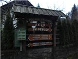 2
2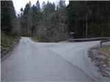 3
3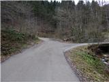 4
4 5
5 6
6 7
7 8
8 9
9 10
10 11
11 12
12 13
13 14
14 15
15 16
16 17
17 18
18 19
19 20
20 21
21 22
22 23
23 24
24 25
25 26
26 27
27 28
28 29
29 30
30
Discussion about the trail Sveta Barbara (Logar) - Tošč (via farm Vodnik)