Zgornja brv - Koča na Klopnem vrhu
Starting point: Zgornja brv (1259 m)
| Lat/Lon: | 46,481°N 15,3599°E |
| |
Time of walking: 1 h 30 min
Difficulty: easy marked way
Altitude difference: 1 m
Altitude difference po putu: 150 m
Map: Pohorje 1:50.000
Recommended equipment (summer):
Recommended equipment (winter):
Views: 5.960
 | 4 people like this post |
Access to the starting point:
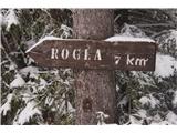
From the Ljubljana - Maribor motorway, take the Slovenske Konjice exit and then follow the road to the above-mentioned place. In Slovenske Konjice turn right towards Oplotnica, which is a few kilometres of winding road away. At Oplotnica, where you join the road from Slovenska Bistrica, turn left towards Osankarica. Continue along the Oplotnica stream for some time, then reach a crossroads where the road splits into two. Here continue left in the direction of Roga. Continue along the road, which soon turns into a macadam past the village Lukanja, and higher up it leads to a slightly larger crossroads, where you continue left in the direction of Rogle and Koča na Pesku, (right Osankarica). From here, after about 7. 0 kilometres, you will see a small parking area on the left-hand bend, where you can leave your vehicle. The starting point is identified by the signs for Lovrenec. From here it is 7. 0 km to Roga and 4. 0 km to Pesek.
The starting point can also be reached from the direction of Koča na Pesku.
Path description:
From the parking lot, we focus (from the starting point there are three paths - the left and the middle Lovrenc) on the middle path, which we leave after a few metres and focus right into the forest following the markings (Klopni vrh - Osankarica and also the marked Slovenian mountain trail (transversal)). From here on, the trail leads us almost all the time through the beautiful forests of Pohorje and also some wetlands. The forest trail connects and branches off a few times to a well-maintained cycle path and a macadam trail, so it is necessary to keep an eye on the markings at all times, which are not lacking and there are enough of them. The only place to watch out for is at the turnoff for Osankarica (right), where we continue off the road to the left into the forest (also well marked). After about 1. 15h walking time, we see a signpost on the dirt road (Klopni vrh 0. 15h to the left), where we can turn off the trail and first visit Klopni vrh 1. 340 m and descend from the top on the other side to the hut at Klopni vrh, or continue straight for about 15 minutes on the trail to the right turn, where the trail branches off to the left into the woods where you can almost see the hut, and later from the hut climb to the top.
The trail goes along gentle ascents and descents, and is very suitable for both younger and older hikers.

We can extend the trip to the following destinations: Klopni vrh
Pictures:
 1
1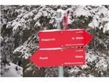 2
2 3
3 4
4 5
5 6
6 7
7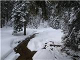 8
8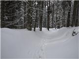 9
9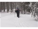 10
10 11
11 12
12 13
13 14
14 15
15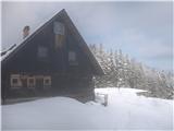 16
16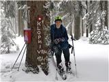 17
17
Discussion about the trail Zgornja brv - Koča na Klopnem vrhu
|
| Mašika22. 08. 2020 |
Naprej od Oplotnice je cesta levo proti Lukanji zaprta - šli po desni, bistveno daljši.
Pri mokrišču smo malo hodili v krogu, ampak vendarle našli markacijo.
Škoda, da v lepi obnovljeni koči niso imeli hrane.
|
|
|
|
| bbugari122. 08. 2020 |
Ni uradna koča, ni mogoče računati na hrano. Mimogrede, gobov golaž je najboljši na svetu na Koči na Klopnem vrhu.
|
|
|