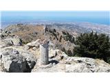
Starting point: Zia (286 m)
| Lat/Lon: | 36,84712°N 27,20426°E |
| |
Time of walking: 1 h 50 min
Difficulty: easy marked way
Altitude difference: 560 m
Altitude difference po putu: 560 m
Map:
Recommended equipment (summer):
Recommended equipment (winter):
Views: 2.750
 | 5 people like this post |
Access to the starting point:
The starting point is a village Zia on Kos island in Greece (Greek: Ζία).
From the main road of the island, turn for Zia at Zipari (Greek: Ζιπάρι). Note that the signs are seen only when driving in the direction from Kos, in the opposite direction, however, they are easily missed.
A parking spot is just below the village Zia. Immediately when the stony road begins, turn right to the big parking spot (it is free of charge).
Path description:
A hike to the summit can be divided into 4 logical parts. The first part is a somewhat steep part through the Zia village (15 min). The second part is a 35 min walk on a dusty road. The third part is a 40-minute-long path through a dense forest of juniper trees. The final part is exposed to the sun all the way to the summit (20 min).
PART 1
After parking, follow the road up through a left road turn, walk 50 meters and turn right, walk by the souvenir shops and restaurant to the church, pass the church, after 50 to 100 meters turn right (mark the signs) and follow the steep road up through the upper more rural part of village Zia.
PART 2
Follow a dusty country road for around 30 to 40 minutes. Expect a rural environment, with chickens, roosters, and later with sheep and goats.
PART 3
On the left side of the road, when you see the markings for the Dikeos mountain (in Greek: Δίκαιος), turn left to a footpath through the dense forest of juniper trees. The path is steeper than the road.
PART 4
The path eventually comes out of the forest. Follow it through its steepest part to the upper plateau and follow it left or upwards. The path ascends slowly, then descends and again ascends in a steeper tone. The summit is to the right or west of the chapel.
INFRASTRUCTURE: A bivouac, a chapel, two greek flags, a summit-cross.
PANORAMA
Excellent. The Turkish coast (city of Bodrum), three Greek islands to the north: Pserimos (100 inhabitants including tourists in the summer), Plati (1 inhabitant as of 2020), and Kalymnos (worldly renown for its industry of sponges), the southwestern part of the Kos island with Kefalos city, steep slopes to the south, and Nisiros island to the south.

Pictures:
 1
1 2
2 3
3 4
4 5
5 6
6 7
7 8
8 9
9 10
10 11
11 12
12 13
13 14
14 15
15 16
16 17
17 18
18 19
19 20
20 21
21 22
22 23
23 24
24 25
25 26
26 27
27 28
28 29
29 30
30 31
31 32
32 33
33 34
34 35
35 36
36 37
37 38
38 39
39 40
40 41
41 42
42 43
43 44
44 45
45 46
46 47
47 48
48 49
49 50
50 51
51 52
52 53
53 54
54 55
55 56
56 57
57 58
58 59
59 60
60 61
61 62
62
Discussion about the trail Zia - Dikeos (Kos)