Planina Ravne - Chapel on Molička planina (via Zelene trate)
Starting point: Planina Ravne (1580 m)
| Latitude/Longitude: | 46,3574°N 14,7002°E |
| |
Route name: via Zelene trate
Walking time: 2 h
Difficulty: easy marked way
Elevation gain: 200 m
Elevation difference along the route: 475 m
Map: Kamniške in Savinjske Alpe 1:50.000
Recommended equipment (summer):
Recommended equipment (winter): ice axe, crampons
Views: 58.481
 | 3 people like this post |
Access to starting point:
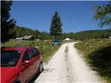
A) First, we drive to Kamnik, and then we continue driving towards Stahovica and the mountain pass Črnivec. A few hundred meters before the mountain pass Črnivec, we leave the main road which leads towards Gornji Grad and continue driving sharply left in the direction of the mountain pass Volovljek (Kranjski Rak). From the mentioned mountain pass, we continue straight (left road which leads to Velika planina, right Štajerski Rak) and start descending towards Luče. Lower down, the road flattens a little and brings us into the valley Podvolovljek. Further, first we drive past the turn-off of the road which leads into the valley of Lučka Bela, then also past the bar Pri Gamsu. After the bar, we need to pay attention, because only a few hundred meters further, the road which leads towards the mountain pasture Podvežak and mountain pasture Ravne and farm Planinšek branches off to the left (by the spot where we leave the main road, there is a road sign approximately 11 km). Further, we drive on the initially still asphalt road, which then ascends towards the plateau Dleskovška planota. Higher, the road towards Planinšek branches off to the right, and here we continue on the left upper road, which a few hundred meters further from the turn-off towards the farm Planinšek becomes macadam, and a little further it brings us to the next crossroad, where we continue straight in the direction of the mountain pasture Ravne (left mountain pasture Podvežak). Further on a somewhat rougher road, we then follow to the beginning of the mountain pasture Ravne, where we park in an appropriate place by the road.
From the main road to the mountain pasture Ravne is approximately 10 km, of which approximately 4 km macadam.
B) First, we drive to Luče, and then we continue driving towards Kamnik. When by the road we notice a road sign which shows 10.5 km, we need to pay attention to the right turn-off, because only a little further to the right, the road towards the mountain pasture Podvežak and Ravne and farm Planinšek branches off. Further, we drive on the initially still asphalt road, which then ascends towards the plateau Dleskovška planota. Higher, the road towards Planinšek branches off to the right, and here we continue on the left upper road, which a few hundred meters further from the turn-off towards the farm Planinšek becomes macadam, and a little further it brings us to the next crossroad, where we continue straight in the direction of the mountain pasture Ravne (left mountain pasture Podvežak). Further on a somewhat rougher road, we then follow to the beginning of the mountain pasture Ravne, where we park in an appropriate place by the road.
From the main road to the mountain pasture Ravne is approximately 10 km, of which approximately 4 km macadam.
Route description:
From the starting point across the mountain pasture we walk to the shepherd hut, which we bypass on the right side, so that we continue in the direction of the mountain pasture Molička planina and mountain pasture Polšak (on the left side of the hut leads the path over Dolga trata). Behind the hut, the path is at first a little harder to follow, but the blazes help us, and a little ahead we join the cart track which branches off from the road on the mountain pasture Ravne at the right bend.
When we step on the cart track we continue left, on it at first we walk without major changes in altitude, then we start gently to moderately ascending. After a few minutes, we reach an indistinct saddle between Dleskovec on the left and Smrekovec on the right. Here from the right joins the path from the end of the road, and we continue straight across the grazing fence. Behind the grazing fence follows a short crossing, then we arrive at the next marked junction, where we continue left in the direction of Lučka koča, straight to mountain pasture Polšak.
The path ahead continues in a series of several smaller dells, then it brings us to the NOB monument, by which there are benches with a table. From here onward, the path ascends somewhat more steeply, and somewhat higher the first nice views open towards Križevnik, Raduha and the surrounding mountains. Higher we moderately ascend for some time through belts of brushwood, then the path flattens and brings us to Sedelce, where from the left joins the path over Dolga trata.
We continue a few more meters ahead on the path, which slightly descends to the sign for Molička planina and Korošica.
We continue straight in the direction of Korošica and Molička planina (right Veliki vrh) on the path, which occasionally slightly descends and rises again. The path ahead encircles the slopes of Veliki vrh and brings us to a junction, where to the right upwards branches off the path to the mentioned peak. Here we continue straight on the path which a little further brings us to the pass Prag, where there is the next junction. We continue straight (sharply left mountain pasture Podvežak) on the marked mountain path, which gradually starts to descend. After a good 10 minutes of descent the path flattens and brings us to a smaller marsh, behind which we come to the next junction. We continue straight (slightly left Korošica, right Robanov kot) on the pleasant mountain path, along which in a few minutes of further walking we arrive at Kocbekovo zavetišče below Ojstrica. The chapel on Molička planina (peči) is located only a few meters above the mentioned shelter.

Along the route: Sedelce (1840m), Prag (1870m)
Photos:
 1
1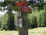 2
2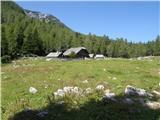 3
3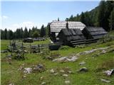 4
4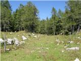 5
5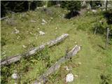 6
6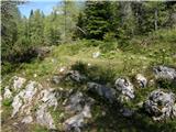 7
7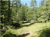 8
8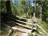 9
9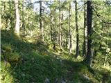 10
10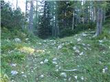 11
11 12
12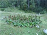 13
13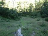 14
14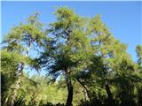 15
15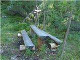 16
16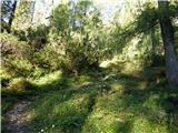 17
17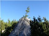 18
18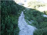 19
19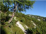 20
20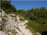 21
21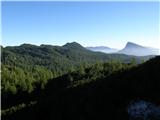 22
22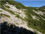 23
23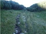 24
24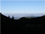 25
25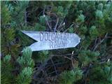 26
26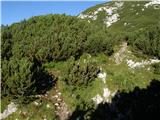 27
27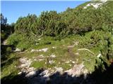 28
28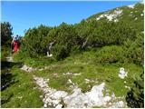 29
29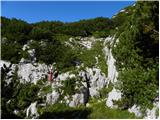 30
30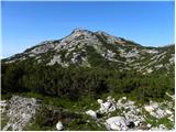 31
31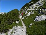 32
32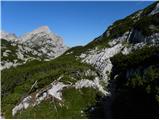 33
33 34
34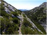 35
35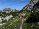 36
36 37
37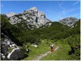 38
38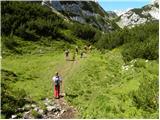 39
39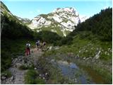 40
40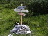 41
41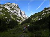 42
42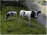 43
43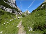 44
44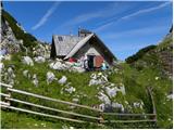 45
45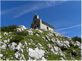 46
46
Discussion about the trip Planina Ravne - Chapel on Molička planina (via Zelene trate)
|
| ljubica17. 08. 2006 |
Beautiful mountain walk among larch groves, flowers, blueberries (this week) and views of the mountains surrounding the Dleskovec plateau. In my opinion, a more beautiful variant than from Pl. Podvežak. LpLj
|
|
|
|
| Gost25. 01. 2008 |
Hello!
Is anyone by chance walking around Molička planina these days, I'm interested in the conditions and how the road is?
LP
|
|
|
|
| Kriška30. 06. 2008 |
Yesterday's path to Molička planina was considerably longer than described, not because of the path's difficulty, but because it was like a walk through a rich botanical garden, and we had to take time to admire and photograph the flowers. At this time, nature on the Dleskovška planota is very generous.
Kocbekovo zavetišče on the planina is open on Saturdays and Sundays and you can get chilled drinks as if taken from your own fridge (chilled under rocks in a natural environment). The pastoral community takes care of serving drinks, so on some Saturday it might happen that the shelter is closed for a few hours because the shepherd goes to check on the livestock grazing in a wider area.
The chapel was also unlocked, so we could see the nice interior.
Highly recommend a visit!
|
|
|
|
| reina25. 05. 2009 |
This weekend we would like to go to Molička planina. I'm interested in the distance between Planina Ravne and Podvežak, we would like to make a loop, if possible. I hope there's no more snow and the weather will be nice. Best regards to all.
|
|
|
|
| rozka26. 05. 2009 |
I was on Saturday 23.05. on Ojstrica via planina Podvežak, where a little higher than planina Podvežak the snow starts... there was still a huge amount of it at least on Saturday
|
|
|
|
| reina8. 06. 2009 |
After a long time back up here a bit. Has anyone been to Molička planina in the last 14 days? Nice weather is forecast for the end of this week. I'd like to take a group up, as it's not too tough a hike for slower ones. Hope there's no snow.
|
|
|
|
| reina14. 06. 2009 |
I was there yesterday. The path is quite snowy. No living soul anywhere, hut still closed. I'll repeat the hike when all paths are snow-free.
|
|
|
|
| marjanah17. 03. 2012 |
Apparently this is not exactly a popular winter destination, as the path isn't even trodden. Snow sinks to the knees today, so we turned back. We'll try our luck again in summer.
|
|
|
|
| otiv17. 03. 2012 |
@marjanah this is primarily a paradise for ski tourers, of course with a bit more snow as there was this winter. In July it's especially beautiful when everything is full of flowers.
|
|
|
|
| trilko17. 03. 2012 |
Yes, I've already turned back twice this year on the way to Molička, last time 1 month ago  I thought there might be less snow given the current temperatures, and planned to try again. Obviously I'll wait a bit more I thought there might be less snow given the current temperatures, and planned to try again. Obviously I'll wait a bit more
|
|
|
|
| otiv17. 03. 2012 |
@trilko wait for cooler weather and of course set off before sunrise. I've done the path in snow many times without problems, but it all depends on current conditions, which in recent days are not favorable for walking on snow.
|
|
|
|
| Stamp14. 07. 2017 |
Is there a (marked?) trail from Veliki Vrh (and Velika Zelenica) towards Molička Kapelica to SW or do you have to return towards Sedlec (Zelene trate) to SE and then towards the Chapel?
Thanks..
|
|
|
|
| garmont14. 07. 2017 |
You have to return to Sedelce, from where you previously ascended to the summit.
|
|
|
|
| garmont14. 07. 2017 |
I was too quick.
Of course you can descend from the summit to the other side, which is closer to Molička planina. The trail has been marked for three years, so you don't need to return towards the trail's starting point.
Lp
|
|
|
|
| Stamp14. 07. 2017 |
Super.. If only there was some *.gpx for that part..
|
|
|
|
| Stamp25. 07. 2017 |
We were there. Both the Dom and the Chapel were closed.. Otherwise super.. Description, photos and map on my Photo : click Here and gpx on Wikiloc or Endomondo (or as GPX) if anyone needs..
|
|
|
|
| orchigu24. 07. 2021 11:43:09 |
Walked 21.7.2021. The path is really beautiful, at this time strewn with colors (pinks, rusts, patches of snow, also quite a few cows grazing right on the path - it was a bit stressful to avoid them sometimes), I'd say for people with average fitness it takes concretely more than two hours, also the signs at the parking lot (whichever path from pl. Ravne) say 2.30 or 2.45. The path can start to drag a bit for some, because it's constantly "up down around" and during the path we don't really have a good feel for what's waiting in the next 100m and how much we have left to the goal. Pleasant path with especially phenomenal views at the chapel, but count on quite a bit more than 2 hours of walking.
|
|
|
|
| Merlin188. 08. 2022 21:02:55 |
What's the macadam section of the road towards Planina Ravne like, is the road in poor condition recently or can it be driven with a smaller car?
|
|
|
|
| KarmenT9. 08. 2022 07:37:50 |
The road is without any special features.
|
|
|
|
| ajdapetrovec9. 10. 2022 09:22:36 |
Beautiful trip, varied and easy path with nice views. At the top also very friendly caretaker and excellent tea.
The road to the starting point was normally drivable.
|
|
|
To post a comment you must log in:
If you do not yet have a username, you must first
register.