Pasjek - Žamboh (Špeglovec, Kleviška špica and Žamboh - from north)
Starting point: Pasjek (231 m)
Name of path: Špeglovec, Kleviška špica and Žamboh - from north
Time of walking: 5 h 30 min
Difficulty: very difficult pathless terrain
Altitude difference: 507 m
Altitude difference po putu: 560 m
Map: Zagorje ob Savi 1:30.000
Recommended equipment (summer): helmet
Recommended equipment (winter): helmet, ice axe, crampons
Views: 1.260
 | 4 people like this post |
Access to the starting point:
Žamboh - northern ridge access from Pasjek - from Blejak
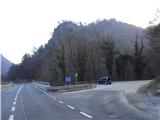
From the route of Litija towards Zagorje, it is necessary to drive about 500 m further from Pasjek (the turn-off for Polšnik), where just off the main road on the right lies a small and undistinguished narrow avoidance area for about 3 cars. There is really little space along the road, so you really have to be careful when getting in / out of your car, as the main road is relatively busy. Just after the steel cable above the road we start our way up.
Note: It is safer to park the car at the bridge in Pasjek, but then you have to walk along the main road to the starting point, which can be even more awkward and dangerous.
Path description:
Along the undistinguished small gorge of the usually dry watercourse Blejak, walk for about 600 m gently uphill on rough grassy terrain until you reach the forest road logging trail, where a forest road has been made to the right towards Lepe hill for the purpose of harvesting timber. The saddle below Lepi hill, where you first see an old hunting lodge in a tree, can be reached in about 20 minutes. We then continue our journey along the gently sloping road, which turns left or goes further, to the right - past the hunting lodge we can (approx. 5 min) go to a lookout point called Lepi hrib, from where we can see the Sava river below, the road and the railway and of course the villages and hills on the left bank of the Sava towards Zasavska Gora, Roviškovec, Pleša, etc. From here we have to go back to the saddle. Follow the comfortable forest road, which more or less runs flatly along the stratified road, for some time until it widens and bends sharply down towards the village, where you turn left onto the worse cart track, which starts to climb a little more and goes around the hill below the ridge of Špeglovec. When this cart track almost looks at the south side of the hill, a very steep climb up to the left at a large mogic starts on the ridge of Špeglovec. There is no beaten track, we have to find the best passages between the forest grasses and the rock world, with trees growing sturdily to help us grip the path. When we emerge from the forest onto a relatively wide ridge, our hearts skip a beat, first from the beautiful views, then from the easier climbing spots over the rock crags. Don't worry, they're not too hard, but you have to use all fours to help yourself, and stow your poles on the rudzak. The ridge from Špeglovec is just long enough to warm up, but shortly afterwards the upper part turns into forest again and lays down. Continue along the wide plateau, and from there a little to the left uphill to the small church of St. Lawrence, which is hidden on a small rise in the middle of the forest. Fairytale-like, really beautiful. There is an information board next to the church, describing its history, and the locals have put a memory book in the window, and there are also a few benches in front of the church for resting. From the church of St. Lovrenec, a marked trail leads down to the south-east to the village of Tepe, but leave it on the plain or saddle between St. Lovrenec and Žamboh and head left, past a distinctive hunting lodge, down to the northern side of the hills. Follow the forest path down for a short distance until you reach a crossroads (orientir: a large blue PVC barrel on a tree), where you turn right, following the initially more inclined cart track, which later, below the central part of the Kleviška Spit, turns into a hunting track or hunting trail. As we approach Renki, it begins to descend and become wider again, becoming again the cart track, which bypasses the hill and which leads to the hamlet of Kleviše (hence the name of the hill). When the cart track turns from the north to the east side, at the viewpoint (Presnica) - there is a bench under the track and a rocky lookout to Renke, turn steeply uphill again and look across the steep grasses to the NE ridge of Kleviška Špica. The terrain is brutally steep, steeper than the one to Špeglovec, longer and therefore more strenuous. In between there are also a few rock outcrops with views of the neighbouring Ostrež and the villages to the left of Polšnik. Kleviška špica is forested, but its top is quite vast and the peak itself is not spike-like.
From the top of Kleviška Špica, initially descend more on the southern side of the hill, and further in the direction of Žamboh, keep a little more to the right, the wooded area between Kleviška Špica and Žamboh is beautiful, easily passable and more sloping. The top of Žamboh is also spacious, undeveloped and wooded. If Kleviška Špica had at least a stone geomeynik, Žamboh, at the time of our visit, had instead only a large wooden man (made of scraps of fallen wood and branches) and the letter Ž carved on a tree.
From Žamboh to the saddle or plain between Žamboh and St. Lawrence is reached in a ten-minute walk; if you keep a little more to the right, you will catch a faint forest trail downhill, but the path already taken from this plain, past the hunting lodge on the left and on to the blue PVC barrel on the north side of the hill, has to be repeated here. At the well-known crossroads of the kolovozas, now turn left and past the blue PVC barrel nailed to a tree, find the path leading down to the central ridge of the Žamboh with a large rock outcrop in the middle, which then leads all the way to our starting point of the stream/ gorge Blejak to the main Zasavska road along the Sava River. When we find ourselves in front of the rock giant, we are quite surprised, it is so big and mighty. It is easy to climb (difficulty II, sometimes III), the rock is good and there are lots of holds, and we are helped by a few tree bushes that have grown in the crevices. Of course, it is possible to avoid this rock wonder, the southern detour is easier than the northern one, but even with this detour you have to be very careful and keep a safe and steady step. There is some very challenging climbing to be found in this little natural rock eldorado, which will also appeal to more demanding mountaineers, but of course the more usual approach is from the bottom up. For its longest route - from the west side - you need 60 m of rope for the exercise, no pegs are used because the tree bushes or the necks of the rock heads at the top are solid enough.
The descent down the ridge is also difficult because of the steepness, and the last part just before the road is particularly tricky because it is grassy and less overgrown, and is also a slip hazard in the dry, but should not be attempted in the wet. The emergency exit is to take the left fork up towards Blejak.
The described circular tour (almost in the shape of a figure of eight) with normal stops for refreshments and views takes about 5-6 hours, but if you are going to explore something on your own for the first time, add the obligatory reserve for potholed terrain and for your own combinations of directions and routes.

Pictures:
 1
1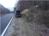 2
2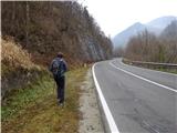 3
3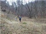 4
4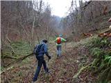 5
5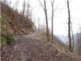 6
6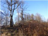 7
7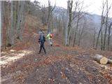 8
8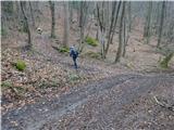 9
9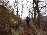 10
10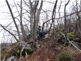 11
11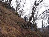 12
12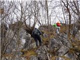 13
13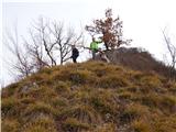 14
14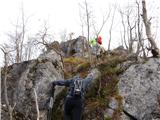 15
15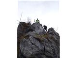 16
16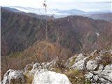 17
17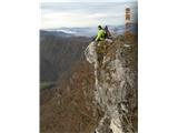 18
18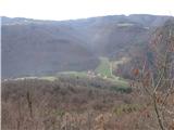 19
19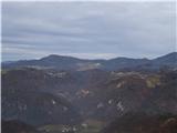 20
20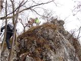 21
21 22
22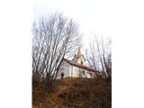 23
23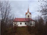 24
24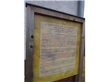 25
25 26
26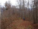 27
27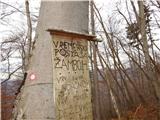 28
28 29
29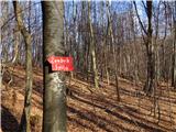 30
30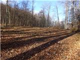 31
31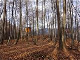 32
32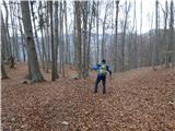 33
33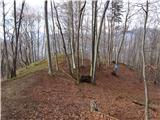 34
34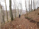 35
35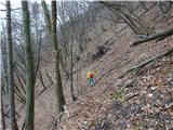 36
36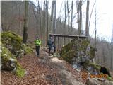 37
37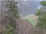 38
38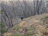 39
39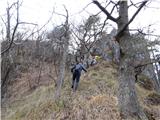 40
40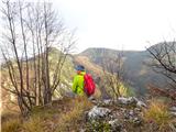 41
41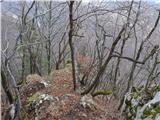 42
42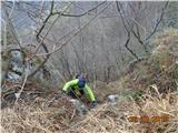 43
43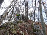 44
44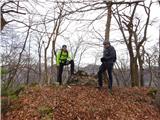 45
45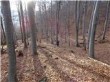 46
46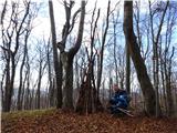 47
47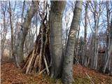 48
48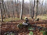 49
49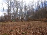 50
50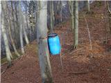 51
51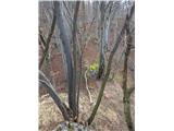 52
52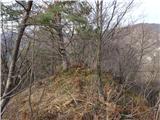 53
53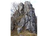 54
54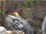 55
55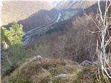 56
56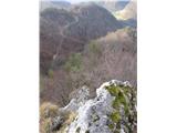 57
57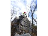 58
58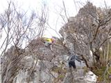 59
59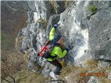 60
60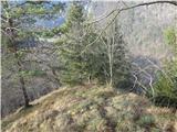 61
61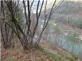 62
62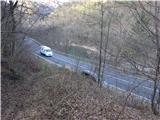 63
63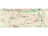 64
64
Discussion about the trail Pasjek - Žamboh (Špeglovec, Kleviška špica and Žamboh - from north)