Starting point: Želimlje (321 m)
| Lat/Lon: | 45,9151°N 14,5744°E |
| |
Time of walking: 1 h 50 min
Difficulty: easy marked way
Altitude difference: 505 m
Altitude difference po putu: 535 m
Map:
Recommended equipment (summer):
Recommended equipment (winter): ice axe, crampons
Views: 8.681
 | 2 people like this post |
Access to the starting point:
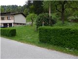
a) From Ljubljana or Grosuplje, take the Škofljica, and from there continue to Kočevje. At Pijava Gorica, the signs for Želimlje direct you to the right. After a few kilometres, when you reach Želimlje, at a triangular junction with a chapel in the middle, continue straight on towards Turjaka. A few 100 metres further on, we see an old quarry on the right, and a few metres before the left-hand bend, the mountain signs for Kurešček, and we are at the beginning of the route described above. There are no suitable parking places at the starting point.
b) First drive to Turjak, then take the road that leads past the castle. Near the castle, the road descends steeply and leads to a crossroads, where you continue to the right (left Ščurki, Četež pri Turjaku, Prazniki). Continue along Želimeljščićica, then the valley widens and the road leads to Želimlje. Pass through Želimlje to a place where you can see the mountain signs for Kurešček. There are no suitable parking places at the starting point.
c) First drive to Ig and from there continue to Škofljica. When the main road turns left just before the end of Ig, we continue straight on to a slightly narrower asphalt road, which quickly leads us to Kremenica. We continue straight through this settlement and also continue straight into a few small junctions after the settlement. Later, we join the road leading from Pijava Gorica to Želimlje, and we follow it to the right. After a few kilometres, when we reach Želimlje, at a triangular intersection with a chapel in the middle, we continue straight on towards Turjak. A few 100 metres further on, we see an old quarry on the right, and a few metres before the left turn, we see the mountain signs for Kurešček, and we are at the beginning of the route described above. There are no suitable parking places at the starting point.
Path description:
From the road, the signs for Kurešček direct us to an initially almost imperceptible path that climbs steeply along the hedgerow. After a short steep climb into the woods, the track becomes more distinct, and above the quarry it turns left and quickly leads to cart track, which is reached near a crossroads.
Continue on the ascending cart track, which turns slightly to the left and then climbs transversely. The cart track climbs quite steeply, mostly through the forest, with only one part offering some views of the surrounding hills. Higher up, cart track gently descends, and we follow it to its end, from where some views open up again.
From the end of cart track we continue straight on the marked path, which changes to steeper slopes. Somewhat further on, we are helped by jeklenice (the passage is easy, even in wet conditions there is no greater danger, greater caution is needed only if there is ice), which accompany us at intervals until we reach a wooded ridge, where a short unmarked path branches off to the left towards Castle Stari grad, and a marked path continues to the right towards Kureščko.
At this crossroads, turn right and continue along and then along the ridge, which in some places offers a view of the other side of Benšetov Gurn towards the Church of St Marjeta in Golem. A little further along the ridge, the path passes onto the hayfields of the nearby village of Rogatec nad Želimljami, which is soon reached.
Before the first house, turn right, then follow the macadam road quickly to the asphalt road, which you can follow to the right in the direction of Kureščko. After the settlement, the road returns to the forest, and then leads us past a few individual houses of the neighbouring settlement of Visoko. At two small crossroads, continue right, then a little higher up you reach a slightly larger crossroads, where you continue left in the direction of Kureščko.
From the crossroads, walk along the asphalt road for a few minutes, then turn right at the left-hand bend onto a footpath that begins to climb through the forest. Follow the markings through the forest and they will lead you to the Mountain Home at Kureščko. Go around the house on the left and immediately get on the asphalt road (if you continue on the right side of the mountain home, you can climb to the top over the hayfield on a slightly shorter path). The road then leads us past the parking lot, and behind it we begin to climb gently up the grassy slope. A little further on, the path to Turjak branches off to the left, and at the right-hand bend before the cemetery we join the sub-trail from Pirmane or Turjak.
Continue along the road, and immediately a cross-route branches off slightly to the right. You can continue along the road, which will take you to the top of Kureščko in about 3 minutes, or you can follow the Way of the Cross. The latter is a little longer, but it is not on the road.
Description and pictures refer to the situation in 2015 (May).

Pictures:
 1
1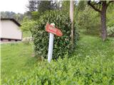 2
2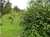 3
3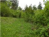 4
4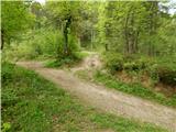 5
5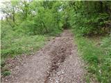 6
6 7
7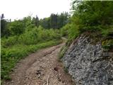 8
8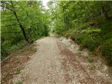 9
9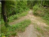 10
10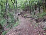 11
11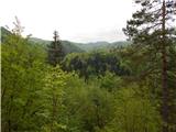 12
12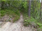 13
13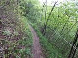 14
14 15
15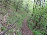 16
16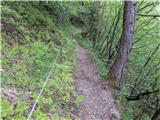 17
17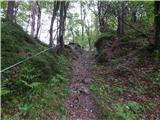 18
18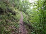 19
19 20
20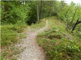 21
21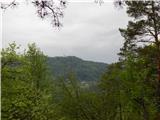 22
22 23
23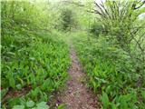 24
24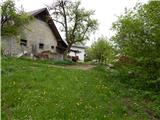 25
25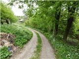 26
26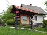 27
27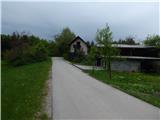 28
28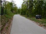 29
29 30
30 31
31 32
32 33
33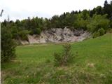 34
34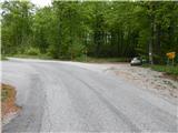 35
35 36
36 37
37 38
38 39
39 40
40 41
41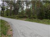 42
42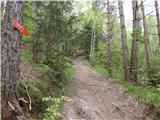 43
43 44
44 45
45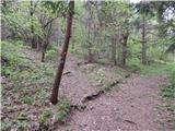 46
46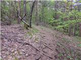 47
47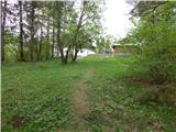 48
48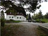 49
49 50
50 51
51 52
52 53
53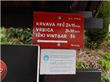 54
54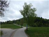 55
55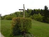 56
56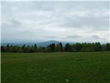 57
57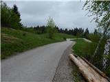 58
58 59
59 60
60 61
61 62
62
Discussion about the trail Želimlje - Kurešček
|
| KarmenT5. 03. 2018 |
Včeraj na Kurešček iz Želimelj. Začela na parkirišču pri cerkvi. Pot zasnežena ves čas. Gaz do Rogatca, potem po kopnem asfaltu, nato ob pašniku v celo - udiralo se je čez kolena in za konec po sankaški progi do cerkvice. Na vrhu megla, nič sonca, vendar pot kljub temu odlična. Pravo zimsko vzdušje. Na poti je tudi odsek z jeklenico, ki da malo gorskega vtisa. Srečala nisva nikogar, le tik pod vrhom več sankačev in nekaj sprehajalcev.
|
|
|