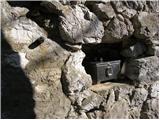
 | End of road below Jelovec - Castle Stari grad (Čušperk Castle)
Castle Stari grad, or Castle Čušperk, is located south of Grosuplje, specifically west of the village of Čušperk. Today, only ruins remain of the...
1 h 30 min |
 | Lovrenc na Pohorju (cemetery) - Koglerjev vrh (via Hožičev vrh)
Koglerjev vrh is a 698-metre-high, forested peak located south-west of the Šlaus-Kogler organic farm, which is above the village of Lovrenc na Po...
1 h |
 | Činžat - Lobnikov vrh
Lobnikov vrh is a forested peak above the Drava Valley, situated between Fala and Ruta. From the east, it loks like a solitary rock due to its di...
1 h |
 | Poljana (Završnica) - Sveti Lovrenc above Zabreznica (via Mali vrh)
Sveti Lovrenc is a lookout point with a church of the same name, located on the southern slope of Grebenc Breznik Ovens, 180 metres above the vil...
1 h |
 | Logatec (Gorenja vas) - Šenčurjev vrh (via Žibrše)
Šenčurjev vrh is a 725-metre-high hill located above the settlement Žibrše, between Logatec, Hotedršica and Rovtami. At the top, which offers a b...
1 h 30 min |
 | Olševek - Apnišče (west path)
Apnišče is a 740 m high mountain located between Možjanca and Štefanja gora. It is the highest point of the Šenčur municipality. There is a bench...
55 min |
 | Olševek - Apnišče (via Šterna)
Apnišče is a 740 m high mountain located between Možjanca and Štefanja gora. It is the highest point of the Šenčur municipality. There is a bench...
55 min |
 | Šembije - Gradišče (Čepan)
Gradišče aka Čepan is a 791 m high peak located in the mountain ridge between Šembije and Pivka. From the top, which with its 791 m is also the h...
1 h 20 min |
 | Podgorje - Kojnik (via hunting cottage)
Kojnik is a partially vegetated peak located in the southern part of the Podgorje Karst near the Slovenian-Croatian border. From the top of the s...
1 h 30 min |
 | Rovte - Medvedje Brdo (via Trtovška grapa)
Medvedje Brdo is a small settlement located north of Hotedršice. The highest point of the village is a pleasant lookout point located on Šinkovco...
1 h 10 min |
 | Rodik - Sveti Socerb (Artviže)
The Church of St. Socerbo is situated on a hill overloking the village of Artviže, which is the highest peak in Brkina with its 817 m. The church...
1 h 20 min |
 | Kropa (Slovenska peč) - Sveti Primož in Felicijan (Jamnik)
The Church of St. Primož and Felicijan on Jamnik, is situated on a scenic grassy ridge rising between Kropa and Podblica. From the church or its ...
1 h 10 min |
 | Podblica - Sveti Križ above Selca (via Sleme)
The Sveti Križ above Selca church is situated on a lookout point, which offers a beautiful view over part of the Škofjeloško hribovje....
1 h 30 min |
 | Podblica - Sleme (Površnica)
Sleme is a scenic peak located between Rudni, Dražgoše and Lajša. The summit, where the transmitters are located, offers a beautiful view of the ...
1 h 10 min |