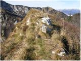
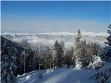
 | Kozji hrbet - Možic
Možic is a 1602 m high peak located west of Soriška mountain pasture. It is at the highest point of the peak that there is an old military bunker...
1 h |
 | Bohinjsko sedlo - Slatnik (northwestern peak) (direct way)
Slatnik is a scenic mountain located to the west of the Soriška mountain pasture ski resort. The grassy peak offers a beautiful view of the Škofj...
1 h |
| Bohinjsko sedlo - Slatnik (northwestern peak) (by Lajnar)
Slatnik is a scenic mountain located to the west of the Soriška mountain pasture ski resort. The grassy peak offers a beautiful view of the Škofj...
1 h 15 min |
 | Križovec - Ptičji vrh
Ptičji vrh is a 1550 m high mountain located between Barentaler Kotschna and Golica. The summit, which borders between Slovenia and Austria, offe...
1 h |
 | Železnica - Techantinger Mittagskogel (Trupejevo poldne)
The mountain is located on the border with Austria and is above Gozd Martuljko. From the uncultivated summit there is a beautiful view of Julian ...
1 h 15 min |
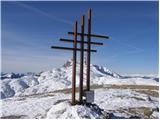
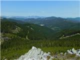
 | Planina Dol - Koritni vrh (Velika planina)
Koritni vrh is a 1648 m high mountain located in the northern part of Velika planina. From the top, on which stands a small cross, a beautiful vi...
1 h |
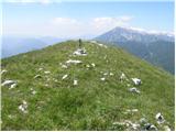
 | Bohinjsko sedlo - Lajnar (unmarked way)
Lajnar is a 1549 m high mountain located north of Soriška mountain pasture. From the top, which is also the highest point of the ski resort, we h...
45 min |
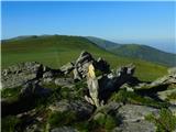
 | Kozji hrbet - Šavnik
Šavnik is a grassy peak located between the Soriška planina and Kobla ski resorts. From the summit, which has a registration box with a stamp, yo...
50 min |
 | Za Malim vrhom - Krevl
Krevl is a 1515 m high peak located to the south of the Kobla ski area, more precisely between Koble Peak and Kravje Črna Gora. From the summit, ...
1 h |
 | Rosstratte - Zwolfernock (by road)
Zwolfernock is a peak located on the slopes of Dobratsch. From the top, where the cross and the registration box are located, there is a beautifu...
1 h |
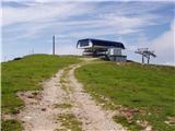 | Dom na Gospincu - Krvavec
Krvavec is an 1853 m high peak located in the heart of the ski resort of the same name. The summit, which is criss-crossed with cable cars, offer...
1 h |
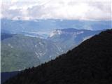
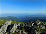
 | Planina Lom - Kobilja glava
Kobilja glava is a 1475 m high peak located east of Tolmin. From the top with a cross, we have a beautiful view of the Krn, the Lower Bohinj Moun...
1 h 15 min |
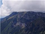
 | Koča na Gozdu - Visoki Mavrinc
Visoki Mavrinc (Špica v Sedelcih) is a 1562 m high mountain located between Suha, Mala and Velika Pišnica. From the top of the peak, where there ...
1 h 15 min |
 | Vršič - Prednje Robičje
Prednje Robičje is a 1941 m high mountain located in the mountain ridge between the valleys of Mala and Velika Pišnica. From the top of the summi...
1 h |
 | Topla (Končnik) - Šoparjev vrh
Šoparjev vrh is a 1524 m high mountain located between Olševa and Peca, more precisely on the ridge that separates the Koprivna valley from the T...
1 h 15 min |
| Koprivna (Kumer) - Šoparjev vrh
Šoparjev vrh is a 1524 m high mountain located between Olševa and Peca, more precisely on the ridge that separates the Koprivna valley from the T...
1 h 10 min |
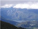
 | Bohinjsko sedlo - Črni vrh (above Soriška planina)
Črni vrh is a fairly scenic peak located above the Bohinjski Preval. From the partially vegetated summit or the surrounding area, we have a beaut...
1 h |
 | Ravne - Bela peč (above Dovje)
Bele peči is a less known peak, located above the marked Dovje - Dovška Baba trail. The summit offers a beautiful view to the south and west, whi...
45 min |
 | Pfaffensattel - Großer Pfaff
...
55 min |
 | Weinebene - Brandhöhe
...
1 h |
 | Weinebene - Moschkogel
...
1 h 15 min |
 | Bürgeralm (Panoramastraße) - Schönleitenhaus (Windgrube) (po južnem grebenu)
...
50 min |