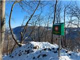
 | Gosteče - Osolnik (via Vidmovec)
Osolnik is an 858 m high mountain located south of Škofja Loka and west of Medvode. From the top, where the Church of St. Mohor and Fortunatus st...
1 h 30 min |
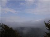
 | Mlinše - Zasavska Sveta gora
Zasavska Sveta gora is a popular excursion point located between Litija and Izlaki. From the top, where the parish church of the Nativity of the ...
1 h 30 min |
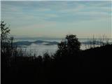
 | Vidrga - Zasavska Sveta gora (on forest footpath)
Zasavska Sveta gora is a popular excursion point located between Litija and Izlaki. From the top, where the parish church of the Nativity of the ...
1 h 30 min |
| Vidrga - Zasavska Sveta gora (on a cart track)
Zasavska Sveta gora is a popular excursion point located between Litija and Izlaki. From the top, where the parish church of the Nativity of the ...
1 h 30 min |
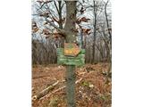
 | Mala voda - Kožljek
Kožljek is a 788 m high peak located to the west of Koreno, specifically above the village of Samotorica. From the top, where there are a few ben...
1 h 15 min |
 | Mala voda - Koreno
Koreno also Koreno is a 729 m high hill located north of Horjul. From the top, where there is a large cross, the Church of St. Mohorj and Fortuna...
1 h 15 min |
 | Briše - Mali vrh
To the west of Polhov Gradec, between the rivers Mala voda and Velika Božna, is a 708-metre-high hill called Mali vrh. From the grassy summit, wh...
1 h 5 min |
 | Hotovlja - Bukov vrh (by road)
Bukov vrh, on which the Church of the Sorrowful Mother of God stands, is located in the north-western part of the Polhograje hills. From the top ...
1 h 30 min |
 | Planina - Petričev hrib
Petričev hrib is the peak north of Postojna and west of Mountain pasture. From the summit, which has a registration box, there is a beautiful vie...
1 h 30 min |
| Planina (Dolnja Planina) - Petričev hrib (via Zavrtniki)
Petričev hrib is the peak north of Postojna and west of Mountain pasture. From the summit, which has a registration box, there is a beautiful vie...
1 h 35 min |
| Planina (Dolnja Planina) - Petričev hrib (via Sv. Duh)
Petričev hrib is the peak north of Postojna and west of Mountain pasture. From the summit, which has a registration box, there is a beautiful vie...
1 h 35 min |
 | Liboje (quarry) - Kotečnik (via eastern ridge)
Kotečnik is a peak in Posavsko hribovje, located north of Šmohor. Kotečnik is a peak with two entry boxes. The first one is located on the wester...
1 h 5 min |
 | Tržič - Kamnek (Milanova pot)
Kamnek (Kamnik on maps, but also Kamnjek) is a scenic peak above Tržič....
1 h 5 min |
 | Tržič (Slap) - Kamnek (via Dobrivc)
Kamnek (Kamnik on maps, but also Kamnjek) is a scenic peak above Tržič....
1 h |
 | Podpeč - Grmada on Mala gora
Grmada (also Grmada nad Ortnek) is an 887 m high peak located above the village of Vrh pri Poljanah in the Mala Gora mountain range. Just a few m...
1 h 35 min |
| Novi Lazi - Livoldski vrh
Livoldski vrh is a forested peak located in the south-eastern part of Stojna. The summit has a registration box and a stamp....
1 h 10 min |
 | Planina - Grmada (Planinska gora)
Grmada is an 873m high peak rising west of Planinsko Polje. The summit is overgrown, but from the lookout point just below the summit we have a b...
1 h |
 | Planina (Dolnja Planina) - Grmada (Planinska gora) (via Zavrtniki)
Grmada is an 873m high peak rising west of Planinsko Polje. The summit is overgrown, but from the lookout point just below the summit we have a b...
1 h 5 min |
| Planina (Dolnja Planina) - Grmada (Planinska gora) (via Sv. Duh)
Grmada is an 873m high peak rising west of Planinsko Polje. The summit is overgrown, but from the lookout point just below the summit we have a b...
1 h 5 min |
 | Olševek - Štefanja gora (via Apnišče)
Štefanja gora on which the Church of St Stephen stands, is located above Cerkly in Gorenjska. Just 10 metres below the summit, the Pr'Mežnarju ex...
1 h 15 min |
 | Preddvor - Štefanja gora (on footpath)
Štefanja gora on which the Church of St Stephen stands, is located above Cerkly in Gorenjska. Just 10 metres below the summit, the Pr'Mežnarju ex...
1 h 20 min |
 | Polhov Gradec - Mala Grmada (via Ravnek and via Sveta Uršula)
Mala Grmada is an 853 m high peak located south-west of the slightly higher Polhograjska Grmada. From the top, you have a beautiful view over the...
1 h 35 min |
| Polhov Gradec (Božna) - Mala Grmada (via Sveta Uršula)
Mala Grmada is an 853 m high peak located south-west of the slightly higher Polhograjska Grmada. From the top, you have a beautiful view over the...
1 h 10 min |
 | Spodnja Idrija - Cerkovni vrh
Cerkovni vrh is a broadleaved stump above Spodnja Idrija. From the top we have beautiful views of local peaks such as Kobalove mountain pasture, ...
1 h 15 min |
 | Nemilje - Sveti Mohor (Zabrekve)
The Church of St. Mohor is situated on a 952 m high hill, between Zgornja Besnica and Selce. From the church, or its immediate surroundings, we h...
1 h 20 min |
 | Nemilje - Sveti Mohor (Zabrekve) (via Prevoje)
The Church of St. Mohor is situated on a 952 m high hill, between Zgornja Besnica and Selce. From the church, or its immediate surroundings, we h...
1 h 35 min |
 | Brezovica - Sveti Primož in Felicijan (Jamnik)
The Church of St. Primož and Felicijan on Jamnik, is situated on a scenic grassy ridge rising between Kropa and Podblica. From the church or its ...
1 h 20 min |
| Češnjica pri Kropi - Sveti Primož in Felicijan (Jamnik) (via Berigla)
The Church of St. Primož and Felicijan on Jamnik, is situated on a scenic grassy ridge rising between Kropa and Podblica. From the church or its ...
1 h 20 min |
 | Jasen - Ahac
Ahac or St. Ahac is a 799 m high peak located east of Ilirska Bistrica. The summit, which is home to a registration box, a cross and the ruins of...
1 h |
| Vrbovo - Ahac
Ahac or St. Ahac is a 799 m high peak located east of Ilirska Bistrica. The summit, which is home to a registration box, a cross and the ruins of...
1 h |
| Nevlje pri Kamniku - Vovar
An obscure hill in front of the Kamnik mountains. Recently covered by storms, it has been covered with wood harvesting tracks.There is also a sma...
1 h 30 min |
 | Žiri - Javorč
Javorč is a 901-metre-high peak located to the north-east of Žiri. The summit, where the registration box with the registration book is located, ...
1 h 15 min |
 | Log - Pečke (by road)
Pečke is an easily accessible and recently less and less visited peak located north of the main ridge of Pohorje. It receives more visitors only ...
1 h 5 min |
 | Preddvor - Apnišče (on footpath)
Apnišče is a 740 m high mountain located between Možjanca and Štefanja gora. It is the highest point of the Šenčur municipality. There is a bench...
1 h 15 min |
 | Jamce - Podrta gora above Ajdovščina
Podrta gora above Ajdovščina, also called the Broke Mountain above Šturje, is a mountain rising above the Vipava valley. Some time ago, a large c...
1 h 20 min |
 | Jamce - Kraguljc
Kraguljc is a mountain located between Podrto gora and Sončnica. A trigonometric point is located on the lookout point, which offers a beautiful ...
1 h 30 min |
 | Kokra (resting place Kokra-sotočje) - Skutman
Skutman is a lesser-known peak located above the left bank of the Kokra River and north of Štefanje Gora. The summit is marked by a metal sign wi...
1 h 10 min |
 | Mežica - Andrejev vrh (by cart track)
Andrejev vrh is a forested peak located between Mežica and Lesa. There is a bench on the top and a registration box with a registration book....
1 h 15 min |
| Mežica - Andrejev vrh (past the chapel)
Andrejev vrh is a forested peak located between Mežica and Lesa. There is a bench on the top and a registration box with a registration book....
1 h 20 min |
| Leše - Andrejev vrh (via Leše churches and via chapel)
Andrejev vrh is a forested peak located between Mežica and Lesa. There is a bench on the top and a registration box with a registration book....
1 h 35 min |
| Leše - Andrejev vrh (past Leše churches and on cart track)
Andrejev vrh is a forested peak located between Mežica and Lesa. There is a bench on the top and a registration box with a registration book....
1 h 30 min |
 | Selca - Sleme (Površnica)
Sleme is a scenic peak located between Rudni, Dražgoše and Lajša. The summit, where the transmitters are located, offers a beautiful view of the ...
1 h 35 min |
| Železniki - Sleme (Površnica) (via Štalca)
Sleme is a scenic peak located between Rudni, Dražgoše and Lajša. The summit, where the transmitters are located, offers a beautiful view of the ...
1 h 35 min |
 | Selca - Sveti Križ above Selca
The Sveti Križ above Selca church is situated on a lookout point, which offers a beautiful view over part of the Škofjeloško hribovje....
1 h 15 min |
| Železniki - Sveti Križ above Selca (via Štalca)
The Sveti Križ above Selca church is situated on a lookout point, which offers a beautiful view over part of the Škofjeloško hribovje....
1 h 15 min |
 | Ravne na Koroškem - Brinjeva gora (above Prevalje)
Brinjeva gora is a popular excursion spot for Prevalj inhabitants, located between the Meža River and the Zelenbreški brok. At the top of the hil...
1 h 10 min |
 | Senično - Planica (Paragliding site Gozd) (gentle path)
Planica is a 926-metre-high peak located above the village of Gozd. From the top, where the JPK Kriška gora hut is located, we have a beautiful v...
1 h 15 min |
| Senično - Planica (Paragliding site Gozd) (steep path)
Planica is a 926-metre-high peak located above the village of Gozd. From the top, where the JPK Kriška gora hut is located, we have a beautiful v...
1 h 10 min |
| Pristava - Planica (Paragliding site Gozd)
Planica is a 926-metre-high peak located above the village of Gozd. From the top, where the JPK Kriška gora hut is located, we have a beautiful v...
1 h 20 min |
 | Rudnik pri Radomljah - Tolsta gora
Tolsta gora is a 734-metre-high mountain located above Vrhpolje near Kamnik. From the top, where cairn stands, there is no better view, thanks to...
1 h 25 min |
 | Rudnik pri Radomljah - Vrtače (via Lancar)
Vrtače is a 758-metre-high peak located above the village of Zgornje Palovče. The peak is covered with forest, but the clearing slightly below th...
1 h 30 min |
 | Dravograd (Meža) - Sveti Danijel (above Trbonje)
The Church of St. Danijel is located on the outskirts of the village of St. Danijel, just above Trbonyi. From the church we have a beautiful view...
1 h 30 min |
 | Škofja Loka - Vrh soteske (Križna gora)
Vrh soteske is a 735 m high peak located in the south-western part of Križna Gora. There is no better view from the top, which is covered by fore...
1 h 25 min |
| Vešter - Vrh soteske (Križna gora)
Vrh soteske is a 735 m high peak located in the south-western part of Križna Gora. There is no better view from the top, which is covered by fore...
1 h 15 min |
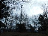
 | Hotavlje - Vrh Slajke
Vrh Slajke is a 790-metre-high hill located above Hotavlje, on the right bank of the Kopačnice River. From the top, where the antenna tower stand...
1 h 15 min |
| Hotavlje - Vrh Slajke (via Bela)
Vrh Slajke is a 790-metre-high hill located above Hotavlje, on the right bank of the Kopačnice River. From the top, where the antenna tower stand...
1 h 30 min |
| Podgora - Vrh Slajke
Vrh Slajke is a 790-metre-high hill located above Hotavlje, on the right bank of the Kopačnice River. From the top, where the antenna tower stand...
1 h 25 min |
 | Ledinica - Krog (Ledinski grič)
Krog is a 940 m high peak located on the western part of the Ledinski grič ridge, which is situated between the Jerešča and Ledinščica watercours...
1 h 15 min |
 | Selca - Lepo brdo
Lepo brdo is a 778-metre-high hill located above the settlements of Selca and Studeno....
1 h |
 | Zreče (Terme Zreče) - Golek (steep path)
Golek is a 769-metre-high peak located north-west of Zreče. At the top there is a registration box with a registration book, a stamp and a bench,...
1 h 20 min |
 | Deutschfeistritz - Parmaseggkogel (čez Kugelberg)
...
1 h 15 min |
 | Borovnica - Planina nad Borovnico (Češnjeva pot)
...
55 min |
 | Selnica ob Dravi - Janžev vrh
...
1 h 35 min |
| Janževa Gora - Janžev vrh (mimo cerkve sv. Janeza Krstnika)
...
1 h 35 min |