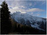
 | Gozd - Tolsti vrh (Ovčja pot over Kriška gora)
Tolsti vrh, located to the west of Storžič, is also the highest peak of the Kriška Gora, a mountain range rising steeply above the central Gorenj...
2 h 30 min |
 | Tominčev slap Waterfall - Dobrča
Dobrča is a 1634 m high mountain located between Begunje and Tržič. From the top, where the registration box with the stamp is located, we can se...
3 h |
 | Draga - Dobrča (via Ledena trata)
Dobrča is a 1634 m high mountain located between Begunje and Tržič. From the top, where the registration box with the stamp is located, we can se...
3 h |
 | Hudi Graben - Dobrča (via Lešanska planina)
Dobrča is a 1634 m high mountain located between Begunje and Tržič. From the top, where the registration box with the stamp is located, we can se...
2 h 35 min |
| Hudi Graben - Dobrča
Dobrča is a 1634 m high mountain located between Begunje and Tržič. From the top, where the registration box with the stamp is located, we can se...
2 h 30 min |
 | Grahovše - Veliki Javornik (Ženiklovec)
Veliki Javornik or Ženiklovec is a 1716 m high peak located between Storžič and Stegovnik. From the grassy summit, where the registration box is ...
2 h 45 min |
 | Grahovše - Veliki Javornik (Ženiklovec) (via Rekar)
Veliki Javornik or Ženiklovec is a 1716 m high peak located between Storžič and Stegovnik. From the grassy summit, where the registration box is ...
2 h 45 min |
 | Leskovica - Blegoš (on unmarked path)
Blegoš is a 1562 m high mountain located between Selška and Poljane Sora. From the grassy summit, on which there is a stamp and a registration bo...
2 h 5 min |
| Volaka - Blegoš (on unmarked path)
Blegoš is a 1562 m high mountain located between Selška and Poljane Sora. From the grassy summit, on which there is a stamp and a registration bo...
2 h 35 min |
 | Potoče - Javorov vrh (via Sveti Jakob, below Potoška gora and over Baba)
Javorov vrh (also Javorjev vrh according to some records) is a 1434 m high mountain located northeast of Preddvor. From the top, which has a regi...
2 h 55 min |
| Spodnja Kokra - Javorov vrh (via Baba)
Javorov vrh (also Javorjev vrh according to some records) is a 1434 m high mountain located northeast of Preddvor. From the top, which has a regi...
2 h 30 min |
 | Smrečje - Pečovnik (survey point 1668) (by road)
Pečovnik) is a 1668 m high mountain located between Plešivec (1801 m) and Virnik's Grintovec (1654 m). The grassy peak, located on the border bet...
2 h 45 min |
 | Rateče - Ofen/Peč (western path, past bivouac and on footpath)
Peč (also Tromeja), in Italian Monte Forno and in German Dreiländereck or Ofen, is a 1508 m high peak located on the tri-border between Slovenia,...
2 h 15 min |
| Rateče - Ofen/Peč (western path, past bivouac and on mule track)
Peč (also Tromeja), in Italian Monte Forno and in German Dreiländereck or Ofen, is a 1508 m high peak located on the tri-border between Slovenia,...
2 h 20 min |
 | Klemenčevo - Kamniški vrh (by Korošaki waterfalls)
Kamniški vrh is a 1259 m high mountain located north of Kamnik, between Stahovica and the Korošica Valley. From the top of the peak there is a sm...
2 h 15 min |
 | Klemenčevo - Kamniški vrh (on southwest slope)
Kamniški vrh is a 1259 m high mountain located north of Kamnik, between Stahovica and the Korošica Valley. From the top of the peak there is a sm...
1 h 45 min |
 | Dol - Bukovec
The mountain is located between Kozji vrh, Stegovnik and Virnik's Grintovec. The summit partly overloks the forest so that there is a nice view t...
1 h 40 min |
 | Log - Vošca
Vošca is a 1737 m high peak located west of Trupe's Non. From the grassy summit, we have a beautiful view of Julian Alps, the western Karawanks, ...
2 h 30 min |
 | Okrog pri Motniku - Vivodnik (via Biba planina)
At 1508 m, Vivodnik is the highest peak of the Menina mountain pasture, a plateau rising south of Gornji Grad. From the top, where there is a sma...
2 h 25 min |
| Okrog pri Motniku - Vivodnik (čez Oseke in vrh Drč)
At 1508 m, Vivodnik is the highest peak of the Menina mountain pasture, a plateau rising south of Gornji Grad. From the top, where there is a sma...
2 h 15 min |
| Češnjice v Tuhinju - Vivodnik
At 1508 m, Vivodnik is the highest peak of the Menina mountain pasture, a plateau rising south of Gornji Grad. From the top, where there is a sma...
2 h 25 min |
 | Razdrto - Vojkova koča na Nanosu (Janez way)
Vojkova koča is located on the southern edge of the Nanoše plateau, close to Pleše, a peak that is clearly visible from the motorway. From the hu...
2 h |
 | Source of Ljubija - Smrekovec (via Leskovškova pustota)
Smrekovec is a volcanic mountain on the eastern edge of the Smrekov Mountains. The extensive grassy summit, on which stands a pyramid with a regi...
2 h 20 min |
| Source of Ljubija - Smrekovec (by road)
Smrekovec is a volcanic mountain on the eastern edge of the Smrekov Mountains. The extensive grassy summit, on which stands a pyramid with a regi...
2 h 30 min |
 | Dolina potoka Žep - Komen
At 1684m, Komen is the highest peak of the Smrekov Mountains, a mountain range bordering Styria and Carinthia. From the top, in good weather, we ...
2 h 30 min |
 | Dolina potoka Žep - Veliki Travnik (via partisan hospital)
Veliki Travnik, or Turnovka as the locals call it, is located on the western edge of the Smrekov Mountains. From the top of the hill, where a woo...
2 h 25 min |
 | Mislinjski graben (Pestotnik) - Rogla (via Ostruščica)
Rogla is the peak in the middle of the ski resort of the same name. The summit is woded with a small clearing on which stands a lookout tower. Th...
3 h |
 | Smrečje - Pečovnik (by road)
Pečovnik is a 1640 m high peak located in the mountain ridge between Košuta and Virnik Grintovec. The partially vegetated peak offers a beautiful...
2 h 35 min |
 | Ivarčko jezero - Uršlja gora (Plešivec) (Grofovska pot)
Uršlja gora or Plešivec is a lookout mountain between Slovenj Gradec and Črna na Koroškem. On the top or just below it stands the Church of St Ur...
2 h 50 min |
 | Bohinjska Bistrica - Krevl (on ski track)
Krevl is a 1515 m high peak located to the south of the Kobla ski area, more precisely between Koble Peak and Kravje Črna Gora. From the summit, ...
2 h 45 min |
 | Jevšček - Monte Mataiur/Matajur
Monte Mataiur is a scenic mountain located on the border between Slovenia and Itali. From the top, you have a beautiful view of the Kobarid or Br...
2 h 30 min |
 | Poljšica pri Gorjah (Zatrata) - Galetovec (on footpath)
Galetovec is an undistinguished peak in the south-eastern part of the Pokljuka plateau. From the summit, which has a registration box, there is a...
2 h 35 min |
 | Hudi Graben - Šentanski vrh (via Lešanska planina)
Šentanski vrh, located in the Dobrča mountain range, only 5 minutes away from the main peak, offers a beautiful view of the central Karawanks, th...
2 h 40 min |
| Hudi Graben - Šentanski vrh
Šentanski vrh, located in the Dobrča mountain range, only 5 minutes away from the main peak, offers a beautiful view of the central Karawanks, th...
2 h 35 min |
 | NC Planica - Glave (by ski jumping hill)
Glave are an undistinguished side ridge of the Ponce, rising steeply to the west of Planica. The highest peak of Glav, which measures 1760m, is c...
2 h 30 min |
| Rateče (Ledine) - Glave
Glave are an undistinguished side ridge of the Ponce, rising steeply to the west of Planica. The highest peak of Glav, which measures 1760m, is c...
2 h 50 min |
 | Gozd Martuljek - Kurji vrh
Kurji vrh is a little visited mountain located southeast of Kranjska Gora. From the summit, which has a registration box, we have a beautiful vie...
3 h |
 | Grant - Jehlc (Špičasta kupa)
For Jehlc we will get different names on different maps, which also differ in height. The locals call the peak Jehlc (1625 m), but on more recent...
2 h 45 min |
 | Orehek - Kojca (new path)
Kojca is a scenic peak rising south of Baška Grape. The hay pile on the top offers a beautiful view of the Lower Bohinj Mountains, the Škofjelošk...
1 h 40 min |
 | Bukovo - Kojca (north path)
Kojca is a scenic peak rising south of Baška Grape. The hay pile on the top offers a beautiful view of the Lower Bohinj Mountains, the Škofjelošk...
2 h 15 min |
| Bukovo - Kojca (south path)
Kojca is a scenic peak rising south of Baška Grape. The hay pile on the top offers a beautiful view of the Lower Bohinj Mountains, the Škofjelošk...
2 h 15 min |
 | Jesenice (Ukova) - Španov vrh
Španov vrh is a 1334m high mountain located between Javorniški Rovt and Mountain pasture below Golica. From the top, reached by the cable car of ...
2 h |
 | Jesenice (Straža) - Španov vrh (via Jelenkamen)
Španov vrh is a 1334m high mountain located between Javorniški Rovt and Mountain pasture below Golica. From the top, reached by the cable car of ...
2 h 30 min |
 | Zalog - Grebenc
Grebenc is a lesser-known peak, rising steeply above Malo and Velika Poljana. From this little visited peak, in good weather we can enjoy a beaut...
2 h 20 min |
 | Povlje - Grebenc
Grebenc is a lesser-known peak, rising steeply above Malo and Velika Poljana. From this little visited peak, in good weather we can enjoy a beaut...
2 h 5 min |
| Povlje - Grebenc (by cart track)
Grebenc is a lesser-known peak, rising steeply above Malo and Velika Poljana. From this little visited peak, in good weather we can enjoy a beaut...
2 h 5 min |
 | Dolina potoka Žep - Mali Travnik
Mali Travnik is a lesser-known peak, located south of the better-known Velika Travnik. From the partially vegetated summit, we have a beautiful v...
2 h 5 min |
 | 2nd hairpin turn of Vršič road - Visoki Mavrinc (Za Kumlehom)
Visoki Mavrinc (Špica v Sedelcih) is a 1562 m high mountain located between Suha, Mala and Velika Pišnica. From the top of the peak, where there ...
2 h |
 | Spodnje Danje - Altemaver (Ratitovec)
Altemaver is the highest peak of Ratitovec at 1678 m. The grassy peak offers a beautiful view of Julian Alps, Jelovica, Karawanks, Kamnik Savinja...
2 h 30 min |
 | Makekova Kočna - Visoki vrh above Jezersko (via Javornik)
Visoki vrh is a 1459 m high mountain located in the ridge between Makekovo and Ravensko Kočna. From the top, we have a beautiful view towards Koč...
2 h 15 min |
 | Kal - Rušni vrh
Rušni vrh is a 1786 m high peak located to the east of Črna prsti. From the summit, which is the boundary stone of the old Rapallo border, we hav...
2 h 20 min |
 | Spodnje Danje - Kremant (Ratitovec)
Kremant is a 1654 m high peak located in the western part of Ratitovec. From the top, where a stamp is attached to a metal pole, we have a beauti...
2 h 30 min |
 | Rateče - Monte Coppa
Kopa (also Kopje on some maps) or after ital. Monte Coppa is a 1496 metres high peak located on the Italian side of the Karavanke Mountains. The ...
2 h |
 | Radovna - Vošni vrh
Vošni vrh is a 1621 metre high mountain located in the ridge of mountains starting at Radovna and ending at Tosc. The peak itself is located in a...
3 h |
 | Ridovc / Ridovcsäge - Mejnik (via valley of Mrzli potok)
Mejnik is a 1517 m high peak located on the Austrian side of Karawanks, more precisely in the side ridge of Kosuta. There is a milestone on the s...
2 h 5 min |
 | Podkoren - Visoka Bavha
Visoka Bavha is a 1650 m high peak located in the Karavanke border ridge. The view of the Austrian side is better from the summit, as the view of...
2 h |
 | Podvolovljek (Petkov graben) - Kunšperski vrh (Brezovec)
Kunšperski vrh, Brezovec is also a lesser known peak located west of Lepenatka. The partially vegetated peak offers a beautiful view towards Veli...
2 h |
 | Tolminske Ravne - Grušnica (via planina na Kalu)
Grušnica is a 1570 m high peak located between Čadrg, the Tolmin valley and Tolminski Ravne. From the top, which descends steeply towards the riv...
1 h 45 min |
 | Mislinjski graben (Pestotnik) - Ostruščica
Ostruščica is a 1498 m high peak located west of the ski slopes at Rogla....
2 h 30 min |
 | Podljubelj (Lajb) - Čisovec
Čisovec is a scenic peak located between Dobrča and Begunjščica. From the top we have a beautiful view towards Košuta, Kamnik Savinja Alps, Begun...
2 h |
 | Trbiž / Tarviso - Florjanka / Monte Florianca (on transport road)
Florjanka is a 1,653-metre-high mountain on the Italian side of the Julian Alps. At the top or just below it, there is a reservoir for snowmaking...
2 h 30 min |
 | Rebrca / Rechberg - Stara gora / Altberg (via Bukovnik)
Stara gora is a 1552 m high peak located north-east of Hochobir, the highest peak of the Obir. A wooden cross and a bench are placed on the summi...
2 h 50 min |
 | Bela Peč / Villa Bassa - Črni vrh / Colrotondo
Črni vrh is a fairly scenic peak located west to south-west of the Belopek Lakes. From the summit, on which the hunting observation tower is situ...
2 h |
 | Podljubelj - Robič (via Zavetišče na Kalu)
Robič is a 1384 m high peak located between the valley of Tržiška Bistrica and the ridge of Košuta. The summit offers a beautiful view, especiall...
2 h 15 min |
| Dolina - Robič
Robič is a 1384 m high peak located between the valley of Tržiška Bistrica and the ridge of Košuta. The summit offers a beautiful view, especiall...
1 h 55 min |
| Tržič (Čegelše) - Robič (via Zavetišče na Kalu)
Robič is a 1384 m high peak located between the valley of Tržiška Bistrica and the ridge of Košuta. The summit offers a beautiful view, especiall...
2 h 55 min |
| Podljubelj (Pod Košuto) - Robič (via lake Jezero pri Čežov)
Robič is a 1384 m high peak located between the valley of Tržiška Bistrica and the ridge of Košuta. The summit offers a beautiful view, especiall...
2 h 15 min |
 | Dovje - Bela peč (above Dovje)
Bele peči is a less known peak, located above the marked Dovje - Dovška Baba trail. The summit offers a beautiful view to the south and west, whi...
2 h |
| Dovje - Bela peč (above Dovje) (via Blažčeva skala)
Bele peči is a less known peak, located above the marked Dovje - Dovška Baba trail. The summit offers a beautiful view to the south and west, whi...
2 h 15 min |
 | Veliko Tinje - Veliki vrh (on Pohorje) (via Sveti Urh)
Veliki vrh is a 1344-metre-high peak located above the RTC Jakec - Trije kralji ski resort. The highest point of the peak is located in the fores...
2 h 55 min |
 | Mixnitz (Parkirišče Bärenschützklamm) - Ranerwand
...
2 h 30 min |