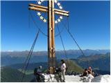
 | Pri Mlinču - Mangart (italijanska pot)
Mangart (also Mangrt, both spellings are grammatically correct) is a mountain that receives a very high number of visitors in summer. Access to t...
4 h 45 min |
 | end of road on Pokljuka - Triglavski dom na Kredarici
Triglavski dom na Kredarici is Slovenia's highest mountain hut. It is open all year round but only on an emergency basis out of season. From the ...
5 h |
| Rudno polje - Triglavski dom na Kredarici
Triglavski dom na Kredarici is Slovenia's highest mountain hut. It is open all year round but only on an emergency basis out of season. From the ...
5 h 20 min |
| Uskovnica (Lom) - Triglavski dom na Kredarici (via Planina Spodnji Tosc)
Triglavski dom na Kredarici is Slovenia's highest mountain hut. It is open all year round but only on an emergency basis out of season. From the ...
5 h 35 min |
| Uskovnica (Razpotje) - Triglavski dom na Kredarici (via planina Spodnji Tosc)
Triglavski dom na Kredarici is Slovenia's highest mountain hut. It is open all year round but only on an emergency basis out of season. From the ...
5 h 30 min |
 | End of road on Pokljuka - Rjavina
Rjavina is located between two Alpine valleys. The two valleys are Kot and Krma. From the summit, which has a registration book, there is a very ...
7 h 30 min |
 | Gozdec - Prestreljenik (via dom Petra Skalarja)
Prestreljenik is a 2499 m high mountain located in the heart of the Kanin Mountains. From the top, where the Aljaž Tower-shaped registration box ...
5 h 45 min |
| Sella Nevea - Prestreljenik (via Rifugio Gilberti)
Prestreljenik is a 2499 m high mountain located in the heart of the Kanin Mountains. From the top, where the Aljaž Tower-shaped registration box ...
4 h 15 min |
 | End of road on Pokljuka - Begunjski vrh
Begunjski vrh is a 2461 m high mountain located in the heart of the highest mountains in the Julian Alps. From the top, which has a registration ...
6 h 30 min |
 | Bodenbauer - Hochstuhl/Stol
At 2236 m, Stol is the highest peak in the Karavanke Mountains. From the summit, which has a registration box and a stamp, we have a beautiful vi...
4 h 30 min |
 | Bodenbauer - Vertatscha/Vrtača
Vertatscha is a 2181 m high peak located to the east of Stol. From the top of the peak, on which stands a large wedge, we have a beautiful view o...
4 h 45 min |
 | Ravne - Mittagskogel/Kepa
Kepa, also Jepa, or Mittagskogel in German, is a scenic mountain in the western Karawanks, located on the border ridge between Slovenia and Austr...
4 h 15 min |
 | Dom na Gospincu - Kalška gora (via Zvoh)
Kalška gora is located between Kalški greben and Kokrsko sedlo. From the top, which is covered with grass, there is a beautiful view towards the ...
4 h 45 min |
| Planina Jezerca - Kalška gora (via Dom na Krvavcu and Zvoh)
Kalška gora is located between Kalški greben and Kokrsko sedlo. From the top, which is covered with grass, there is a beautiful view towards the ...
5 h |
 | Planina Ravne - Ojstrica (via Mala Ojstrica)
Ojstrica, named after its sharp shape, rises steeply above the Korošica River, the Logar Valley and Robanov Kot. From the top, where the registra...
4 h 15 min |
 | Kraljev dol - Ojstrica (via Kocbekov dom)
Ojstrica, named after its sharp shape, rises steeply above the Korošica River, the Logar Valley and Robanov Kot. From the top, where the registra...
4 h 15 min |
 | Podnar / Bodenbauer - Prešernova koča na Stolu
Prešernova koča na Stolu, is located just a few metres below the summit of the 2198 m high Mali Stol. From the hut or the nearby Mali Stol, we ha...
4 h 25 min |
 | Planina Jezerca - Kalški greben (via Dom na Krvavcu and Zvoh)
Kalški greben is 2224 m high and is the highest peak of the eponymous ridge. The summit, which has a registration box and a stamp, offers a beaut...
4 h 25 min |
 | Vršič - Planja
The summit is located between two Alpine valleys. On the northern side is the Mlinarica valley and on the southern side is the Zadnjica valley. F...
5 h 45 min |
 | Planina Blato - Veliko Špičje (via Štapce)
Veliko Špičje is the highest peak in the ridge from Travnik to Zasavska hut. From the top there is a very nice view over the plateaus of Komna, t...
5 h 45 min |
| Planina Blato - Veliko Špičje (Za Kopico)
Veliko Špičje is the highest peak in the ridge from Travnik to Zasavska hut. From the top there is a very nice view over the plateaus of Komna, t...
7 h 15 min |
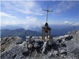
 | Plockenpass - Monte Coglians (Hohe Warte) (via Rifugio Marinelli)
At 2780 metres, Monte Coglians is the highest mountain in the Carnic Alps. From the top, where the cross and the bell stand, you have a very nice...
5 h |
| Rifugio Tolazzi - Monte Coglians (Hohe Warte) (via Rifugio Marinelli)
At 2780 metres, Monte Coglians is the highest mountain in the Carnic Alps. From the top, where the cross and the bell stand, you have a very nice...
4 h 25 min |
 | Sella Nevea - Velika Črnelska špica (on ski track)
Velika Črnelska špica is located in the Kanin Mountains on the border between Itali and Slovenia. From the top, you can enjoy a very nice view of...
4 h 30 min |
| Sella Nevea - Velika Črnelska špica (via 636)
Velika Črnelska špica is located in the Kanin Mountains on the border between Itali and Slovenia. From the top, you can enjoy a very nice view of...
4 h 45 min |
 | Sella Nevea - Koštrunove špice (via Forcella Lavinal dell Orso)
Koštrunove špice is a 2502 m high peak located south-west of Viš (2666 m). The summit offers a beautiful view over most of the western Julian Alp...
4 h 30 min |
 | Erschbaum - Große Kinigat / Monte Cavallino (western way)
Große Kinigat is a 2,689 metre high peak in Carnic Alpsah. The peak is located in the western part of the Carnic Alps and is one of the few in th...
6 h |
 | Plockenpass - Cima di Mezzo / Keller Warte (via Rifugio Marinelli)
The Cima di Mezzo (German: Keller Warte) is a 2713-metre-high mountain in Carnic Alps on the border between Austria and Itali. There is a small c...
4 h 35 min |