 | Smrečje - Plešivec (by road)
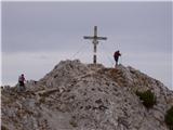
Plešivec is an 1801 m high peak located south of the eastern part of Košuta. The summit, on which the border signpost stands, offers a beautiful ...
3 h 30 min |
 | Gate (Belca) - Mallestiger Mittagskogel (by road)
Mallestiger Mittagskogel, or Mallestiger Mittagskogel in German, is an 1801 m high mountain located on the northern side of the main Karavanke mo...
3 h 25 min |
 | Srednji vrh - Mallestiger Mittagskogel (Via Grajšca)
Mallestiger Mittagskogel, or Mallestiger Mittagskogel in German, is an 1801 m high mountain located on the northern side of the main Karavanke mo...
3 h 10 min |
 | Trbiž / Tarviso - Svete Višarje / Monte Lussari (on transport road)
Svete Višarje is a pilgrimage site for Slavs, Germans and Romans. As early as the 16th century, the mountain was called the God's Way of the Thre...
3 h 25 min |
 | Stržišče - Jehlc (Špičasta kupa)
For Jehlc we will get different names on different maps, which also differ in height. The locals call the peak Jehlc (1625 m), but on more recent...
3 h 30 min |
 | Kosmačev preval - Lengarjeva glava
Lengarjeva glava is a 1498 m high peak located between the valleys of Vrata and Kot. From the partially vegetated summit, we have a beautiful vie...
3 h 30 min |
 | Kneške Ravne - Grušnica (via Planina na Kalu)
Grušnica is a 1570 m high peak located between Čadrg, the Tolmin valley and Tolminski Ravne. From the top, which descends steeply towards the riv...
4 h 30 min |
 | Javorje - Gradovec (path over Glin)
Gradovec is a 1692 m high peak located north of the ridge of the Lower Bohinj Mountains, above mountain pasture Poljana. From the summit, where d...
3 h 10 min |
 | Jasna - Visoka peč (via Mojčin dom)
Visoka peč is a 1,749-metre-high mountain located south-west of Ciprnik. From the top, which descends steeply towards Planica and on which a smal...
3 h 30 min |
| Kranjska Gora - Visoka peč (via Bedančev dom)
Visoka peč is a 1,749-metre-high mountain located south-west of Ciprnik. From the top, which descends steeply towards Planica and on which a smal...
3 h 25 min |
 | Rebrca / Rechberg - Stara gora / Altberg (via Rokov vrh)
Stara gora is a 1552 m high peak located north-east of Hochobir, the highest peak of the Obir. A wooden cross and a bench are placed on the summi...
3 h 10 min |
 | Concentration camp - Hajnžev Praprotnik / Zeller Prapotnik
Hajnžev Praprotnik is a 1727 m high peak located on the Austrian side of Karawanks, more precisely between Loibler Baba and the village of Sele-Z...
3 h 15 min |
| Vranček - Hajnžev Praprotnik / Zeller Prapotnik
Hajnžev Praprotnik is a 1727 m high peak located on the Austrian side of Karawanks, more precisely between Loibler Baba and the village of Sele-Z...
3 h 20 min |
| Sele-Zvrhnji Kot (Male) / Zell-Oberwinkel (Male) - Hajnžev Praprotnik / Zeller Prapotnik
Hajnžev Praprotnik is a 1727 m high peak located on the Austrian side of Karawanks, more precisely between Loibler Baba and the village of Sele-Z...
3 h 55 min |
 | St. Vinzenz (St. Vinzenz) - Kleinalpl
...
3 h 35 min |
 | Aflenz Kurort (Freibad Aflenz) - Hochstein (at Mitteralm) (čez Windgrube)
...
3 h 35 min |
| Aflenz Kurort (Bürgergraben) - Hochstein (at Mitteralm) (čez Windgrube)
...
3 h 35 min |