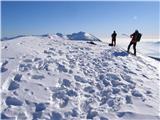
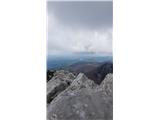
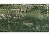
 | Planina pod Golico - Kahlkogel/Golica (winter way)
Kahlkogel is an unvegetated peak located north of Jesenice. From the top, which has a registration box, there is a beautiful view of the western ...
2 h 10 min |
 | Kanonir - Kozji vrh
Kozji vrh is situated northeast of Storžič and, thanks to its uncultivated summit, has a beautiful view of all the mountains around Jezersko. Sto...
2 h 30 min |
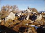
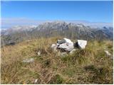
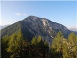
 | Klemenčevo - Kamniški vrh
Kamniški vrh is a 1259 m high mountain located north of Kamnik, between Stahovica and the Korošica Valley. From the top of the peak there is a sm...
2 h |
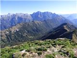
 | Dol - Stegovnik (via Močnikovo sedlo)
Stegovnik (also Štegovnik) is a scenic ridge mountain between the valley of the Tržiška Bistrica and the Kokra. From the top there is a very nice...
2 h 30 min |
 | Breginj - Muzec - Musc (Mali Muzec)
Muzec - Musc (also called Little Muzec on maps) is a 1612 m high mountain located north of the Breginj corner. From the top, where there is a reg...
2 h 55 min |
 | Crni Lug - Veliki Risnjak (Horvatova staza)
At 1528m, Veliki Risnjak is the highest peak in the Risnjak National Park. From the summit, which has a registration box and a stamp, there is a ...
3 h 30 min |
 | Predmeja (tunnels) - Veliki Rob (Srednječavenska pot)
Veliki Rob is a scenic peak located between Kuclje (1237m) and Čavno (1185m). From the summit on which the cross is located, there is a beautiful...
3 h |
 | Razdrto - Suhi vrh (Nanos) (steep way)
At 1313m, Suhi vrh is the highest peak of the karst plateau of Nanos. From the summit, which has a registration box and a stamp (the stamp is cur...
3 h 25 min |
 | Breginj - Gabrovec (Veliki Muzec)
Gabrovec (also called Veliki Muzec on maps) is a 1630 m high mountain located northwest of Breginj, the westernmost village in Slovenia. From the...
3 h |
 | Vranček - Lokovnikov Grintovec / Grintoutz
Lokovnikov Grintovec is the dwarf pines vegetated peak to the north of Loibler Baba, from which it is separated by Dovjakovo sedlo (1728 m). Its ...
2 h 50 min |
 | Hintergupf - Matzen
Matzen is a 1,627-metre-high peak located north of Košuta and south of the River Drava. Macna offers a beautiful view of the nearby Obir, Košuta,...
2 h 30 min |
 | Bajdiše (Gozdar) / Waidisch (forsthaus) - Matzen
Matzen is a 1,627-metre-high peak located north of Košuta and south of the River Drava. Macna offers a beautiful view of the nearby Obir, Košuta,...
3 h |
 | Breginj - Nizki vrh
Nizki vrh is located at the crossroads between Breški Jalovec / Monte maggiore (ITA) and Gabrovec near the state border, with a beautiful view of...
3 h |
 | Bajdiše / Waidisch - Borovski vrh (Žehtar) / Sechter
Borovski vrh is a 1449 m high peak located between Grlovec / Ferlacher Horn and Borovlje / Ferlach. From the top, where a metal cross stands, you...
3 h |
 | Prezid (at Gračac) - Crnopac
...
2 h 30 min |
 | Gornje Sitno - Ljubljan (via Klančac)
...
3 h 30 min |
 | Gornje Sitno - Vickov stup (via Ljuvač and past Kabal)
...
3 h 30 min |
 | Gornje Sitno - Ljubirna (via Ljuvač and past Kabal)
...
3 h 25 min |
 | Gornje Sitno - Veliki Kabal (via Ljuvač)
...
3 h |
 | Passo Tanamea - Monte Zajavor
...
3 h |